Cooke City, Montana
Cooke City, Montana | |
|---|---|
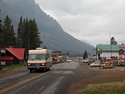 Entering Cooke City from the east | |
 Cooke City | |
| Coordinates: 45°1′10″N 109°56′4″W / 45.01944°N 109.93444°WCoordinates: 45°1′10″N 109°56′4″W / 45.01944°N 109.93444°W | |
| Country | United States |
| State | Montana |
| County | Park |
| Area | |
| • Total | 9.5 sq mi (24.7 km2) |
| • Land | 9.5 sq mi (24.7 km2) |
| • Water | 0.0 sq mi (0.0 km2) |
| Elevation | 7,580 ft (2,310 m) |
| Population (2010)[2] | 75 |
| • Density | 7.8/sq mi (3.03/km2) |
| Time zone | UTC-7 (Mountain (MST)) |
| • Summer (DST) | UTC-6 (MDT) |
| ZIP Code | 59020 |
| Area code(s) | 406 |
| FIPS code | 30-17350 |
| GNIS feature ID | 2583800[3] |


Cooke City is an unincorporated community and census-designated place (CDP) in Park County, Montana, United States. As of the 2010 census, it had a population of 75.[2] Prior to 2010, it was part of the Cooke City-Silver Gate CDP.
The community sits northeast of Yellowstone National Park on the Beartooth Highway, which leads east to Red Lodge, Montana, on a scenic route climbing to 10,947 feet (3,337 m) in elevation through the Beartooth Mountains and across the Beartooth Plateau. The town's chief industry is tourism, which during the winter includes skiing and snowmobiling.
It is named for Jay Cooke, financier of the Northern Pacific Railroad.[4]
Geography[]
Cooke City is near the southeast corner of Park County, bordered to the south by the North Absaroka Wilderness within Shoshone National Forest in the state of Wyoming, and to the west by the community of Silver Gate, Montana. The two towns sit in the valley of Soda Butte Creek, which flows southwest into Wyoming to join the Lamar River in Yellowstone National Park. The valley is part of the Yellowstone River watershed.
U.S. Route 212, the Beartooth Highway, passes through the center of Cooke City, leading southwest into Yellowstone National Park, and east over 8,040-foot (2,450 m) Colter Pass in the eastern part of the CDP to continue southeast back into Wyoming in the valley of the Clarks Fork Yellowstone River and thence into the Beartooth Mountains.
Climate[]
Cooke City has a subarctic climate (Dfc) or subalpine climate due its extremely high elevation, at 7,580 feet (2,310 m), with only two months averaging above 50 °F (10 °C). Summers consist of mild to warm days with crisp, cool mornings, and winters are long and very cold, with many nights falling below zero. Snowfall is abundant, with most of it falling between the months of October to May, though snow does occasionally fall in the months of June and September. Cooke City is listed as the snowiest community in Montana.[5]
| Climate data for Cooke City, Montana | |||||||||||||
|---|---|---|---|---|---|---|---|---|---|---|---|---|---|
| Month | Jan | Feb | Mar | Apr | May | Jun | Jul | Aug | Sep | Oct | Nov | Dec | Year |
| Record high °F (°C) | 48 (9) |
54 (12) |
58 (14) |
72 (22) |
80 (27) |
88 (31) |
90 (32) |
88 (31) |
85 (29) |
76 (24) |
58 (14) |
47 (8) |
90 (32) |
| Average high °F (°C) | 24.3 (−4.3) |
30.1 (−1.1) |
37.1 (2.8) |
44.4 (6.9) |
54.2 (12.3) |
64.5 (18.1) |
74.0 (23.3) |
72.2 (22.3) |
62.4 (16.9) |
48.6 (9.2) |
32.1 (0.1) |
23.6 (−4.7) |
47.3 (8.5) |
| Daily mean °F (°C) | 14.3 (−9.8) |
17.9 (−7.8) |
24.4 (−4.2) |
31.6 (−0.2) |
40.8 (4.9) |
49.1 (9.5) |
56.2 (13.4) |
54.6 (12.6) |
46.1 (7.8) |
35.6 (2.0) |
22.3 (−5.4) |
14.1 (−9.9) |
33.9 (1.1) |
| Average low °F (°C) | 4.3 (−15.4) |
5.7 (−14.6) |
11.8 (−11.2) |
18.8 (−7.3) |
27.5 (−2.5) |
33.7 (0.9) |
38.5 (3.6) |
37.0 (2.8) |
29.9 (−1.2) |
22.6 (−5.2) |
12.4 (−10.9) |
4.6 (−15.2) |
20.6 (−6.4) |
| Record low °F (°C) | −41 (−41) |
−43 (−42) |
−27 (−33) |
−18 (−28) |
1 (−17) |
20 (−7) |
22 (−6) |
20 (−7) |
3 (−16) |
−13 (−25) |
−23 (−31) |
−42 (−41) |
−43 (−42) |
| Average precipitation inches (mm) | 2.30 (58) |
1.76 (45) |
1.93 (49) |
1.96 (50) |
2.75 (70) |
3.14 (80) |
2.05 (52) |
2.03 (52) |
1.87 (47) |
1.70 (43) |
2.08 (53) |
2.27 (58) |
25.84 (657) |
| Average snowfall inches (cm) | 40.7 (103) |
29.4 (75) |
26.5 (67) |
18.6 (47) |
9.3 (24) |
2.2 (5.6) |
0.0 (0.0) |
0.0 (0.0) |
2.2 (5.6) |
11.1 (28) |
29.5 (75) |
39.4 (100) |
208.9 (530.2) |
| Average precipitation days (≥ 0.01 in) | 17 | 13 | 13 | 11 | 14 | 13 | 11 | 11 | 10 | 10 | 14 | 16 | 153 |
| Source: [6][7] | |||||||||||||

Miners Saloon and Republic Mountain, 2003

Looking east, January 2010


References[]
- ^ "2020 U.S. Gazetteer Files – Montana". United States Census Bureau. Retrieved June 14, 2021.
- ^ a b "Total Population: 2010 DEC Summary File 1 (P1): Cooke City CDP, Montana". data.census.gov. U.S. Census Bureau. Retrieved June 14, 2021.
- ^ "Cooke City Census Designated Place". Geographic Names Information System. United States Geological Survey.
- ^ "Cooke City". Montana Place Names Companion. Montana Historical Society. Retrieved 2 April 2021.
- ^ "Average Annual Snowfall in Montana". currentresults.com. Retrieved June 14, 2021.
- ^ "Cooke City 2 W Climate Summary - Temperature". Western Regional Climate Center. Retrieved July 1, 2012.
- ^ "Cooke City 2 W Climate Summary - Precipitation". Western Regional Climate Center. Retrieved July 1, 2012.
| Wikivoyage has a travel guide for Cooke City. |
Municipalities and communities of Park County, Montana, United States | ||
|---|---|---|
| City |  | |
| Town | ||
| CDPs | ||
| Other communities | ||
| Ghost town | ||
| ||
Yellowstone National Park - Tower-Roosevelt and Lamar Valley | ||
|---|---|---|
Geography, historic structures and other attractions in the Tower Roosevelt and Lamar Valley areas | ||
| Structures and history |  | |
| Geography and geology |
| |
| ||
Authority control | |
|---|---|
| General |
|
| National libraries | |
This Montana state location article is a stub. You can help Wikipedia by . |
- Census-designated places in Park County, Montana
- Census-designated places in Montana
- Montana geography stubs