Coon Island Township, Butler County, Missouri
Coon Island Township | |
|---|---|
 | |
| Coordinates: 36°33′04″N 090°23′56″W / 36.55111°N 90.39889°WCoordinates: 36°33′04″N 090°23′56″W / 36.55111°N 90.39889°W | |
| Country | United States |
| State | Missouri |
| County | Butler |
| Area | |
| • Total | 38.19 sq mi (98.91 km2) |
| • Land | 38.17 sq mi (98.87 km2) |
| • Water | 0.01 sq mi (0.03 km2) 0.03% |
| Elevation | 299 ft (91 m) |
| Population (2010) | |
| • Total | 187 |
| • Density | 5.7/sq mi (2.2/km2) |
| FIPS code | 29-16264[2] |
| GNIS feature ID | 0766352[1] |

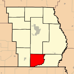
Coon Island Township is one of ten townships in Butler County, Missouri, USA. As of the 2010 census, its population was 187.[3]
Geography[]
Coon Island Township covers an area of 38.19 square miles (98.9 km2) and contains no incorporated settlements. It contains one cemetery, Coon Island.
Allred Lake is within this township. The streams of Big Hunting Slough, Caney Slough and Little Hunting Slough run through this township.
References[]
External links[]
Municipalities and communities of Butler County, Missouri, United States | ||
|---|---|---|
| Cities |  | |
| Townships | ||
| CDPs | ||
| Other communities | ||
| Ghost town | ||
| Footnotes | ‡This populated place also has portions in an adjacent county or counties | |
| ||
This Butler County, Missouri state location article is a stub. You can help Wikipedia by . |
Categories:
- Townships in Butler County, Missouri
- Townships in Missouri
- Southeast Missouri geography stubs