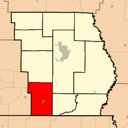
Neely Township, Butler County, Missouri
Neely Township | |
|---|---|
 | |
| Coordinates: 36°33′47″N 090°31′06″W / 36.56306°N 90.51833°WCoordinates: 36°33′47″N 090°31′06″W / 36.56306°N 90.51833°W | |
| Country | United States |
| State | Missouri |
| County | Butler |
| Area | |
| • Total | 59.9 sq mi (155.15 km2) |
| • Land | 59.86 sq mi (155.05 km2) |
| • Water | 0.04 sq mi (0.1 km2) 0.06% |
| Elevation | 302 ft (92 m) |
| Population (2010) | |
| • Total | 1,126 |
| • Density | 21/sq mi (8.1/km2) |
| FIPS code | 29-51392[2] |
| GNIS feature ID | 0766355 |

Neely Township is one of ten townships in Butler County, Missouri, USA. As of the 2010 census, its population was 1,126.[3]
Neely Township was organized in 1871, and named after Obadiah Neely, an early citizen.[4]
Geography[]
Neely Township covers an area of 59.9 square miles (155 km2) and contains one incorporated settlement, Neelyville. It contains seven cemeteries: Crab, Harris Ridge, Lutz, Neeleyville, Roberts, Sheely and Sims.
The streams of Big Cane Creek, Cane Creek, Cope Branch, Fox Branch and Gaines Slough run through this township.
Transportation[]
Neely Township contains one airport or landing strip: Wattle Landing Strip.
References[]
- ^ "US Board on Geographic Names". United States Geological Survey. 2007-10-25. Retrieved 2008-01-31.
- ^ "U.S. Census website". United States Census Bureau. Retrieved 2008-01-31.
- ^ https://www.census.gov/prod/cen2010/cph-2-27.pdf
- ^ "Butler County Place Names, 1928–1945 (archived)". The State Historical Society of Missouri. Archived from the original on 24 June 2016. Retrieved 6 September 2016.CS1 maint: bot: original URL status unknown (link)
External links[]
Municipalities and communities of Butler County, Missouri, United States | ||
|---|---|---|
| Cities |  | |
| Townships | ||
| CDPs | ||
| Other communities | ||
| Ghost town | ||
| Footnotes | ‡This populated place also has portions in an adjacent county or counties | |
| ||
This Butler County, Missouri state location article is a stub. You can help Wikipedia by . |
Categories:
- Townships in Butler County, Missouri
- Townships in Missouri
- Southeast Missouri geography stubs