Cotswold District
Coordinates: 51°43′08″N 1°58′05″W / 51.719°N 1.968°W

Cotswold District | |
|---|---|
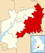 Cotswold shown within Gloucestershire | |
| Sovereign state | United Kingdom |
| Constituent country | England |
| Region | South West England |
| Non-metropolitan county | Gloucestershire |
| Status | Non-metropolitan district |
| Admin HQ | Cirencester |
| Incorporated | 1 April 1974 |
| Government | |
| • Type | Non-metropolitan district council |
| • Body | Cotswold District Council |
| • Leadership | Joe Harris Leader & Cabinet (Liberal Democrats) |
| • MPs | Geoffrey Clifton-Brown |
| Area | |
| • Total | 449.6 sq mi (1,164.5 km2) |
| Area rank | 23rd (of 309) |
| Population (mid-2019 est.) | |
| • Total | 89,862 |
| • Rank | 270th (of 309) |
| • Density | 200/sq mi (77/km2) |
| • Ethnicity | 98.8% White |
| Time zone | UTC0 (GMT) |
| • Summer (DST) | UTC+1 (BST) |
| ONS code | 23UC (ONS) E07000079 (GSS) |
| OS grid reference | SP0221002304 |
| Website | www |
Cotswold is a local government district in Gloucestershire, England. It is named after the wider Cotswolds region. Its main town is Cirencester. Other notable towns include Tetbury, Moreton-in-Marsh, Stow-on-the-Wold and Chipping Campden. Notable villages in the district include Bourton-on-the-Water, Blockley, Kemble and Upper Rissington among other villages and hamlets in the district.
It was formed on 1 April 1974 by the merger of the urban district of Cirencester with Cirencester Rural District, North Cotswold Rural District, Northleach Rural District, and Tetbury Rural District. The population of the Cotswold District in the 2011 Census was 83,000.[1]
Eighty per cent of the district lies within the River Thames catchment area, with the Thames itself and several tributaries including the River Windrush and River Leach running through the district. Lechlade in an important point on the river as the upstream limit of navigation. In the 2007 floods in the UK, rivers were the source of flooding of 53 per cent of the locations affected and the Thames at Lechlade reached record levels with over 100 reports of flooding.[2]
The District is spread over 450 square miles, with some 80% of the land located within the Cotswold Area of Outstanding Natural Beauty.[3][1] The much larger area referred to as the Cotswolds encompasses nearly 800 square miles,[4] over five counties: Gloucestershire, Oxfordshire, Warwickshire, Wiltshire, and Worcestershire.[5] This large Area of Outstanding Natural Beauty had a population of 139,000 in 2016.[6]
References[]
- ^ a b https://www.cotswold.gov.uk/media/240336/Census2011-who-we-are.pdf
- ^ "Cotswold District Council - Review of the Summer 2007 floods in Cotswold District". Archived from the original on 22 July 2011.
- ^ "About the Council - Cotswold District Council". cotswold.gov.uk.
- ^ "Cotswolds.com - The Official Cotswolds Tourist Information Site". Cotswolds.
- ^ "In Deep: Idyllic England in the Cotswolds | Butterfield & Robinson". 14 August 2017.
- ^ https://www.cotswoldsaonb.org.uk/wp-content/uploads/2017/07/NEW-FACT-SHEET-6-v1.pdf
![]() Media related to Cotswold at Wikimedia Commons
Media related to Cotswold at Wikimedia Commons
| Unitary authorities | |
|---|---|
| Boroughs or districts | |
| Major settlements |
|
| Rivers |
|
| Topics | |
This Gloucestershire location article is a stub. You can help Wikipedia by . |
- Cotswold District
- Local authorities adjoining the River Thames
- Non-metropolitan districts of Gloucestershire
- Gloucestershire geography stubs