Council Grove, Kansas
Council Grove, Kansas | |
|---|---|
City and County seat | |
 Downtown Council Grove (2012) | |
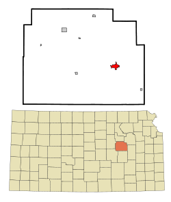 Location within Morris County and Kansas | |
 | |
| Coordinates: 38°39′38″N 96°29′23″W / 38.66056°N 96.48972°WCoordinates: 38°39′38″N 96°29′23″W / 38.66056°N 96.48972°W | |
| Country | United States |
| State | Kansas |
| County | Morris |
| Incorporated | 1887[1] |
| Government | |
| • Type | Mayor–Council |
| • Mayor | Debi Schwerdtfeger |
| Area | |
| • Total | 2.06 sq mi (5.32 km2) |
| • Land | 2.04 sq mi (5.29 km2) |
| • Water | 0.01 sq mi (0.03 km2) |
| Elevation | 1,237 ft (377 m) |
| Population | |
| • Total | 2,182 |
| • Estimate (2019)[4] | 2,121 |
| • Density | 1,038.18/sq mi (400.80/km2) |
| Time zone | UTC-6 (CST) |
| • Summer (DST) | UTC-5 (CDT) |
| ZIP codes | 66846, 66873 |
| Area code | 620 |
| FIPS code | 20-15925[5] |
| GNIS ID | 0477021[6] |
| Website | cityofcouncilgrove.com |

Council Grove is a city and county seat in Morris County, Kansas, United States.[7] As of the 2010 census, the city population was 2,182.[8] It was named after an agreement between American settlers and the Osage Nation allowing settlers' wagon trains to pass westward through the area on the Santa Fe Trail. Pioneers gathered at a grove of trees so that wagons could band together for their trip west.
History[]

Council Grove was a stop on the Santa Fe Trail. The first European-American settler was Seth M. Hays, who came to the area in 1847 to trade with the Kaw tribe, which had a reservation established in the area in 1846. Hays was a great grandson of Daniel Boone.

The Main street in Council Grove is the old Santa Fe Trail. The Rawlinson-Terwilliger Home, 803 West Main Street, is the oldest stone home on the Santa Fe Trail and houses the Trail Days Cafe & Museum.
A post office was established in Council Grove on February 26, 1855.[9]
In 1858, the town was officially incorporated by the legislature.[10] Hays also opened a restaurant in 1857, the Hays House, which is said to be the oldest continuously operating restaurant west of the Mississippi River.
The town has 15 sites listed on the National Register of Historic Places. One is the Post Office Oak. Travelers left their mail in this designated tree to be picked up by others going in the right direction. General Custer of the United States Army slept here with his troops during the American Civil War, under a large tree known now as the Custer Elm.
The National Old Trails Road, also known as the Ocean-to-Ocean Highway, was established in 1912, and was routed through Herington, Delavan, Council Grove.
In 1943, German and Italian prisoners of World War II were brought to Kansas and other Midwest states as a means of solving the labor shortage caused by American men serving in the war effort. Large internment camps were established in Kansas: Camp Concordia, Camp Funston (at Fort Riley), Camp Phillips (at Salina under Fort Riley). Fort Riley established 12 smaller branch camps, including Council Grove.[11]
Geography[]
According to the United States Census Bureau, the city has a total area of 2.01 square miles (5.21 km2), of which, 1.99 square miles (5.15 km2) is land and 0.02 square miles (0.05 km2) is water.[12] The city is fifty-five miles southwest of Topeka.
Climate[]
The climate in this area is characterized by hot, humid summers and generally mild to cool winters. According to the Köppen Climate Classification system, Council Grove has a humid subtropical climate, abbreviated "Cfa" on climate maps.[13]
Area events[]
- Heritage Rendezvous
- Washunga Days
Area attractions[]
- Allegawaho Heritage Memorial Park
- Kaw Mission State Historic Site
- 1857 Hays House
- Madonna of the Trail monument
- Trail Days Historic Site
Presently, both the Council Grove Reservoir and the City Lake are popular for recreational activities. While both lakes are open to the public and motorized boats, most of the land around the City Lake is privately owned with over three hundred lake houses. Building is restricted on the larger Council Grove Reservoir but there are many well-positioned camp sites. Excellent fishing is found on these lakes as well. Walleye, crappie, white bass, and many more fish are in both the Council Grove Reservoir and the City Lake.
Demographics[]
| Historical population | |||
|---|---|---|---|
| Census | Pop. | %± | |
| 1870 | 712 | — | |
| 1880 | 1,042 | 46.3% | |
| 1890 | 2,211 | 112.2% | |
| 1900 | 2,265 | 2.4% | |
| 1910 | 2,545 | 12.4% | |
| 1920 | 2,857 | 12.3% | |
| 1930 | 2,898 | 1.4% | |
| 1940 | 2,875 | −0.8% | |
| 1950 | 2,722 | −5.3% | |
| 1960 | 2,664 | −2.1% | |
| 1970 | 2,403 | −9.8% | |
| 1980 | 2,381 | −0.9% | |
| 1990 | 2,228 | −6.4% | |
| 2000 | 2,321 | 4.2% | |
| 2010 | 2,182 | −6.0% | |
| 2019 (est.) | 2,121 | [4] | −2.8% |
| U.S. Decennial Census | |||
2010 census[]
As of the census[3] of 2010, there were 2,182 people, 991 households, and 565 families residing in the city. The population density was 1,096.5 inhabitants per square mile (423.4/km2). There were 1,107 housing units at an average density of 556.3 per square mile (214.8/km2). The racial makeup of the city was 95.8% White, 0.4% African American, 0.2% Native American, [14]0.2% Asian, 1.9% from other races, and 1.6% from two or more races. Hispanic or Latino of any race were 6.0% of the population.
There were 991 households, of which 26.5% had children under the age of 18 living with them, 45.5% were married couples living together, 8.3% had a female householder with no husband present, 3.2% had a male householder with no wife present, and 43.0% were non-families. 39.5% of all households were made up of individuals, and 20% had someone living alone who was 65 years of age or older. The average household size was 2.14 and the average family size was 2.85.
The median age in the city was 45.9 years. 21.7% of residents were under the age of 18; 7% were between the ages of 18 and 24; 19.8% were from 25 to 44; 27.1% were from 45 to 64; and 24.4% were 65 years of age or older. The gender makeup of the city was 46.8% male and 53.2% female.
2000 census[]
As of the census[5] of 2000, there were 2,321 people, 1,002 households, and 634 families residing in the city. The population density was 1,293.2 people per square mile (500.6/km2). There were 1,099 housing units at an average density of 612.3 per square mile (237.1/km2). The racial makeup of the city was 98.23% White, 0.26% African American, 0.22% Native American, 0.22% Asian, 0.47% from other races, and 0.60% from two or more races. Hispanic or Latino of any race were 2.11% of the population.
There were 1,002 households, out of which 29.0% had children under the age of 18 living with them, 51.3% were married couples living together, 8.7% had a female householder with no husband present, and 36.7% were non-families. 34.8% of all households were made up of individuals, and 19.0% had someone living alone who was 65 years of age or older. The average household size was 2.24 and the average family size was 2.90.
In the city, the population was spread out, with 24.7% under the age of 18, 6.5% from 18 to 24, 23.8% from 25 to 44, 21.7% from 45 to 64, and 23.4% who were 65 years of age or older. The median age was 42 years. For every 100 females, there were 89.2 males. For every 100 females age 18 and over, there were 82.8 males.
The median income for a household in the city was $28,949, and the median income for a family was $37,061. Males had a median income of $29,500 versus $20,625 for females. The per capita income for the city was $20,189. About 7.4% of families and 8.5% of the population were below the poverty line, including 8.7% of those under age 18 and 15.6% of those age 65 or over.
Education[]

The community is served by Morris County USD 417 public school district.[15] Council Grove High School is a high school located at 129 Hockaday St., Council Grove. Students from the surrounding areas travel to Council Grove to attend high school.[16] Council Grove Middle School includes grades 6 through 8 and is located at 706 E Main St. Council Grove Elementary School includes kindergarten through the 5th grade and is attached to the middle school. The athletic teams are known as the Braves.
Transportation[]
Council Grove was located on the National Old Trails Road, also known as the Ocean-to-Ocean Highway, that was established in 1912.
Notable people[]
- Charles Curtis Vice President of the United States under Herbert Hoover 1929 - 1933, member Kaw Indian tribe.
- Don Harvey, actor
- Clara Hazelrigg, author, educator, social reformer
- James Miller, U.S. Representative from Kansas
- John Rhodes, United States House of Representatives from Arizona 1952 - 1983, House Republican Leader 1973 - 1981
Gallery[]
- Historic Images of Council Grove, Special Photo Collections at Wichita State University Library

Historic Farmers and Drovers Bank building (2012)

1894 Missouri, Kansas & Texas Railway Depot (2015)
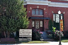
Carnegie Library (2015)

Madonna of the Trail monument in Council Grove (2005)
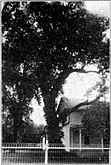
Council Oak at Council Grove (1912)

1857 Historic Last Chance Store (1958)


See also[]
- National Register of Historic Places listings in Morris County, Kansas
- Santa Fe Trail
- National Old Trails Road
References[]
- ^ Jump up to: a b "City of Council Grove". The League of Kansas Municipalities. May 27, 2019.
- ^ "2019 U.S. Gazetteer Files". United States Census Bureau. Retrieved July 24, 2020.
- ^ Jump up to: a b "U.S. Census website". United States Census Bureau. Retrieved 2012-07-06.
- ^ Jump up to: a b "Population and Housing Unit Estimates". United States Census Bureau. May 24, 2020. Retrieved May 27, 2020.
- ^ Jump up to: a b "U.S. Census website". United States Census Bureau. Retrieved 2008-01-31.
- ^ "US Board on Geographic Names". United States Geological Survey. 2007-10-25. Retrieved 2008-01-31.
- ^ "Find a County". National Association of Counties. Archived from the original on 2011-05-31. Retrieved 2011-06-07.
- ^ "2010 City Population and Housing Occupancy Status". U.S. Census Bureau. Retrieved March 6, 2011.[dead link]
- ^ "Kansas Post Offices, 1828-1961". Kansas Historical Society. Retrieved 15 June 2014.
- ^ History of the State of Kansas: Containing a Full Account of Its Growth from an Uninhabited Territory to a Wealthy and Important State. A. T. Andreas. 1883. p. 803.
- ^ List of Prisoner Of War (POW) Camps in Kansas
- ^ "US Gazetteer files 2010". United States Census Bureau. Archived from the original on 2012-07-02. Retrieved 2012-07-06.
- ^ Climate Summary for Council Grove, Kansas
- ^ "The Santa Fe Trail", Disaster At The Colorado, Utah State University Press, pp. 13–22, doi:10.2307/j.ctt46nx9w.5, ISBN 978-0-87421-461-1, retrieved 2021-04-18
- ^ USD 417 website.
- ^ "Council Grove High School", Great Schools
Further reading[]
- The Story of Council Grove on the Santa Fe Trail; 2nd Ed; Lalla Maloy Brigham; 176 pages; 1921.
External links[]
| Wikimedia Commons has media related to Council Grove, Kansas. |
- City
- City of Council Grove
- Council Grove - Directory of Public Officials
- Council Grove Chamber of Commerce & Tourism
- Historical
- Hays House on YouTube, from Hatteberg's People on KAKE TV news
- Historic Images of Council Grove, Special Photo Collections at Wichita State University Library
- Kansas Photo Tour - Council Grove
- Council Grove 19th Century History
- Historical information about Council Grove
- Maps
- Council Grove City Map, KDOT
| hide Municipalities and communities of Morris County, Kansas, United States | ||
|---|---|---|
| Cities |  | |
| Unincorporated communities | ||
| Ghost towns | ||
| Townships |
| |
| Footnotes | †This populated place is designated a Census-Designated Place (CDP) by the United States Census Bureau. ‡This populated place also has portions in an adjacent county or counties. | |
| ||
| show Authority control |
|---|
- Cities in Kansas
- County seats in Kansas
- Cities in Morris County, Kansas
- Native American history of Kansas
- Kaw tribe
- Osage Nation
- Santa Fe Trail
- Populated places established in 1847
- 1847 establishments in Indian Territory