Cranbury, New Jersey
Cranbury, New Jersey | |
|---|---|
| Township of Cranbury | |
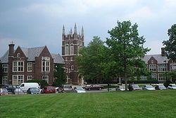
 Central business district of Cranbury | |
 Map of Cranbury Township in Middlesex County. Inset: Location of Middlesex County highlighted in the State of New Jersey. | |
 Census Bureau map of Cranbury Township, New Jersey | |
 Cranbury Location in Middlesex County | |
| Coordinates: 40°18′48″N 74°31′13″W / 40.31345°N 74.520233°WCoordinates: 40°18′48″N 74°31′13″W / 40.31345°N 74.520233°W[1][2] | |
| Country | |
| State | |
| County | Middlesex |
| Incorporated | March 7, 1872 |
| Government | |
| • Type | Township |
| • Body | Township Committee |
| • Mayor | Michael Ferrante (D, term ends December 31, 2021)[3][4] |
| • Administrator | Denise Marabello[5] |
| • Municipal clerk | Debra A. Rubin[6] |
| Area | |
| • Total | 13.43 sq mi (34.79 km2) |
| • Land | 13.28 sq mi (34.40 km2) |
| • Water | 0.15 sq mi (0.39 km2) 1.12% |
| Area rank | 181st of 565 in state 9th of 25 in county[1] |
| Elevation | 82 ft (25 m) |
| Population | |
| • Total | 3,857 |
| • Estimate (2019)[12] | 4,067 |
| • Rank | 417th of 566 in state 24th of 25 in county[13] |
| • Density | 291.2/sq mi (112.4/km2) |
| • Density rank | 481st of 566 in state 25th of 25 in county[13] |
| Time zone | UTC−05:00 (Eastern (EST)) |
| • Summer (DST) | UTC−04:00 (Eastern (EDT)) |
| ZIP Codes | |
| Area code(s) | 609[16] |
| FIPS code | 3402315550[1][17][18] |
| GNIS feature ID | 0882160[1][19] |
| Website | www |


Cranbury is a township in Middlesex County, New Jersey, United States. Located within the Raritan Valley region, Cranbury is roughly equidistant between New York City and Philadelphia in the heart of the state. As of the 2010 United States Census, the township's population was 3,857,[9][10][11] reflecting an increase of 630 (+19.5%) from the 3,227 counted in the 2000 Census, which had in turn increased by 727 (+29.1%) from the 2,500 counted in 1990.[20]
Cranbury, along with the municipalities of Bellmawr, Egg Harbor Township, Montclair, and Woodbridge Township, were among the original five municipalities (of 565 in the state) that had authorized dispensaries for the sale of medical marijuana in their municipality.[21] However, on Monday July 12, 2021, in an ordinance the township unanimously voted down the allowance of all types of marijuana businesses from operating within the municipality.[22]
History[]
A deed for a sale of land and improvements dated March 1, 1698, is the earliest evidence of buildings constructed in present-day Cranbury. A home in Cranbury was used by Alexander Hamilton and the Marquis de Lafayette as a headquarters during the American Revolutionary War, and they were visited by General George Washington on June 26, 1778.[23][24] As part of orders issued during the Presidency of George Washington, maps of Cranbury were made showing the presence of a church, a mill and 25 other buildings. During its earliest years, the location was usually spelled as "Cranberry". Rev. Joseph G. Symmes argued in 1857 that the name was spelled improperly and that the suffix "bury" was more appropriate, leading the name of the community and brook to be changed to "Cranbury" in 1869.[25] The name has been attributed to wild cranberries that grew in the area.[26]
The so-called Hightstown rail accident occurred in or near Cranbury, in 1833. According to John Quincy Adams, who was aboard the train and who wrote in his diary about it, the train was 3 miles (4.8 km) from Hightstown when the disaster struck, putting the accident near what is now Cranbury Station.[27][28] Among the passengers aboard were Tyrone Power and Cornelius Vanderbilt.
Cranbury was incorporated as a township by an act of the New Jersey Legislature on March 7, 1872, from portions of both Monroe Township and South Brunswick Township. Portions of the township were taken on April 1, 1919, to form Plainsboro Township.[29]
George Washington's headquarters were located in Cranbury while planning for the Battle of Monmouth, a major turning point during the Revolutionary War.[30]
Many buildings on Cranbury's Main Street and in the surrounding area date to the 18th or 19th century. The entire downtown area is designated as a Historic District, which was added to the National Register of Historic Places in September 1980 as District #80002502. The nomination form describes how "Cranbury is the best preserved 19th century village in Middlesex County" and states that "While there are many small mill towns in New Jersey, few are in such an undisturbed environment as that of Cranbury."[25][31]
The township celebrated its tricentennial in 1998.[30]
Updike Parsonage Barn, originally constructed c. 1759, was disassembled, relocated and reconstructed in 2010 at its current location in Barn Park.[32]
Geography[]


According to the United States Census Bureau, the township had a total area of 13.43 square miles (34.79 km2), including 13.28 square miles (34.40 km2) of land and 0.15 square miles (0.39 km2) of water (1.12%).[1][2]
Cranbury CDP (2010 Census population of 2,181[33]) is an unincorporated community and census-designated place (CDP) located within Cranbury Township.[34][35] Despite the match between the name of the Township and the CDP, the two are not one and the same, as was the case for most paired Township / CDP combinations (i.e., a CDP with the same as its parent township) before the 2010 Census, when most such paired CDPs were coextensive with a township of the same name.[34]
Other unincorporated communities, localities and place names located partially or completely within the township include Brain Grove Lake, Cranbury Station, Wescott and Wyckoffs Mills.[36]
The township borders Monroe Township, Plainsboro Township and South Brunswick Township in Middlesex County; and East Windsor Township in Mercer County.[37][38][39]
Demographics[]
| Historical population | |||
|---|---|---|---|
| Census | Pop. | %± | |
| 1880 | 1,509 | — | |
| 1890 | 1,422 | −5.8% | |
| 1900 | 1,428 | 0.4% | |
| 1910 | 1,424 | −0.3% | |
| 1920 | 1,083 | * | −23.9% |
| 1930 | 1,278 | 18.0% | |
| 1940 | 1,342 | 5.0% | |
| 1950 | 1,797 | 33.9% | |
| 1960 | 2,001 | 11.4% | |
| 1970 | 2,253 | 12.6% | |
| 1980 | 1,927 | −14.5% | |
| 1990 | 2,500 | 29.7% | |
| 2000 | 3,227 | 29.1% | |
| 2010 | 3,857 | 19.5% | |
| 2019 (est.) | 4,067 | [12][40] | 5.4% |
| Population sources: 1880-1920[41] 1880-1890[42] 1890-1910[43] 1910-1930[44] 1930-1990[45] 2000[46][47] 2010[9][10][11] * = Lost territory in previous decade.[29] | |||
Census 2010[]
The 2010 United States census counted 3,857 people, 1,320 households, and 1,060 families in the township. The population density was 291.2 per square mile (112.4/km2). There were 1,371 housing units at an average density of 103.5 per square mile (40.0/km2). The racial makeup was 80.53% (3,106) White, 3.45% (133) Black or African American, 0.10% (4) Native American, 13.74% (530) Asian, 0.03% (1) Pacific Islander, 0.36% (14) from other races, and 1.79% (69) from two or more races. Hispanic or Latino of any race were 2.57% (99) of the population.[9]
Of the 1,320 households, 41.4% had children under the age of 18; 71.3% were married couples living together; 7.0% had a female householder with no husband present and 19.7% were non-families. Of all households, 17.5% were made up of individuals and 7.8% had someone living alone who was 65 years of age or older. The average household size was 2.82 and the average family size was 3.21.[9]
27.2% of the population were under the age of 18, 5.4% from 18 to 24, 15.1% from 25 to 44, 35.5% from 45 to 64, and 16.6% who were 65 years of age or older. The median age was 46.2 years. For every 100 females, the population had 94.2 males. For every 100 females ages 18 and older there were 88.2 males.[9]
The Census Bureau's 2006-2010 American Community Survey showed that (in 2010 inflation-adjusted dollars) median household income was $131,667 (with a margin of error of +/- $21,076) and the median family income was $146,250 (+/- $24,045). Males had a median income of $122,566 (+/- $25,917) versus $60,781 (+/- $22,066) for females. The per capita income for the borough was $55,236 (+/- $5,718). About 3.1% of families and 4.1% of the population were below the poverty line, including 8.2% of those under age 18 and none of those age 65 or over.[48]
Census 2000[]
As of the 2000 United States Census[17] there were 3,227 people, 1,091 households, and 877 families residing in the township. The population density was 240.6 people per square mile (92.9/km2). There were 1,121 housing units at an average density of 83.6 per square mile (32.3/km2). The racial makeup of the township was 88.78% White, 2.26% African American, 7.41% Asian, 0.22% from other races, and 1.33% from two or more races. Hispanic or Latino of any race were 1.70% of the population.[46][47]
There were 1,091 households, out of which 46.3% had children under the age of 18 living with them, 74.6% were married couples living together, 4.3% had a female householder with no husband present, and 19.6% were non-families. 16.3% of all households were made up of individuals, and 7.9% had someone living alone who was 65 years of age or older. The average household size was 2.92 and the average family size was 3.31.[46][47]
In the township the population was spread out, with 30.4% under the age of 18, 3.4% from 18 to 24, 27.6% from 25 to 44, 27.3% from 45 to 64, and 11.2% who were 65 years of age or older. The median age was 40 years. For every 100 females, there were 93.3 males. For every 100 females age 18 and over, there were 90.4 males.[46][47]
The median income for a household in the township was $111,680, and the median income for a family was $128,410. Males had a median income of $94,683 versus $44,167 for females. The per capita income for the township was $50,698. About 0.7% of families and 1.6% of the population were below the poverty line, including 2.7% of those under age 18 and 0.9% of those age 65 or over.[46][47]
Economy[]
Cranbury is host to many warehouses along Route 130 and the roads leading to the NJ Turnpike. A company making the Boy Scout Pinewood Derby cars is also here. Cranbury was noted for a used Rolls-Royce dealership located in the center of township, but it has gone out of business. The alternative energy business Blacklight Power, which occupies a building formerly occupied by Creative Playthings, is in fact located in East Windsor, in an area served by the Cranbury Post Office.
The Associated University Presses is an academic publishing company supplying textbooks to colleges and universities.[49]
Government[]
Local government[]

Cranbury Township is governed under the Township form of government, one of 141 municipalities (of the 565) statewide governed under this form.[50] The Township Committee is comprised of five members, who are elected directly by the voters at-large in partisan elections to serve three-year terms of office on a staggered basis, with either one or two seats coming up for election each year as part of the November general election in a three-year cycle.[7][51] At an annual reorganization meeting, the Township Committee selects one of its members to serve as Mayor. In 1990, the Cranbury Township Committee was expanded from three to five members and the position of Township Administrator by ordinance.[3]
As of 2020, members of the Cranbury Township Committee are Mayor Michael J. Ferrante (D, term on committee ends December 31, 2021), term as mayor ends 2021), Deputy Mayor Barbara Rogers (D, term ends December 31, 2022, term as Deputy mayor ends 2021), Matthew A. Scott (D, term ends December 31, 2023), James M. Taylor (Independent, term ends December 31, 2021), and M. Evelyn Spann (R, term ends December 31, 2022).[3][52][53][54][55][56]
In 2018, the township had an average property tax bill of $11,960, the highest in the county, compared to an average bill of $8,767 statewide.[57]
Federal, state and county representation[]
Cranbury Township is located in the 12th Congressional District[58] and is part of New Jersey's 14th state legislative district.[10][59][60]
For the 117th United States Congress, New Jersey's Twelfth Congressional District is represented by Bonnie Watson Coleman (D, Ewing Township).[61][62] New Jersey is represented in the United States Senate by Democrats Cory Booker (Newark, term ends 2027)[63] and Bob Menendez (Harrison, term ends 2025).[64][65]
For the 2018–2019 session (Senate, General Assembly), the 14th Legislative District of the New Jersey Legislature is represented in the State Senate by Linda R. Greenstein (D, Plainsboro Township) and in the General Assembly by Daniel R. Benson (D, Hamilton Township, Mercer County) and Wayne DeAngelo (D, Hamilton Township, Mercer County).[66][67]
Middlesex County is governed by a Board of Commissioners, whose seven members are elected at-large on a partisan basis to serve three-year terms of office on a staggered basis, with either two or three seats coming up for election each year as part of the November general election. At an annual reorganization meeting held in January, the board selects from among its members a Commissioner Director and Deputy Director. As of 2021, Middlesex County's Commissioners (with party affiliation, term-end year, and residence listed in parentheses) are Commissioner Director Ronald G. Rios (D, term ends December 31, 2021, Carteret; Ex-officio on all committees),[68] Commissioner Deputy Director Shanti Narra (D, 2021; North Brunswick),[69] Claribel A. Azcona-Barber (D, 2022, New Brunswick),[70] Charles Kenny (D, 2022, Woodbridge Township),[71] Leslie Koppel (D, 2023, Monroe),[72] Charles E. Tomaro (D, 2023, Edison)[73] and Chanelle Scott McCullum (D, 2021, Piscataway).[74][75]
Constitutional officers are County Clerk Nancy J. Pinkin (D, 2025, East Brunswick),[76] Sheriff Mildred S. Scott (D, 2022, Piscataway)[77] and Surrogate Claribel Cortes (D, 2021; North Brunswick).[75][78]
Politics[]
As of March 23, 2011, there were a total of 2,768 registered voters in Cranbury Township, of which 836 (30.2%) were registered as Democrats, 684 (24.7%) were registered as Republicans and 1,246 (45.0%) were registered as Unaffiliated. There were 2 voters registered to other parties.[79]
| Year | Republican | Democratic | Third Parties |
|---|---|---|---|
| 2016[80] | 37.1% 794 | 55.9% 1,196 | 7.0% 150 |
| 2012[81] | 46.9% 971 | 52.0% 1,076 | 1.1% 22 |
| 2008[82] | 45.3% 986 | 53.0% 1,153 | 1.3% 29 |
| 2004[83] | 50.8% 1,044 | 48.0% 987 | 0.9% 23 |
In the 2012 presidential election, Democrat Barack Obama received 52.0% of the vote (1,076 cast), ahead of Republican Mitt Romney with 46.9% (971 votes), and other candidates with 1.1% (22 votes), among the 2,082 ballots cast by the township's 2,839 registered voters (13 ballots were spoiled), for a turnout of 73.3%.[84][85] In the 2008 presidential election, Democrat Barack Obama received 53.0% of the vote (1,153 cast), ahead of Republican John McCain with 45.3% (986 votes) and other candidates with 1.3% (29 votes), among the 2,176 ballots cast by the township's 2,777 registered voters, for a turnout of 78.4%.[82] In the 2004 presidential election, Republican George W. Bush received 50.8% of the vote (1,044 ballots cast), outpolling Democrat John Kerry with 48.0% (987 votes) and other candidates with 0.9% (23 votes), among the 2,055 ballots cast by the township's 2,510 registered voters, for a turnout percentage of 81.9.[83]
| Year | Republican | Democratic | Third Parties |
|---|---|---|---|
| 2017[86] | 47.2% 655 | 51.6% 716 | 1.2% 17 |
| 2013[87] | 67.1% 941 | 31.3% 439 | 1.6% 22 |
| 2009[88] | 54.6% 901 | 35.5% 585 | 9.4% 155 |
| 2005[89] | 50.9% 787 | 44.7% 691 | 3.2% 49 |
In the 2013 gubernatorial election, Republican Chris Christie received 67.1% of the vote (941 cast), ahead of Democrat Barbara Buono with 31.3% (439 votes), and other candidates with 1.6% (22 votes), among the 1,421 ballots cast by the township's 2,850 registered voters (19 ballots were spoiled), for a turnout of 49.9%.[87][90] In the 2009 gubernatorial election, Republican Chris Christie received 54.6% of the vote (901 ballots cast), ahead of Democrat Jon Corzine with 35.5% (585 votes), Independent Chris Daggett with 8.7% (144 votes) and other candidates with 0.7% (11 votes), among the 1,649 ballots cast by the township's 2,711 registered voters, yielding a 60.8% turnout.[91]
Education[]
The Cranbury School District serves children in public school for pre-kindergarten through eighth grade at Cranbury School.[92][93] As of the 2019–20 school year, the district, comprised of one school, had an enrollment of 484 students and 55.9 classroom teachers (on an FTE basis), for a student–teacher ratio of 8.7:1.[94] For the 1996–97 school years, Cranbury School was formally designated as a National Blue Ribbon School, the highest honor that an American public school can achieve.[95] During the 2009–10 school year, Cranbury School was awarded the Blue Ribbon School Award of Excellence a second time,[96] and a third time for the 2016–17 school year.[97]
For ninth through twelfth grades, students move on to Princeton High School in Princeton, as part of a sending/receiving relationship with the Princeton Public Schools.[30][98][99][100] Cranbury Township is granted a seat on the Princeton Regional Schools Board of Education, with the designated representative only voting on issues pertaining to Princeton High School and district-wide issues.[101] As of the 2019–20 school year, the high school had an enrollment of 1,582 students and 122.0 classroom teachers (on an FTE basis), for a student–teacher ratio of 13.0:1.[102] Cranbury students had attended Hightstown High School and then Lawrence High School before the relationship was established with Princeton.[103]
Eighth grade students from all of Middlesex County are eligible to apply to attend the high school programs offered by the Middlesex County Vocational and Technical Schools, a county-wide vocational school district that offers full-time career and technical education at Middlesex County Academy in Edison, the Academy for Allied Health and Biomedical Sciences in Woodbridge Township and at its East Brunswick, Perth Amboy and Piscataway technical high schools, with no tuition charged to students for attendance.[104][105]
Public libraries[]
The Cranbury Public Library serves Cranbury residents, sharing a facility with the Cranbury School until summer 2020 when the school evicted the library to provide additional learning space during the COVID-19 pandemic. The public library has operated out of a pocket library since early 2021 while a free-standing public library is being built at 30 Park Place West.[30][106]
Transportation[]
Roads and highways[]

As of May 2010, the township had a total of 51.25 miles (82.48 km) of roadways, of which 31.08 miles (50.02 km) were maintained by the municipality, 12.85 miles (20.68 km) by Middlesex County and 3.16 miles (5.09 km) by the New Jersey Department of Transportation and 4.16 miles (6.69 km) by the New Jersey Turnpike Authority.[107]
Several major roads and highways pass through the township[108] Cranbury hosts a 4-mile (6.4 km) section of Interstate 95 (the New Jersey Turnpike).[109] While there are no exits in Cranbury, the township is accessible by the Turnpike in neighboring East Windsor Township (Exit 8) and Monroe Township (Exit 8A). The Molly Pitcher Service Area is located at mile marker 71.7 on the southbound side.[110]
Other significant roads passing through Cranbury include U.S. Route 130,[111] County Route 535,[112] County Route 539,[113] County Route 615[114] and County Route 614.[115]
Public transportation[]
Middlesex County offers the M6 MCAT shuttle route providing service to Jamesburg and Plainsboro Township.[116]
Notable people[]
People who were born in, residents of, or otherwise closely associated with Cranbury include:
- Melanie Balcomb (born 1962), head coach of the Vanderbilt Commodores women's basketball team.[117]
- Todd Beamer (1968–2001), passenger aboard United Airlines Flight 93, who said "Let's roll" to fellow passengers with whom he was planning an attack on terrorists who had taken over the cockpit.[118]
- Scott Brunner (born 1957), quarterback who played in the NFL from 1981 to 1986, most notably for the New York Giants.[119]
- Ronald C. Davidson (1941-2016), physicist, professor and scientific administrator who served as the first director of the MIT Plasma Science and Fusion Center and as director of the Princeton Plasma Physics Laboratory.[120]
- Wendy Gooditis (born Gwendolyn Wallace in 1960), politician who represents Virginia's 10th House of Delegates district in the Virginia House of Delegates.[121]
- Noah Harlan, independent filmmaker.[122]
- Hughie Lee-Smith (1915–1999), artist.[123]
- Cicero Hunt Lewis (1826–1897), merchant.[124]
- Robert Lougy, judge on the New Jersey Superior Court who served as acting New Jersey Attorney General in 1996.[125]
- Charles McKnight (1750-1791), physician during and after the American Revolutionary War.[126]
- Jan Morris (born 1926), Welsh travel writer and historian, lived in Cranbury for several months in the 1950s whose impressions of the town are recorded in the book Coast to Coast: A Journey Across 1950s America.[127]
- Henry Perrine (1797-1840), physician, horticulturist and an enthusiast for introducing tropical plants into cultivation in the United States.[128]
References[]
- ^ Jump up to: a b c d e f 2019 Census Gazetteer Files: New Jersey Places, United States Census Bureau. Accessed July 1, 2020.
- ^ Jump up to: a b US Gazetteer files: 2010, 2000, and 1990, United States Census Bureau. Accessed September 4, 2014.
- ^ Jump up to: a b c Township Committee, Cranbury Township. Accessed September 15, 2019.
- ^ 2020 New Jersey Mayors Directory, New Jersey Department of Community Affairs. Accessed February 1, 2020.
- ^ Administrator Archived January 27, 2013, at the Wayback Machine, Cranbury Township. Accessed September 15, 2019.
- ^ Township Clerk Archived January 27, 2013, at the Wayback Machine, Cranbury Township. Accessed September 15, 2019.
- ^ Jump up to: a b 2012 New Jersey Legislative District Data Book, Rutgers University Edward J. Bloustein School of Planning and Public Policy, March 2013, p. 70.
- ^ U.S. Geological Survey Geographic Names Information System: Township of Cranbury, Geographic Names Information System. Accessed March 5, 2013.
- ^ Jump up to: a b c d e f DP-1 - Profile of General Population and Housing Characteristics: 2010 for Cranbury township, Middlesex County, New Jersey Archived February 12, 2020, at archive.today, United States Census Bureau. Accessed July 5, 2012.
- ^ Jump up to: a b c d Municipalities Sorted by 2011-2020 Legislative District, New Jersey Department of State. Accessed February 1, 2020.
- ^ Jump up to: a b c Profile of General Demographic Characteristics: 2010 for Cranbury township Archived 2011-10-06 at the Wayback Machine, New Jersey Department of Labor and Workforce Development. Accessed July 5, 2012.
- ^ Jump up to: a b Annual Estimates of the Resident Population for Minor Civil Divisions in New Jersey: April 1, 2010 to July 1, 2019, United States Census Bureau. Accessed May 21, 2020.
- ^ Jump up to: a b GCT-PH1 Population, Housing Units, Area, and Density: 2010 - State -- County Subdivision from the 2010 Census Summary File 1 for New Jersey Archived February 12, 2020, at archive.today, United States Census Bureau. Accessed November 22, 2012.
- ^ Look Up a ZIP Code for Cranbury, NJ, United States Postal Service. Accessed July 5, 2012.
- ^ Zip Codes, State of New Jersey. Accessed September 2, 2013.
- ^ Area Code Lookup - NPA NXX for Cranbury, NJ, Area-Codes.com. Accessed September 2, 2013.
- ^ Jump up to: a b U.S. Census website , United States Census Bureau. Accessed September 4, 2014.
- ^ Geographic codes for New Jersey, Missouri Census Data Center. Accessed September 1, 2019.
- ^ US Board on Geographic Names, United States Geological Survey. Accessed September 4, 2014.
- ^ Table 7. Population for the Counties and Municipalities in New Jersey: 1990, 2000 and 2010, New Jersey Department of Labor and Workforce Development, February 2011. Accessed November 5, 2012.
- ^ Guion, Payton. "Marijuana legalization would force tough choice for N.J. towns", NJ Advance Media for NJ.com, November 15, 2017. Accessed November 15, 2017. "NJ Advance Media reached out to mayors in all five towns that have medical dispensaries: Bellmawr, Cranbury, Egg Harbor, Montclair and Woodbridge."
- ^ [1], myCentral Jersey [myCentralJersey.com], Written by Julia Duggan, July 15, 2021. Accessed August 11, 2021.
- ^ From George Washington to Major General Lafayette, 26 June 1778, Founders Online at National Archives and Records Administration. Accessed December 3, 2019.
- ^ To George Washington from Major General Lafayette, 25 June 1778, Founders Online at National Archives and Records Administration. Accessed December 3, 2019.
- ^ Jump up to: a b History, Cranbury Township. Accessed December 3, 2019. "The marshy land near the mill site might have grown cranberries, hence the name. On 18th Century maps, the name appears as Cranberry and Cranberry Town. In 1857, Reverend Joseph G. Symmes felt the name was incorrectly spelled and suggested it be changed to Cranbury. In Old English 'bury' (connoting 'burgh') could be spelled bury, bery, or berry. In 1869, the town and the brook were renamed Cranbury."
- ^ Hutchinson, Viola L. The Origin of New Jersey Place Names, New Jersey Public Library Commission, May 1945. Accessed August 28, 2015.
- ^ John Quincy Adams diary 39, 1 December 1832 - 31 May 1835, page 179, Massachusetts Historical Society. Accessed September 2, 2013.
- ^ A history book on Cranbury says the accident happened 4 miles from Hightstown, putting the accident near today's retirement communities in Monroe Township. However, the book refers to John Quincy Adams' diary. See Chambers, John Whiteclay. Cranbury: A New Jersey Town from the Colonial Era to the Present, p. 50. Rutgers University Press, 2012. ISBN 9780813553580. Accessed November 10, 2015.
- ^ Jump up to: a b Snyder, John P. The Story of New Jersey's Civil Boundaries: 1606-1968, Bureau of Geology and Topography; Trenton, New Jersey; 1969. p. 169-170. Accessed July 5, 2012.
- ^ Jump up to: a b c d Cheslow, Jerry. "Historic, Sparsely Settled -- and Loving It", The New York Times, March 16, 1997. Accessed July 14, 2011. "The Middlesex County community is celebrating the 300th anniversary of the first documented European settlement in the area.... Cranbury pays tuition to send 106 high school students to nearby Princeton High School. According to Cranbury's Chief School Administrator, Robert J. Bartoletti, 87 percent of the town's youngsters go on to higher education.... As part of the addition, the 28,000-volume Cranbury Public Library, which shares space with the school library, is also being expanded to 6,000 square feet from 4,000 and the school's computers are to be enhanced through the networking of all of the classrooms into the library."
- ^ New Jersey and National Registers of Historic Places, New Jersey Department of Environmental Protection Historic Preservation Office, updated September 18, 2019. Accessed December 3, 2019.
- ^ Barn Park, Cranbury Township. Accessed December 3, 2019. "The Parsonage barn originally belonged to the Parsonage Plantation, c. 1759, of the First Presbyterian Church of Cranbury. It was dismantled in 2004 and stored for five years. In 2010, a foundation was laid and the repaired timbers were re-erected with funding from the Cranbury Historical and Preservation Society, Cranbury Landmarks, Inc., and the Township of Cranbury."
- ^ Profile of General Demographic Characteristics: 2010 for Cranbury CDP Archived 2011-10-06 at the Wayback Machine, New Jersey Department of Labor and Workforce Development. Accessed July 14, 2011.
- ^ Jump up to: a b New Jersey: 2010 - Population and Housing Unit Counts - 2010 Census of Population and Housing (CPH-2-32), United States Census Bureau, August 2012. Accessed November 28, 2012.
- ^ GCT-PH1 - Population, Housing Units, Area, and Density: 2010 - County -- County Subdivision and Place from the 2010 Census Summary File 1 for Middlesex County, New Jersey Archived February 12, 2020, at archive.today, United States Census Bureau. Accessed November 28, 2012.
- ^ Locality Search, State of New Jersey. Accessed May 21, 2015.
- ^ Areas touching Cranbury Township, MapIt. Accessed July 13, 2016.
- ^ Municipalities, Middlesex County, New Jersey. Accessed December 1, 2019.
- ^ New Jersey Municipal Boundaries, New Jersey Department of Transportation. Accessed November 15, 2019.
- ^ Census Estimates for New Jersey April 1, 2010 to July 1, 2019, United States Census Bureau. Accessed May 21, 2020.
- ^ Compendium of censuses 1726-1905: together with the tabulated returns of 1905, New Jersey Department of State, 1906. Accessed September 2, 2013.
- ^ Porter, Robert Percival. Preliminary Results as Contained in the Eleventh Census Bulletins: Volume III - 51 to 75, p. 98. United States Census Bureau, 1890. Accessed November 22, 2012.
- ^ Thirteenth Census of the United States, 1910: Population by Counties and Minor Civil Divisions, 1910, 1900, 1890, United States Census Bureau, p. 337. Accessed July 5, 2012.
- ^ Fifteenth Census of the United States : 1930 - Population Volume I, United States Census Bureau, p. 717. Accessed July 5, 2012.
- ^ New Jersey Resident Population by Municipality: 1930 - 1990, Workforce New Jersey Public Information Network. Accessed June 28, 2015.
- ^ Jump up to: a b c d e Census 2000 Profiles of Demographic / Social / Economic / Housing Characteristics for Pompton Lake borough, New Jersey Archived 2012-08-01 at the Wayback Machine, United States Census Bureau. Accessed July 5, 2012.
- ^ Jump up to: a b c d e DP-1: Profile of General Demographic Characteristics: 2000 - Census 2000 Summary File 1 (SF 1) 100-Percent Data for Cranbury township, Middlesex County, New Jersey Archived February 12, 2020, at archive.today, United States Census Bureau. Accessed November 22, 2012.
- ^ DP03: Selected Economic Characteristics from the 2006-2010 American Community Survey 5-Year Estimates for Cranbury township, Middlesex County, New Jersey Archived February 12, 2020, at archive.today, United States Census Bureau. Accessed July 5, 2012.
- ^ "Associated University Presses". Associated University Presses. Retrieved February 2, 2018.
- ^ Inventory of Municipal Forms of Government in New Jersey, Rutgers University Center for Government Studies, July 1, 2011. Accessed November 18, 2019.
- ^ "Forms of Municipal Government in New Jersey", p. 7. Rutgers University Center for Government Studies. Accessed June 3, 2015.
- ^ 2019 Municipal User Friendly Budget, Cranbury Township. Accessed September 15, 2019.
- ^ Cranbury Township, Middlesex County, New Jersey. Accessed September 15, 2019.
- ^ November 5, 2019 General Election Official Results, Middlesex County, New Jersey. Accessed January 7, 2020.
- ^ November 7, 2017 General Election Official Results, Middlesex County, New Jersey. Accessed January 1, 2018.
- ^ November 8, 2016 General Election Results, Middlesex County, New Jersey. Accessed January 30, 2017.
- ^ Marcus, Samantha. "These are the towns with the highest property taxes in each of N.J.’s 21 counties", NJ Advance Media for NJ.com, April 22, 2019. Accessed November 5, 2019. "The average property tax bill in New Jersey was $8,767 last year. But there can be big swings from town to town and county to county.... The average property tax bill in Cranbury Township was $11,960 in 2018, the highest in Middlesex County."
- ^ Plan Components Report, New Jersey Redistricting Commission, December 23, 2011. Accessed February 1, 2020.
- ^ 2019 New Jersey Citizen's Guide to Government, New Jersey League of Women Voters. Accessed October 30, 2019.
- ^ Districts by Number for 2011-2020, New Jersey Legislature. Accessed January 6, 2013.
- ^ Directory of Representatives: New Jersey, United States House of Representatives. Accessed January 3, 2019.
- ^ Biography, Congresswoman Bonnie Watson Coleman. Accessed January 3, 2019. "Watson Coleman and her husband William reside in Ewing Township and are blessed to have three sons; William, Troy, and Jared and three grandchildren; William, Kamryn and Ashanee."
- ^ [2], United States Senate. Accessed April 30, 2021. "He now owns a home and lives in Newark's Central Ward community."
- ^ Biography of Bob Menendez, United States Senate, January 26, 2015. "Menendez, who started his political career in Union City, moved in September from Paramus to one of Harrison's new apartment buildings near the town's PATH station.."
- ^ [3]. United States Senate. Accessed April 30, 2021. "Booker, Cory A. - (D - NJ) Class II; Menendez, Robert - (D - NJ) Class I"
- ^ Legislative Roster 2018-2019 Session, New Jersey Legislature. Accessed January 22, 2018.
- ^ District 14 Legislators, New Jersey Legislature. Accessed January 22, 2018.
- ^ [4], Middlesex County, New Jersey. Accessed June 11, 2021.
- ^ [5], Middlesex County, New Jersey. Accessed June 11, 2021.
- ^ [6], Middlesex County, New Jersey. Accessed June 11, 2021.
- ^ [7], Middlesex County, New Jersey. Accessed June 11, 2021.
- ^ [8], Middlesex County, New Jersey. Accessed June 11, 2021.
- ^ [9], Middlesex County, New Jersey. Accessed June 11, 2021.
- ^ [10]. Accessed June 11, 2021.
- ^ Jump up to: a b [11], Middlesex County, New Jersey. Accessed June 11, 2021.
- ^ [12], Middlesex County, New Jersey. Accessed June 11, 2021.
- ^ [13], Middlesex County, New Jersey. Accessed June 11, 2021.
- ^ [14], Middlesex County, New Jersey. June January 11, 2021.
- ^ Voter Registration Summary - Middlesex, New Jersey Department of State Division of Elections, March 23, 2011. Accessed November 22, 2012.
- ^ "Presidential General Election Results - November 8, 2016 - Middlesex County" (PDF). New Jersey Department of Elections. Retrieved December 31, 2017.
- ^ "Presidential General Election Results - November 6, 2012 - Middlesex County" (PDF). New Jersey Department of Elections. March 15, 2013. Retrieved December 23, 2014.
- ^ Jump up to: a b 2008 Presidential General Election Results: Middlesex County, New Jersey Department of State Division of Elections, December 23, 2008. Accessed November 22, 2012.
- ^ Jump up to: a b 2004 Presidential Election: Middlesex County, New Jersey Department of State Division of Elections, December 13, 2004. Accessed November 22, 2012.
- ^ "Presidential General Election Results - November 6, 2012 - Middlesex County" (PDF). New Jersey Department of Elections. March 15, 2013. Retrieved December 24, 2014.
- ^ "Number of Registered Voters and Ballots Cast - November 6, 2012 - General Election Results - Middlesex County" (PDF). New Jersey Department of Elections. March 15, 2013. Retrieved December 24, 2014.
- ^ "Governor - Middlesex County" (PDF). New Jersey Department of Elections. Archived from the original (PDF) on January 1, 2018. Retrieved December 31, 2017.
- ^ Jump up to: a b "Governor - Middlesex County" (PDF). New Jersey Department of Elections. January 29, 2014. Archived from the original (PDF) on September 10, 2015. Retrieved December 24, 2014.
- ^ "Governor - Middlesex County" (PDF). New Jersey Department of Elections. Retrieved January 2, 2018.
- ^ "Governor - Middlesex County" (PDF). New Jersey Department of Elections. Retrieved January 2, 2018.
- ^ "Number of Registered Voters and Ballots Cast - November 5, 2013 - General Election Results - Middlesex County" (PDF). New Jersey Department of Elections. January 29, 2014. Retrieved December 24, 2014.
- ^ 2009 Governor: Middlesex County Archived 2012-10-17 at the Wayback Machine, New Jersey Department of State Division of Elections, December 31, 2009. Accessed November 22, 2012.
- ^ Public School Directory 2017-2018, Middlesex County, New Jersey. Accessed December 1, 2019.
- ^ Cranbury Township Board of Education District Policy 0110 - Identification, Cranbury School District. Accessed February 19, 2020. "Purpose: The Board of Education exists for the purpose of providing a thorough and efficient system of free public education in grades K through 8 in the Cranbury School District. Composition: The Cranbury School District is comprised of all the area within the municipal boundaries of Cranbury Township."
- ^ District information for Cranbury Township School District, National Center for Education Statistics. Accessed April 1, 2021.
- ^ Blue Ribbon Schools Program: Schools Recognized 1982-1983 through 1999-2002 (PDF), United States Department of Education, p. 52. Accessed May 21, 2021.
- ^ 2009 Blue Ribbon Schools: All Public and Private Schools, United States Department of Education, p. 13. Accessed July 15, 2011.
- ^ 2016 National Blue Ribbon Schools All Public and Non-Public, National Blue Ribbon Schools Program. Accessed November 13, 2016.
- ^ Princeton Public Schools 2015 Report Card Narrative, New Jersey Department of Education. Accessed June 1, 2016. "As we strive to serve the more than 3500 students from the Princeton and Cranbury communities, we do so knowing that our work with them in the classroom, on the athletic field, and on the stage matters deeply to each one and to the larger society into which they will graduate."
- ^ Capuzzo, Jill P. "Cranbury, N.J.: One Town, Many Personalities", The New York Times, February 25, 2014. Accessed November 2, 2014. "About 545 students in prekindergarten through Grade 8 attend Cranbury School, which has twice been recognized as a National Blue Ribbon School of Excellence. For grades 9 to 12, they move on to Princeton High School, where there are 1,445 students."
- ^ Staff. "Cranbury trims 23 jobs in wake of aid reduction", The Times (Trenton), March 25, 2010. Accessed November 2, 2014. "Cranbury public schools serve about 600 students in pre-kindergarten through eighth grade. The district's high school students attend Princeton High School."
- ^ Board of Education Members Archived 2014-11-03 at the Wayback Machine, Princeton Public Schools. Accessed November 2, 2014.
- ^ School data for Princeton High School, National Center for Education Statistics. Accessed April 1, 2021.
- ^ Kilby, David. "Cranbury: HHS alumni recalls how school used to be", CentralJersey.com, June 24, 2011. Accessed October 3, 2017. "Cranbury stopped sending its students to HHS in 1965, then it began sending its students to Hightstown-East Windsor High School. Cranbury students soon would go to Lawrence High School, then to Princeton High School, which is where they go today."
- ^ Heyboer, Kelly. "How to get your kid a seat in one of N.J.'s hardest-to-get-into high schools", NJ Advance Media for NJ.com, May 2017. Accessed November 18, 2019. "Middlesex County has two stand-alone career academies for high-achieving students: the Academy for Science, Math and Engineering Technology, located on the campus of Middlesex County College in Edison, and the Academy for Allied Health and Biomedical Sciences in Woodbridge. How to apply: Students must attend a mandatory information session and submit an application by November of their 8th grade year."
- ^ Locations, Middlesex County Vocational and Technical Schools. Accessed December 2, 2019.
- ^ Home page, Cranbury Public Library. Accessed June 30, 2021.
- ^ Middlesex County Mileage by Municipality and Jurisdiction, New Jersey Department of Transportation, May 2010. Accessed July 18, 2014.
- ^ Middlesex County Road Map, New Jersey Department of Transportation. Accessed December 1, 2019.
- ^ Interstate 95 Straight Line Diagram, New Jersey Department of Transportation, updated August 2014. Accessed December 3, 2019.
- ^ Travel Resources: Interchanges, Service Areas & Commuter Lots, New Jersey Turnpike. Accessed July 14, 2011.
- ^ U.S. Route 130 Straight Line Diagram, New Jersey Department of Transportation, updated March 2018. Accessed December 3, 2019.
- ^ County Route 535 Straight Line Diagram, New Jersey Department of Transportation, updated October 2012. Accessed December 3, 2019.
- ^ County Route 539 Straight Line Diagram, New Jersey Department of Transportation, updated October 2012. Accessed December 3, 2019.
- ^ Middlesex County Route 615 Straight Line Diagram, New Jersey Department of Transportation, updated May 2011. Accessed December 3, 2019.
- ^ Middlesex County Route 615 Straight Line Diagram, New Jersey Department of Transportation, updated May 2011. Accessed December 3, 2019.
- ^ Mass Transit, Keep Middlesex Moving. Accessed October 2, 2014.
- ^ Konick, Emery Jr. "Women's sports at center court", Home News Tribune, August 17, 2004. Accessed July 14, 2011. "Melanie Balcomb of Cranbury is the head women's basketball coach at Vanderbilt and one of the most successful young women's coaches in the nation."
- ^ 13-minute call bonds her forever with hero, Pittsburgh Post-Gazette, September 22, 2001. "Beamer, 32, of Cranbury, N.J., was the only passenger who dialed zero for the Airfone operator."
- ^ "UD Hall of Fame names nine new members", University of Delaware, October 5, 2004. Accessed February 19, 2020. "Scott Brunner... He currently resides in Cranbury, N.J., and has three children, daughters Ashley (20) and Whitney (16) and son Adam (16)."
- ^ Chang, Kenneth. "Ronald C. Davidson, Pioneer of Fusion Power, Dies at 74", The New York Times, May 29, 2016. Accessed May 30, 2016. "Ronald C. Davidson, who oversaw one of the biggest advances in fusion energy research, attempting to replicate the power of the sun, died on May 19 at his home in Cranbury, N.J. He was 74."
- ^ About, Wendy Gooditis. Accessed February 19, 2020. "Wendy was raised to work hard and serve others. She grew up in Cranbury, New Jersey with two older brothers."
- ^ Rubin, Debra. "Day school and punk rock collide in teen novel", New Jersey Jewish News, December 6, 2010. Accessed February 19, 2020. "The South Orange native author spoke to NJJN by phone from her Manhattan home, where she lives with her Emmy Award-winning filmmaker husband Noah Harlan, a Cranbury native who grew up attending Congregation Beth Chaim in Princeton Junction."
- ^ Raynor, Vivien. "Art Review; A Painter's Evolution, Visual and Political", The New York Times, November 12, 1995. Accessed July 5, 2012. "Hughie Lee-Smith was born in Florida and schooled in Ohio and Michigan, notably at the Cleveland Institute of Art and Wayne State University in Detroit. He is nonetheless a New Jersey artist, and not just because of the many years he has lived in Cranbury."
- ^ Gaston, Joseph. Portland, Oregon, its history and builders:in connection with the antecedent explorations, discoveries, and movements of the pioneers that selected the site for the great city of the Pacific, Volume 2, S. J. Clarke Publishing Company, 1911. Accessed July 5, 2012. "The width of the continent separated Mr. Lewis from his birthplace after he came to the northwest for he was a native of Cranbury, Middlesex county, New Jersey, his birth having there occurred on the 22d of November, 1826."
- ^ "Governor Christie Names Robert Lougy as Acting State Attorney General", Attorney General of New Jersey, press release dated February 29, 2016. Accessed February 19, 2020. "A resident of Cranbury, Lougy graduated from Pennsylvania State University in 1994 and received his law degree from Columbia Law School in 2002."
- ^ Charles McKnight's Surgical Kit, Smithsonian Institution. Accessed May 30, 2016. "Charles McKnight was born in Cranbury, New Jersey, 10 October 1750."
- ^ Morris, Jan. "Once upon a time in America"[permanent dead link], Financial Times, May 9, 2008. Accessed August 27, 2008. "When I was resident in Cranbury more than half a century ago, it was a rustic haven in flat farmland country, with the remains of slave shacks, an 18th century inn, proud memories of the revolutionary war and a firehouse where firemen chewed the cud on kitchen chairs on the sidewalk outside, exchanging bucolic prejudices."
- ^ Wilkinson, Jerry. "Dr. Henry Perrine of Indian Key", Florida Keys History Museum. Accessed November 13, 2016. "Henry Edward Perrine was a descendant of a French Huguenot family who settled in New Jersey around 1665. He was born April 5, 1797 at Cranbury, New Jersey and taught school in Rockyhill, N.J. as a youth."
Further reading[]
- Chambers, John Whiteclay. Cranbury: A New Jersey Town From the Colonial Era to the Present. (Rivergate Books / Rutgers University Press; 2012) 272 pages
External links[]
| Wikimedia Commons has media related to Cranbury, New Jersey. |
- Cranbury Township Official Website
- Cranbury Public Library Website
- Cranbury Township School
- Cranbury School's 2015–16 School Report Card from the New Jersey Department of Education
- Data for Cranbury Township School, National Center for Education Statistics
- Princeton High School
- Cranbury Historical and Preservation Society
| show Places adjacent to Cranbury, New Jersey |
|---|
| show Municipalities and communities of Middlesex County, New Jersey, United States |
|---|

| show Authority control |
|---|
- Cranbury, New Jersey
- 1872 establishments in New Jersey
- Cannabis in New Jersey
- Populated places established in 1872
- Township form of New Jersey government
- Townships in Middlesex County, New Jersey