
Dachigam National Park
| Dachigam National Park | |
|---|---|
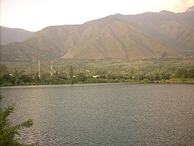 Sarband water body with Dachigam National Park in the background. | |
 | |
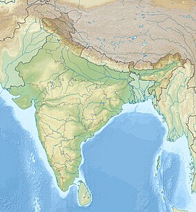
| Location | Jammu and Kashmir, India |
| Nearest city | Srinagar |
| Coordinates | 34°8′14″N 75°2′16″E / 34.13722°N 75.03778°E |
| Area | 141 km2 (54 sq mi) |
| Max. elevation | 4267 m (14,000 ft) |
| Min. elevation | 1676 m (5,499 ft) |
| Established | 1981 |
Dachigam National Park is located 22 kilometers from Srinagar, Jammu and Kashmir. It covers an area of 141 km2. The name of the park literally stands for "ten villages" which is in the memory of the ten villages that were relocated for its formation. These ten villages were living in this region before the World War I the beginning of the early 20th century. The main gate entrance is very close to the New Theed general bus stand on the either side of Darul Uloom Kousaria.[1]
The park has been a protected area since 1910, first under the care of the Maharaja of Jammu and Kashmir and later under the observation of the concerned government authorities. It was initially created to ensure clean drinking water supply for the city of Srinagar. It was upgraded and declared a National Park in the year 1981.[1]
Topography[]
Dachigam National park is located in the Zabarwan Range of the western Himalayas. The variation in altitude is vast, ranging from 5500 ft to 14000 ft above mean sea level. Due to this vast variation, the park is demarcated into an uneven region. The terrain ranges from gently sloping grasslands to sharp rocky outcrops and cliffs.[1] 321
Flora[]
The mountain sides below the tree line are wooded. Most of this coniferous forest consists of broad leaf species. Interspersed between these are alpine pastures, meadows, waterfalls and scrub vegetation with deep gullies, locally known as Nars, running down the mountain face. Most of the grasslands and meadows, except in the harsh winters, are covered with coloured flowers. Located high among its interiors is the Marsar lake from which flows the Dagwan river. This river flows all the way down to, and past, the lower region where it runs along the only proper road in the park and is also known for its fish population, the trout.[1]
Fauna[]
The main animal species that Dachigam is known for is the hangul, or the Kashmir stag. Other species include:
- Musk deer (roose kat)
- Snow Leopard
- Himalayan serow[2]
- Kashmir grey langur
- Kashmir stag (hangul)
- Leopard cat (nt)
- Himalayan black bear (vu)
- Himalayan brown bear
- Jackal
- Hill fox
- Himalayan weasel
- Yellow-throated marten
- Jungle cat
- Long-tailed marmot
- Otter[1]
Birds[]
- Cinnamon sparrow
- Black bulbul
- Himalayan monal
- Golden oriole
- Minivet
- Pygmy owlet
- Woodpecker
- Babbler
- Redstart
- Wagtail
- Koklass pheasant
- Chough
- Orange bullfinch
- Kashmir flycatcher
- Tytler's leaf warbler
- Streaked laughingthrush
- Himalayan rubythroat
- Wallcreeper
- Black-and-yellow grosbeak
- Himalayan griffon vulture
- Bearded vulture
- Red-billed blue magpie
- Titmouse[1][3]
See also[]
References[]
- ^ a b c d e f "Management Plan (2011-2016) - Dachigam National Park" (PDF). jkwildlife.com. Retrieved 4 December 2013.
- ^ Rashid, Afsana (24 January 2009). "Hog deer at Achabal sanctuary". The Tribune. Retrieved 15 July 2013.
- ^ "Some aspects of bird-life in Kashmir". The Himalayan Journal. 1.
External links[]
| Wikimedia Commons has media related to Dachigam National Park. |

| ||||||||||||||||||||||||||||||||||||||||
| ||||||||||||||||||||||||||||||||||||||||
| ||||||||||||||||||||||||||||||||||||||||
| ||||||||||||||||||||||||||||||||||||||||
- IUCN Category II
- National parks in Jammu and Kashmir
- Protected areas established in 1910
- Tourist attractions in Srinagar district
- 1910 establishments in India
- 1981 establishments in Jammu and Kashmir