Damavand County
Damavand County
شهرستان دماوند | |
|---|---|
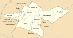 Counties of Tehran Province | |
 Location of Tehran Province in Iran | |
| Coordinates: 35°35′N 52°07′E / 35.583°N 52.117°ECoordinates: 35°35′N 52°07′E / 35.583°N 52.117°E | |
| Country | |
| Province | Tehran |
| Number of Districts | 2 |
| Year Established | 1946 |
| Capital | Damavand |
| Bakhsh (Districts) | Central District, Rudehen District |
| Government | |
| • Governor (Farmandar) | [1] |
| Elevation | 2,000 m (7,000 ft) |
| Population (2016) | |
| • Total | 125,480 |
| Time zone | UTC+3:30 (IRST) |
| • Summer (DST) | UTC+4:30 (IRDT) |
| Website | www |
| Damavand County can be found at GEOnet Names Server, at this link, by opening the Advanced Search box, entering "9206103" in the "Unique Feature Id" form, and clicking on "Search Database". | |
Damavand County (Persian: شهرستان دماوند) is a county in Tehran Province in Iran. The capital of the county is Damavand. At the 2006 census, the county's population was 125,480, in 39,373 families.[2] The county is subdivided into two districts: the Central District and Rudehen District. The county has five cities: Damavand, Rudehen, Abali, Kilan, and Absard.
Subdivisions[]
Damavand county is divided into 2 districts:
- Central District
- Rudehen District
- Rudehen City
- Abali City
- Abali Rural District
- Mehrabad Rural District
History of subdivision[]
It was separated from Tehran County in 1946 in Markazi Province (Known as Second Province at that time). Then in 1976 after the dissolution of Markazi Province it joined General Governorship of Semnan to form Semnan Province. In 1978 it joined the government controlled region of Capital City to form Tehran Province.
References[]
- ^ [1]
- ^ "Census 2016 | Iran Data Portal". Retrieved 2020-11-17.
- اطلس گیتاشناسی استانهای ایران [Atlas Gitashenasi Ostanhai Iran] (Gitashenasi Province Atlas of Iran)
External links[]
| Wikimedia Commons has media related to Damavand County. |
| Capital | |
|---|---|
| Counties and cities | |
| Landmarks |
|
| Populated places | |
^* indicates that this formerly independent city is now absorbed into Tehran. | |

| Capital | |||||||||||||||||||||||
|---|---|---|---|---|---|---|---|---|---|---|---|---|---|---|---|---|---|---|---|---|---|---|---|
| Districts |
| ||||||||||||||||||||||
This Damavand County location article is a stub. You can help Wikipedia by . |
- Damavand County
- Counties of Tehran Province
- Damavand County geography stubs