David City, Nebraska
David City, Nebraska | |
|---|---|
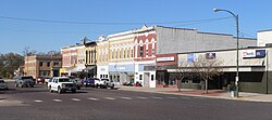 Downtown David City: E Street | |
 Location of David City, Nebraska | |
 David City Location within Nebraska | |
| Coordinates: 41°15′16″N 97°7′35″W / 41.25444°N 97.12639°WCoordinates: 41°15′16″N 97°7′35″W / 41.25444°N 97.12639°W | |
| Country | United States |
| State | Nebraska |
| County | Butler |
| Township | Franklin |
| Founded | 1873 |
| Named for | David Butler |
| Area | |
| • Total | 1.96 sq mi (5.08 km2) |
| • Land | 1.94 sq mi (5.03 km2) |
| • Water | 0.02 sq mi (0.05 km2) |
| Elevation | 1,614 ft (492 m) |
| Population | |
| • Total | 2,906 |
| • Estimate (2019)[3] | 2,852 |
| • Density | 1,467.83/sq mi (566.80/km2) |
| Time zone | UTC-6 (Central (CST)) |
| • Summer (DST) | UTC-5 (CDT) |
| ZIP code | 68632 |
| Area code(s) | 402 |
| FIPS code | 31-12315 |
| GNIS feature ID | 0828587[4] |
| Website | davidcityne.com |


David City is a city in Butler County, Nebraska, United States. The population was 2,906 at the 2010 census. It is the county seat of Butler County.[5]
History[]
David City was founded in 1873 to serve as the county seat when county residents desired a more centrally located county seat than Savannah.[6] The village was named after the first governor of the state of Nebraska.[7]
Geography[]
David City is located at 41°15′16″N 97°7′35″W / 41.25444°N 97.12639°W (41.254543, -97.126457).[8] According to the United States Census Bureau, the city has a total area of 2.07 square miles (5.36 km2), of which 2.06 square miles (5.34 km2) is land and 0.01 square miles (0.03 km2) is water.[9]
Demographics[]
| Historical population | |||
|---|---|---|---|
| Census | Pop. | %± | |
| 1880 | 1,000 | — | |
| 1890 | 2,028 | 102.8% | |
| 1900 | 1,845 | −9.0% | |
| 1910 | 2,177 | 18.0% | |
| 1920 | 2,216 | 1.8% | |
| 1930 | 2,333 | 5.3% | |
| 1940 | 2,272 | −2.6% | |
| 1950 | 2,321 | 2.2% | |
| 1960 | 2,304 | −0.7% | |
| 1970 | 2,380 | 3.3% | |
| 1980 | 2,514 | 5.6% | |
| 1990 | 2,522 | 0.3% | |
| 2000 | 2,597 | 3.0% | |
| 2010 | 2,906 | 11.9% | |
| 2019 (est.) | 2,852 | [3] | −1.9% |
| U.S. Decennial Census[10] 2012 Estimate[11] | |||
2010 census[]
As of the census[2] of 2010, there were 2,906 people, 1,153 households, and 706 families living in the city. The population density was 1,410.7 inhabitants per square mile (544.7/km2). There were 1,274 housing units at an average density of 618.4 per square mile (238.8/km2). The racial makeup of the city was 96.1% White, 0.6% African American, 0.1% Native American, 0.7% Asian, 1.8% from other races, and 0.8% from two or more races. Hispanic or Latino of any race were 3.5% of the population.
There were 1,153 households, of which 30.6% had children under the age of 18 living with them, 47.0% were married couples living together, 10.5% had a female householder with no husband present, 3.7% had a male householder with no wife present, and 38.8% were non-families. 33.4% of all households were made up of individuals, and 18.1% had someone living alone who was 65 years of age or older. The average household size was 2.37 and the average family size was 3.05.
The median age in the city was 42.1 years. 25.9% of residents were under the age of 18; 6.4% were between the ages of 18 and 24; 21.2% were from 25 to 44; 24.8% were from 45 to 64; and 21.7% were 65 years of age or older. The gender makeup of the city was 47.5% male and 52.5% female.
2000 census[]
As of the census of 2000, there were 2,597 people, 1,082 households, and 641 families living in the city. The population density was 1,724.6 people per square mile (664.0/km2). There were 1,203 housing units at an average density of 798.9 per square mile (307.6/km2). The racial makeup of the city was 98.58% White, 0.15% African American, 0.15% Native American, 0.23% Asian, 0.12% Pacific Islander, 0.50% from other races, and 0.27% from two or more races. Hispanic or Latino of any race were 1.00% of the population.
There were 1,082 households, out of which 29.6% had children under the age of 18 living with them, 49.0% were married couples living together, 7.1% had a female householder with no husband present, and 40.7% were non-families. 37.2% of all households were made up of individuals, and 22.6% had someone living alone who was 65 years of age or older. The average household size was 2.31 and the average family size was 3.06.
In the city, the population was spread out, with 26.2% under the age of 18, 5.7% from 18 to 24, 23.2% from 25 to 44, 20.4% from 45 to 64, and 24.5% who were 65 years of age or older. The median age was 41 years. For every 100 females, there were 91.5 males. For every 100 females age 18 and over, there were 85.8 males.
As of 2000 the median income for a household in the city was $34,583, and the median income for a family was $48,098. Males had a median income of $28,185 versus $21,179 for females. The per capita income for the city was $16,550. About 3.1% of families and 8.1% of the population were below the poverty line, including 8.0% of those under age 18 and 10.1% of those age 65 or over.
Education[]
High schools[]
David City has two high schools. The largest is . Its athletic teams are the Scouts.[12] The second is Aquinas High School. The Catholic school is named after Thomas Aquinas. Its teams are the Monarchs.
David City Public Schools[]
David City Public Schools operates a secondary school and two elementary schools: Bellwood and David City.[12]
Media[]
David City has one newspaper, The Banner-Press. The newspaper is published once a week.[13]
Notable people[]
- Ruth Etting – Singer of the 1930s, subject of Love Me or Leave Me
- Joyce Hall – Founder of Hallmark Cards
- Shon Hopwood – Bank robber turned lawyer and law professor
- Roman Hruska – Republican U.S. Senator, 1954–1976
- John Kirby – Professional football player
- Bob Martin – Football player
- Dale Nichols – Artist
- Hugo Otopalik – Iowa State wrestling and golf coach
- Kenneth Steiner – Roman Catholic bishop
References[]
- ^ "2019 U.S. Gazetteer Files". United States Census Bureau. Retrieved July 26, 2020.
- ^ Jump up to: a b "U.S. Census website". United States Census Bureau. Retrieved 2012-06-24.
- ^ Jump up to: a b "Population and Housing Unit Estimates". United States Census Bureau. May 24, 2020. Retrieved May 27, 2020.
- ^ "US Board on Geographic Names". United States Geological Survey. 2007-10-25. Retrieved 2008-01-31.
- ^ "Find a County". National Association of Counties. Archived from the original on May 31, 2011. Retrieved 2011-06-07.
- ^ "David City, Butler County". Center for Advanced Land Management Information Technologies. University of Nebraska. Retrieved 31 July 2014.
- ^ Federal Writers' Project (1938). Origin of Nebraska place names. Lincoln, NE: Works Progress Administration. p. 9.
- ^ "US Gazetteer files: 2010, 2000, and 1990". United States Census Bureau. 2011-02-12. Retrieved 2011-04-23.
- ^ "US Gazetteer files 2010". United States Census Bureau. Archived from the original on January 12, 2012. Retrieved 2012-06-24.
- ^ United States Census Bureau. "Census of Population and Housing". Retrieved October 19, 2013.
- ^ "Annual Estimates of the Resident Population: April 1, 2010 to July 1, 2012". Archived from the original on October 19, 2013. Retrieved October 19, 2013.
- ^ Jump up to: a b "David City Public Schools". www.davidcitypublicschools.org. Retrieved 2019-01-26.
- ^ Telegram, Columbus. "Banner-press". Columbus Telegram. Retrieved 2019-01-26.
External links[]
| hide Municipalities and communities of Butler County, Nebraska, United States | ||
|---|---|---|
| City | ||
| Villages | ||
| Townships | ||
| Unincorporated communities | ||
| Ghost town | ||
| ||
| Authority control |
|
|---|
- Cities in Nebraska
- Cities in Butler County, Nebraska
- County seats in Nebraska
- Populated places established in 1873
- 1873 establishments in Nebraska