DeSoto Township, Jackson County, Illinois
De Soto Township | |
|---|---|
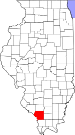
 Location in Jackson County | |
 Jackson County's location in Illinois | |
| Coordinates: 37°49′07″N 89°12′50″W / 37.81861°N 89.21389°WCoordinates: 37°49′07″N 89°12′50″W / 37.81861°N 89.21389°W | |
| Country | United States |
| State | Illinois |
| County | Jackson |
| Established | November 4, 1884 |
| Area | |
| • Total | 37.94 sq mi (98.3 km2) |
| • Land | 36.79 sq mi (95.3 km2) |
| • Water | 1.15 sq mi (3.0 km2) 3.03% |
| Elevation | 390 ft (119 m) |
| Population (2010) | |
| • Estimate (2016)[1] | 2,333 |
| • Density | 64.9/sq mi (25.1/km2) |
| Time zone | UTC-6 (CST) |
| • Summer (DST) | UTC-5 (CDT) |
| ZIP codes | 62901, 62924, 62932, 62966 |
| FIPS code | 17-077-19629 |

De Soto Township is one of sixteen townships in Jackson County, Illinois, USA. As of the 2010 census, its population was 2,388 and it contained 1,060 housing units.[2]
History[]
De Soto Township is named for Hernando de Soto, the discoverer of the Mississippi River.[3]
Geography[]
According to the 2010 census, the township has a total area of 37.94 square miles (98.3 km2), of which 36.79 square miles (95.3 km2) (or 96.97%) is land and 1.15 square miles (3.0 km2) (or 3.03%) is water.[2]
Cities, towns, villages[]
Unincorporated towns[]
- Reeds Station at 37°46′40″N 89°09′39″W / 37.777828°N 89.160914°W
- at 37°51′00″N 89°14′07″W / 37.850051°N 89.235361°W
(This list is based on USGS data and may include former settlements.)
Adjacent townships[]
- Elk Township (north)
- Six Mile Township, Franklin County (northeast)
- Carbondale Township (south)
- Murphysboro Township (southwest)
- Somerset Township (west)
- Vergennes Township (northwest)
Cemeteries[]
The township contains these five cemeteries: Beasley, Central-Crews, De Soto, Howard and Indian Hill.
Major highways[]
Airports and landing strips[]
- Southern Illinois Airport
Demographics[]
| Historical population | |||
|---|---|---|---|
| Census | Pop. | %± | |
| 2016 (est.) | 2,333 | [1] | |
| U.S. Decennial Census[4] | |||
School districts[]
- Elverado Community Unit School District 196
- Herrin Community Unit School District 4
Political districts[]
- Illinois' 12th congressional district
- State House District 115
- State Senate District 58
References[]
- "DeSoto Township, Jackson County, Illinois". Geographic Names Information System. United States Geological Survey. Retrieved 2010-01-17.
- United States Census Bureau 2007 TIGER/Line Shapefiles
- United States National Atlas
- ^ a b "Population and Housing Unit Estimates". Retrieved June 9, 2017.
- ^ a b "Population, Housing Units, Area, and Density: 2010 - County -- County Subdivision and Place -- 2010 Census Summary File 1". United States Census. Archived from the original on 2020-02-12. Retrieved 2013-05-28.
- ^ Gannett, Henry (1905). The Origin of Certain Place Names in the United States. Govt. Print. Off. pp. 105.
- ^ "Census of Population and Housing". Census.gov. Retrieved June 4, 2016.
External links[]
Municipalities and communities of Jackson County, Illinois, United States | ||
|---|---|---|
| Cities | ||
| Villages | ||
| Townships | ||
| CDP | ||
| Other unincorporated communities | ||
| Ghost town | ||
| Footnotes | ‡This populated place also has portions in an adjacent county or counties | |
| ||
Categories:
- Townships in Jackson County, Illinois
- Townships in Illinois