Jackson County, Illinois
Jackson County | |
|---|---|
U.S. county | |
 Jackson County Courthouse in Murphysboro | |
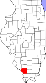 Location within the U.S. state of Illinois | |
 Illinois's location within the U.S. | |
| Coordinates: 37°47′N 89°23′W / 37.79°N 89.38°W | |
| Country | |
| State | |
| Founded | 10 January 1816 |
| Named for | Andrew Jackson |
| Seat | Murphysboro |
| Largest city | Carbondale |
| Area | |
| • Total | 602 sq mi (1,560 km2) |
| • Land | 584 sq mi (1,510 km2) |
| • Water | 18 sq mi (50 km2) 3.0% |
| Population (2020) | |
| • Total | 56,211 |
| • Density | 93/sq mi (36/km2) |
| Time zone | UTC−6 (Central) |
| • Summer (DST) | UTC−5 (CDT) |
| Congressional district | 12th |
| Website | www |

Jackson County is a county located in the U.S. state of Illinois with a population of 56,211 at the 2020 census.[1] Its county seat is Murphysboro,[2] and its most populous city is Carbondale, home to the main campus of Southern Illinois University. The county was incorporated on January 10, 1816 and named for Andrew Jackson. The community of Brownsville served as the fledgling county's first seat.
Jackson County is included in the Carbondale-Marion, IL Metropolitan Statistical Area. It is located in the southern portion of Illinois known locally as "Little Egypt".
History[]
Human occupation of Jackson County began about 11,500 years ago. Extensive documentation of the area's indigenous peoples is ongoing. Exploration from the European explorers began with the Joliet-Marquette exploration along the Mississippi River. It was not until the 18th and 19th century when pioneer farmers began to settle in the area's inexpensive land along the Mississippi River and in the forested Shawnee hills with its one-hundred-foot trees.
As early as 1810 William Boone and his indentured servant Peter mined coal from the banks along Big Muddy River. This was Illinois' first coal mine. By 1813, Conrad Will, namesake of Will County, conducted a large salt extraction operation using slave labor on the banks of the Big Muddy River, south of today's Murphysboro. As this was in the "free" Northwest Territory, Will had to have a legal exemption to own slaves. Jackson County, Illinois' ninth county to be organized, was organized in 1816, having been carved out of Randolph County, Illinois on the north and Johnson County, Illinois on the South. It was named for Andrew Jackson, who had just defeated the British Army at the Battle of New Orleans.[3] Brownsville, located near Will's salt works, was established as the county seat. When the courthouse burned in 1843, the county voted to move the county seat to a more central location. Murphysboro, located on land owned by Dr. John and Elizabeth (Jenkins) Logan, became the second county seat in September 1843. It was named after William C. Murphy, one of the three Commissioners appointed to select the site.
Civil War Major General John A. Logan, Dr. John and Elizabeth Logan's son, was born in what is now Murphysboro on February 9, 1826. During the Civil War he moved to Carbondale, about 10 miles (16 km) east of his birthplace. He moved to Chicago in 1871. During his residence in Carbondale, he took part in a Memorial Day observation at that city's Woodlawn Cemetery. In 1868, Logan, as Commander of the Grand Army of the Republic, issued General Order No. 11 which established Memorial Day as a national holiday.[4]
On 18 March 1925, the great Tri-State Tornado ripped through Jackson County, leaving devastation in its path. The villages of Gorham and DeSoto and the city of Murphysboro were hit especially hard.
The county courthouse is in downtown Murphysboro. The current reinforced concrete courthouse, completed in 1928, replaced earlier brick structures.
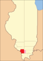
Jackson County (1816–1818), including unorganized territory (formerly part of Johnson County) temporarily attached to it[5]
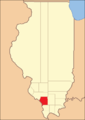
Jackson County (1818–1827)
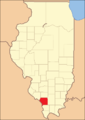
Jackson County (1827–present)


Geography[]
According to the US Census Bureau, the county has a total area of 602 square miles (1,560 km2), of which 584 square miles (1,510 km2) is land and 18 square miles (47 km2) (3.0%) is water.[6] The average elevation is around 400 feet (120 m), except near the Mississippi River.
The first coal mine in Illinois was opened on the south bank of the Big Muddy River near the present-day Route 127 Bridge.
Climate and weather[]
| Murphysboro, Illinois | ||||||||||||||||||||||||||||||||||||||||||||||||||||||||||||
|---|---|---|---|---|---|---|---|---|---|---|---|---|---|---|---|---|---|---|---|---|---|---|---|---|---|---|---|---|---|---|---|---|---|---|---|---|---|---|---|---|---|---|---|---|---|---|---|---|---|---|---|---|---|---|---|---|---|---|---|---|
| Climate chart (explanation) | ||||||||||||||||||||||||||||||||||||||||||||||||||||||||||||
| ||||||||||||||||||||||||||||||||||||||||||||||||||||||||||||
| ||||||||||||||||||||||||||||||||||||||||||||||||||||||||||||
In recent years, average temperatures in the county seat of Murphysboro have ranged from a low of 21 °F (−6 °C) in January to a high of 88 °F (31 °C) in July, although a record low of −25 °F (−32 °C) was recorded in January 1977 and a record high of 113 °F (45 °C) was recorded in August 1930. Average monthly precipitation ranged from 2.91 inches (74 mm) in January to 4.78 inches (121 mm) in May.[7]
Major highways[]
Adjacent counties[]
- Perry County (north)
- Franklin County (northeast)
- Williamson County (east)
- Union County (south)
- Cape Girardeau County, Missouri (southwest)
- Perry County, Missouri (west)
- Randolph County (northwest)
Protected areas[]
- Crab Orchard National Wildlife Refuge (part)
- Shawnee National Forest (part)
- Giant City State Park[8]
Demographics[]
| Historical population | |||
|---|---|---|---|
| Census | Pop. | %± | |
| 1820 | 1,542 | — | |
| 1830 | 1,828 | 18.5% | |
| 1840 | 3,566 | 95.1% | |
| 1850 | 5,862 | 64.4% | |
| 1860 | 9,589 | 63.6% | |
| 1870 | 19,634 | 104.8% | |
| 1880 | 22,505 | 14.6% | |
| 1890 | 27,809 | 23.6% | |
| 1900 | 33,871 | 21.8% | |
| 1910 | 35,143 | 3.8% | |
| 1920 | 37,091 | 5.5% | |
| 1930 | 35,680 | −3.8% | |
| 1940 | 37,920 | 6.3% | |
| 1950 | 38,124 | 0.5% | |
| 1960 | 42,151 | 10.6% | |
| 1970 | 55,008 | 30.5% | |
| 1980 | 61,522 | 11.8% | |
| 1990 | 61,067 | −0.7% | |
| 2000 | 59,612 | −2.4% | |
| 2010 | 60,373 | 1.3% | |
| 2020 | 56,211 | −6.9% | |
| US Decennial Census[9] 1790-1960[10] 1900-1990[11] 1990-2000[12] 2010-2013[1] | |||

As of the 2010 United States Census, there were 60,218 people, 25,538 households, and 12,621 families residing in the county.[13] The population density was 103.1 inhabitants per square mile (39.8/km2). There were 28,578 housing units at an average density of 48.9 per square mile (18.9/km2).[6] The racial makeup of the county was 77.8% white, 14.3% black or African American, 3.2% Asian, 0.4% American Indian, 0.1% Pacific islander, 1.6% from other races, and 2.6% from two or more races. Those of Hispanic or Latino origin made up 4.0% of the population.[13] In terms of ancestry, 26.0% were German, 14.5% were Irish, 10.6% were English, and 5.7% were American.[14]
Of the 25,538 households, 23.0% had children under the age of 18 living with them, 35.5% were married couples living together, 10.2% had a female householder with no husband present, 50.6% were non-families, and 35.1% of all households were made up of individuals. The average household size was 2.20 and the average family size was 2.87. The median age was 29.1 years.[13]
The median income for a household in the county was $32,169 and the median income for a family was $50,787. Males had a median income of $42,747 versus $31,244 for females. The per capita income for the county was $19,294. About 17.4% of families and 28.5% of the population were below the poverty line, including 32.1% of those under age 18 and 7.9% of those age 65 or over.[15]
Economy[]
Much of the county's economic situation is dependent upon Southern Illinois University Carbondale and the city of Carbondale. A rapidly developing city, it is part of the Metro Lakeland area consisting mainly of the major communities of Carbondale, Marion, Herrin, and Carterville. The outer regions of the Metro include Murphysboro, the rest of Jackson County, the rest of Williamson County, Perry County, and Saline County. Jackson County is also located near the Shawnee Hills Wine Trail.
Communities[]
Cities[]
- Ava
- Carbondale (partly in Williamson County)
- Grand Tower
- Murphysboro
Villages[]
Census-designated place[]
Unincorporated communities[]
Ghost towns[]
Townships[]
Politics[]
Jackson County has had a distinctive political history owing to the combination of its typically “Southern” Southern Illinois culture with the presence in recent times of a strong student body in Carbondale. In its early years Jackson County was solidly Democratic: no Republican was to carry the county until Benjamin Harrison – despite losing the 1892 election – won it from Grover Cleveland. For the following seven decades Jackson County turned solidly Republican: only Franklin D. Roosevelt in his first 1932 election won a majority, and the only other Democratic plurality was that of Woodrow Wilson in 1912 when the Republican Party was mortally divided by Theodore Roosevelt's independent campaign.
The 1964 election saw Jackson County turn strongly Democratic due to the growth of student opposition to the conservative Republican nominee Barry Goldwater, and this student liberalism was sufficient eight years later to make Jackson County the only county in Illinois to vote for George McGovern over Richard Nixon, and one of five nationwide to vote for McGovern in 1972 and Alf Landon in 1936.[a] Ronald Reagan did carry Jackson County in both his 1980 and 1984 triumphs, but he remains the last Republican to carry the county, although in common with the rest of Southern Illinois Donald Trump made substantial gains on previous GOP performances. Biden barely held the county in 2020, winning it by just 291 votes.
See also[]
Notes[]
- ^ The other counties supporting both Landon and McGovern are Deuel County in McGovern’s home state of South Dakota, Middlesex and Norfolk in Massachusetts, and Washtenaw County in Michigan.
References[]
- ^ Jump up to: a b "State & County QuickFacts". US Census Bureau. Archived from the original on June 6, 2011. Retrieved July 6, 2014.
- ^ "Find a County". National Association of Counties. Archived from the original on May 31, 2011. Retrieved June 7, 2011.
- ^ Gannett, Henry (1905). The Origin of Certain Place Names in the United States. Govt. Print. Off. p. 167.
- ^ Eclebarger, Gary, Black Jack Logan: An Extraordinary Life in Peace and War
- ^ White, Jesse. Origin and Evolution of Illinois Counties. State of Illinois, March 2010. [1]
- ^ Jump up to: a b "Population, Housing Units, Area, and Density: 2010 - County". US Census Bureau. Archived from the original on February 12, 2020. Retrieved July 11, 2015.
- ^ Jump up to: a b "Monthly Averages for Murphysboro IL". The Weather Channel. Retrieved January 27, 2011.
- ^ Giant City State Park, Jackson County IL Google Maps (accessed 29 December 2018)
- ^ "US Decennial Census". US Census Bureau. Retrieved July 6, 2014.
- ^ "Historical Census Browser". University of Virginia Library. Retrieved July 6, 2014.
- ^ "Population of Counties by Decennial Census: 1900 to 1990". US Census Bureau. Retrieved July 6, 2014.
- ^ "Census 2000 PHC-T-4. Ranking Tables for Counties: 1990 and 2000" (PDF). US Census Bureau. Retrieved July 6, 2014.
- ^ Jump up to: a b c "Profile of General Population and Housing Characteristics: 2010 Demographic Profile Data". US Census Bureau. Archived from the original on February 13, 2020. Retrieved July 11, 2015.
- ^ "Selected Social Characteristics in the United States – 2006-2010 American Community Survey 5-Year Estimates". US Census Bureau. Archived from the original on February 13, 2020. Retrieved July 11, 2015.
- ^ "Selected Economic Characteristics – 2006-2010 American Community Survey 5-Year Estimates". US Census Bureau. Archived from the original on February 13, 2020. Retrieved July 11, 2015.
- ^ Etherton, Jackson County IL Google Maps (accessed 29 December 2018)
- ^ Hallidayboro, Jackson County IL Google Maps (accessed 29 December 2018)
- ^ Howardton, Jackson County IL Google Maps (accessed 29 December 2018)
- ^ Mount Carbon, Jackson County IL Google Maps (accessed 29 December 2018)
- ^ Neunert, Jackson County IL Google Maps (accessed 29 December 2018)
- ^ Raddle, Jackson County IL Google Maps (accessed 29 December 2018)
- ^ Sand Ridge, Jackson County IL Google Maps (accessed 29 December 2018)
- ^ Leip, David. "Atlas of US Presidential Elections". uselectionatlas.org. Retrieved March 19, 2018.
External links[]
| show Places adjacent to Jackson County, Illinois |
|---|
| show Municipalities and communities of Jackson County, Illinois, United States |
|---|


| show Authority control |
|---|
- Illinois counties
- Jackson County, Illinois
- 1816 establishments in Illinois Territory
- Populated places established in 1816
- Southern Illinois
- Metro Lakeland
- Illinois counties on the Mississippi River
- Pre-statehood history of Illinois