Den Helder railway station
Den Helder | |||||||||||||||
|---|---|---|---|---|---|---|---|---|---|---|---|---|---|---|---|
 | |||||||||||||||
| Location | Netherlands | ||||||||||||||
| Coordinates | 52°57′23″N 4°45′39″E / 52.95639°N 4.76083°ECoordinates: 52°57′23″N 4°45′39″E / 52.95639°N 4.76083°E | ||||||||||||||
| Line(s) | Den Helder–Amsterdam railway | ||||||||||||||
| History | |||||||||||||||
| Opened | 20 December 1865 | ||||||||||||||
| Services | |||||||||||||||
| |||||||||||||||
| Location | |||||||||||||||
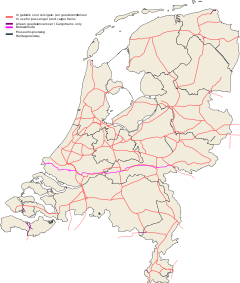
 Den Helder Location within Netherlands | |||||||||||||||
Den Helder is a Terminus railway station in the naval town of Den Helder, The Netherlands. The station opened on 20 December 1865, and is the most northerly station in North Holland. The station is the start of the Den Helder–Amsterdam railway. The original station building was demolished in 1958 and a new building was built a bit further south than previous.
The railway line was electrified in 1958. In 1980 another station, Den Helder Zuid opened. The station now has three platforms. The services are operated by Nederlandse Spoorwegen.
Train services[]
The station is served by the following service(s):
- 2x per hour Intercity services Den Helder - Amsterdam - Utrecht - Nijmegen
Bus services[]
The station is served by the following bus services:
| Line | Route | Notes |
|---|---|---|
| Connexxion | ||
| 28 | Den Helder station - Den Burg - De Koog | Uses the ferry to Texel |
| 30 | Den Helder station - Nieuw-Den Helder - Den Helder Zuid station - Julianadorp | |
| 31 | Den Helder station - Nieuw-Den Helder - Den Helder Zuid station | |
| 32 | Den Helder station - Nieuw-Den Helder - Den Helder Zuid station - Julianadorp | |
| 34 | Den Helder station - De Schooten | |
| 135 | Den Helder station - Hippolytushoef - Den Oever bus station - Wieringerwerf - Middenmeer - Abbekerk - Hoorn | |
| 158 | Den Helder station - Anna Paulowna - Den Oever bus station | |
| 851 | Station Den Helder - Callantsoog - St Maartenszee - Petten | Summer bus along the coast |
External links[]
- NS website (in Dutch)
- Dutch public transport travel planner (in Dutch)
Categories:
- Railway stations in North Holland
- Railway stations opened in 1865
- Railway stations on the Staatslijn K
- Den Helder
