Dogonbadan
Dogonbadan
دوگنبدان | |
|---|---|
City | |
 | |
 Dogonbadan Location in Iran | |
| Coordinates: 30°21′31″N 50°47′53″E / 30.35861°N 50.79806°ECoordinates: 30°21′31″N 50°47′53″E / 30.35861°N 50.79806°E | |
| Country | |
| Province | Kohgiluyeh and Boyer-Ahmad |
| County | Gachsaran County |
| Bakhsh | Central |
| Population (2016 Census) | |
| • Total | 96,728 [1] |
| Time zone | UTC+3:30 (IRST) |
| • Summer (DST) | UTC+4:30 (IRDT) |

Dogonbadan (Persian: دوگنبدان, Persian pronunciation: [dɔəgɔənbadɒːn]; also Romanized as Do Gonbadān, Dow Gonbadān, and Du Gunbadān; also known as Gachsaran (Persian: گچساران), also Romanized as Gachsārān)[2] is a city and the capital of Gachsaran County, Kohgiluyeh and Boyer-Ahmad Province, Iran. At the 2006 census, its population was 81,902, in 18,264 families.[3]
Economy[]
Dogonbadan is an oil and gas producing city that has just started to expand and profits from its industrial capacity. The city has the largest gas reserves in Iran also has the largest recoverable oil field in Iran and third in the world.[4]

Gallery[]

British staffs of an oil company in Gachsaran in 1957

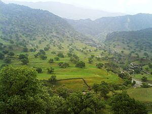
Tange deel around the Gachsaran city, Early spring
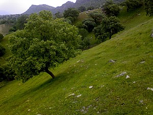
Barabar around the Gachsaran city, Early spring
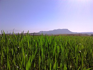
Shelaldoun around the Gachsaran city, Early spring
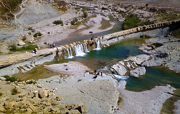
Kayvan fall around Dogonbadan(Gachsaran)


References[]
- ^ "Statistical Center of Iran > Home".
- ^ Dogonbadan can be found at GEOnet Names Server, at this link, by opening the Advanced Search box, entering "-3061393" in the "Unique Feature Id" form, and clicking on "Search Database".
- ^ "Census of the Islamic Republic of Iran, 1385 (2006)" (Excel). Statistical Center of Iran. Archived from the original on 2011-11-11.
- ^ "Extraction of Crude Petroleum in Iran-Overview". mbendi.com. 2010. Retrieved 2013-06-01.
External links[]
| Wikimedia Commons has media related to Dogonbadan. |
| Capital |  | ||||||||||||||||||
|---|---|---|---|---|---|---|---|---|---|---|---|---|---|---|---|---|---|---|---|
| Counties and cities |
| ||||||||||||||||||
| Sights |
| ||||||||||||||||||
| populated places | |||||||||||||||||||
This Gachsaran County location article is a stub. You can help Wikipedia by . |
- Populated places in Gachsaran County
- Cities in Kohgiluyeh and Boyer-Ahmad Province
- Gachsaran County geography stubs