Doi Lo District
Doi Lo
ดอยหล่อ | |
|---|---|
 Wat Phra That Doi Noi | |
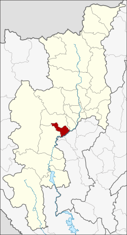 District location in Chiang Mai Province | |
| Coordinates: 18°28′28″N 98°47′1″E / 18.47444°N 98.78361°ECoordinates: 18°28′28″N 98°47′1″E / 18.47444°N 98.78361°E | |
| Country | Thailand |
| Province | Chiang Mai |
| Seat | Doi Lo |
| Area | |
| • Total | 260.1 km2 (100.4 sq mi) |
| Population (2005) | |
| • Total | 27,623 |
| • Density | 106.2/km2 (275/sq mi) |
| Time zone | UTC+7 (ICT) |
| Postal code | 50160 |
| Geocode | 5024 |

Doi Lo (Thai: ดอยหล่อ, pronounced [dɔ̄ːj lɔ̀ː]; Northern Thai: ![]() ) is a district (amphoe) of Chiang Mai Province in northern Thailand.
) is a district (amphoe) of Chiang Mai Province in northern Thailand.
Geography[]
Neighboring districts are (from the southwest clockwise) Chom Thong, Mae Wang, San Pa Tong of Chiang Mai Province, Pa Sang and Wiang Nong Long of Lamphun Province.
History[]
The minor district (king amphoe) was established on 1 April 1995, when four tambons were split off from Chom Thong.[1]
On 15 May 2007, all 81 minor districts were upgraded to full districts.[2] On 24 August the upgrade became official.[3]
Administration[]
The district is divided into four sub-districts (tambon), which are further subdivided into 54 villages (muban). There are no municipal (thesaban) areas, and four tambon administrative organizations (TAO).
| No. | Name | Thai name | Villages | Pop. | |
|---|---|---|---|---|---|
| 1. | Doi Lo | ดอยหล่อ | 26 | 12,809 | |
| 2. | Song Khwae | สองแคว | 8 | 5,560 | |
| 3. | Yang Khram | ยางคราม | 11 | 5,182 | |
| 4. | Santi Suk | สันติสุข | 9 | 4,072 |
References[]
- ^ ประกาศกระทรวงมหาดไทย เรื่อง แบ่งเขตท้องที่อำเภอจอมทอง จังหวัดเชียงใหม่ ตั้งเป็นกิ่งอำเภอดอยหล่อ (PDF). Royal Gazette (in Thai). 112 (Special 9 ง): 65. March 22, 2007.
- ^ แถลงผลการประชุม ครม. ประจำวันที่ 15 พ.ค. 2550 (in Thai). Manager Online.
- ^ พระราชกฤษฎีกาตั้งอำเภอฆ้องชัย...และอำเภอเหล่าเสือโก้ก พ.ศ. ๒๕๕๐ (PDF). Royal Gazette (in Thai). 124 (46 ก): 14–21. August 24, 2007.
External links[]
This Chiang Mai province location article is a stub. You can help Wikipedia by . |
- Amphoe of Chiang Mai Province
- Chiang Mai province geography stubs