Hang Dong District
Hang Dong
หางดง | |
|---|---|
 | |
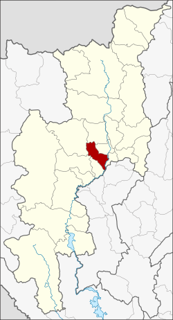 District location in Chiang Mai Province | |
| Coordinates: 18°41′13″N 98°55′8″E / 18.68694°N 98.91889°ECoordinates: 18°41′13″N 98°55′8″E / 18.68694°N 98.91889°E | |
| Country | Thailand |
| Province | Chiang Mai |
| Tambon | 11 |
| Muban | 109 |
| Area | |
| • Total | 277.1 km2 (107.0 sq mi) |
| Population (2018) | |
| • Total | 88,926 |
| • Density | 300.6/km2 (779/sq mi) |
| Time zone | UTC+7 (ICT) |
| Postal code | 50230 |
| Geocode | 5015 |

Hang Dong (Thai: หางดง, pronounced [hǎːŋ dōŋ]) is a district (amphoe) of Chiang Mai Province in northern Thailand.
Geography[]
Neighboring districts are (from the southwest clockwise) San Pa Tong, Mae Wang, Samoeng, Mae Rim, Mueang Chiang Mai, Saraphi of Chiang Mai Province, and Mueang Lamphun of Lamphun Province.
The village Ban Tawai (บ้านถวาย) in Khun Khong sub-district is known for its handicraft center, as wood carving has been a local speciality since the 1960s.[citation needed]
History[]
Before 1917, the district was named Mae Tha Chang (แม่ท่าช้าง).[1] 1938 the district was downgraded to a minor district (king amphoe) and made subordinate to Mueang Chiang Mai District.[2] In 1947 it was elevated to full district status again.[3]
Administration[]
Central administration[]
Hang Dong is divided into 11 sub-districts (tambons), which are further subdivided into 109 administrative villages (muban).
| No. | Name | Thai | Villages | Pop.[4] |
|---|---|---|---|---|
| 1. | Hang Dong | หางดง | 9 | 11,320 |
| 2. | Nong Kaeo | หนองแก๋ว | 9 | 5,425 |
| 3. | Han Kaeo | หารแก้ว | 9 | 5,815 |
| 4. | Nong Tong | หนองตอง | 14 | 8,564 |
| 5. | Khun Khong | ขุนคง | 9 | 5,181 |
| 6. | Sop Mae Kha | สบแม่ข่า | 5 | 2,444 |
| 7. | Ban Waen | บ้านแหวน | 13 | 11,063 |
| 8. | San Phak Wan | สันผักหวาน | 7 | 15,755 |
| 9. | Nong Khwai | หนองควาย | 12 | 10,985 |
| 10. | Ban Pong | บ้านปง | 11 | 5,367 |
| 11. | Nam Phrae | น้ำแพร่ | 11 | 6,997 |
Local administration[]
There are 10 sub-district municipalities (thesaban tambons) in the district:
- Nong Tong Phatthana (Thai: เทศบาลตำบลหนองตองพัฒนา) consisting of sub-district Nong Tong.
- Hang Dong (Thai: เทศบาลตำบลหางดง) consisting of parts of sub-district Hang Dong.
- Mae Tha Chang (Thai: เทศบาลตำบลแม่ท่าช้าง) consisting of parts of sub-district Hang Dong.
- Nong Kaeo (Thai: เทศบาลตำบลหนองแก๋ว) consisting of sub-district Nong Kaeo.
- Han Kaeo (Thai: เทศบาลตำบลหารแก้ว) consisting of sub-district Han Kaeo.
- Ban Waen (Thai: เทศบาลตำบลบ้านแหวน) consisting of sub-district Ban Waen.
- San Phak Wan (Thai: เทศบาลตำบลสันผักหวาน) consisting of sub-district San Phak Wan.
- Nong Khwai (Thai: เทศบาลตำบลหนองควาย) consisting of sub-district Nong Khwai.
- Ban Pong (Thai: เทศบาลตำบลบ้านปง) consisting of sub-district Ban Pong.
- Nam Phrae Phatthana (Thai: เทศบาลตำบลน้ำแพร่พัฒนา) consisting of sub-district Nam Phrae.
There are two sub-district administrative organizations (SAO) in the district:
- Khun Khong (Thai: องค์การบริหารส่วนตำบลขุนคง) consisting of sub-district Khun Khong.
- Sop Mae Kha (Thai: องค์การบริหารส่วนตำบลสบแม่ข่า) consisting of sub-district Sop Mae Kha.
Gallery[]

, Hang Dong, (c. 1858), 8 km SW of Chiang Mai's walls

Wihan, Wat Ton Kwaen

Interior view of the wihan


Further reading[]
- "Wat Ton Kwen and Wat Hang Dong: Two Hidden Gems of Lan Na Architecture", in Forbes, Andrew, and Henley, David, Ancient Chiang Mai v 4. Chiang Mai, Cognoscenti Books, 2012. ASIN: B006J541LE
References[]
- ^ "ประกาศกระทรวงมหาดไทย เรื่อง เปลี่ยนชื่ออำเภอ" (PDF). Royal Gazette (in Thai). 34 (ก): 40–68. 1917-04-29.
- ^ "ประกาศสำนักนายกรัฐมนตรี เรื่อง ยุบอำเภอลงเป็นกิ่งอำเภอ" (PDF). Royal Gazette (in Thai). 55 (ง): 2067. 1938-09-12.
- ^ "ประกาศสำนักนายกรัฐมนตรี เรื่อง ยกฐานะกิ่งอำเภอขึ้นเป็นอำเภอ" (PDF). Royal Gazette (in Thai). 64 (50 ง): 2661–2662. 1947-10-21.
- ^ "ข้อมูลสถิติ". stat.bora.dopa.go.th. Retrieved 2021-05-03.
External links[]
| Wikimedia Commons has media related to Hang Dong District. |
| show Authority control |
|---|
This Chiang Mai Province location article is a stub. You can help Wikipedia by . |
- Amphoe of Chiang Mai Province
- Chiang Mai geography stubs