Doller (river)
| Doller | |
|---|---|
 | |
| Location | |
| Country | France |
| Physical characteristics | |
| Source | |
| • location | Vosges Mountains |
| • elevation | 940 m (3,080 ft) |
| Mouth | |
• location | Ill |
• coordinates | 47°45′56″N 7°19′51″E / 47.76556°N 7.33083°ECoordinates: 47°45′56″N 7°19′51″E / 47.76556°N 7.33083°E |
| Length | 46 km (29 mi) |
| Basin features | |
| Progression | Ill→ Rhine→ North Sea |

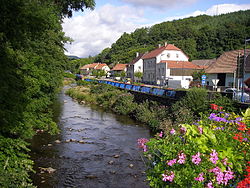
The Doller is a river in Alsace (Haut-Rhin), in north-eastern France. It is a left tributary of the Ill (a tributary of the Rhine), in Mulhouse. It is 46.5 km (28.9 mi) long.[1]
The source of the Doller is in the Vosges Mountains, east of the Ballon d'Alsace, at 940 metres (3,080 ft) elevation. It flows generally east, through the towns Sewen, Dolleren, Masevaux, Sentheim, Reiningue, before it enters the Ill in Mulhouse.
References[]
External links[]
| Authority control |
|
|---|
This Haut-Rhin geographical article is a stub. You can help Wikipedia by . |
Categories:
- Tributaries of the Ill (France)
- Rivers of France
- Rivers of Haut-Rhin
- Rivers of Grand Est
- Haut-Rhin geography stubs
- France river stubs