Dumaran
Dumaran | |
|---|---|
| Municipality of Dumaran | |
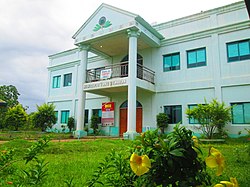 Municipal Hall | |
 Seal | |
 Map of Palawan with Dumaran highlighted | |
show OpenStreetMap | |
 Dumaran Location within the Philippines | |
| Coordinates: 10°32′N 119°46′E / 10.53°N 119.77°ECoordinates: 10°32′N 119°46′E / 10.53°N 119.77°E | |
| Country | Philippines |
| Region | Mimaropa |
| Province | Palawan |
| District | 1st district |
| Barangays | 16 (see Barangays) |
| Government | |
| • Type | Sangguniang Bayan |
| • Mayor | Arnel T. Caabay |
| • Vice Mayor | Medwin C. Pablico |
| • Representative | Franz Josef George E. Alvarez |
| • Electorate | 14,068 voters (2019) |
| Area | |
| • Total | 435.00 km2 (167.95 sq mi) |
| Elevation | 20 m (70 ft) |
| Highest elevation | 165 m (541 ft) |
| Lowest elevation | 0 m (0 ft) |
| Population (2020 census) [3] | |
| • Total | 23,528 |
| • Density | 54/km2 (140/sq mi) |
| • Households | 5,757 |
| Economy | |
| • Income class | 3rd municipal income class |
| • Poverty incidence | 24.32% (2015)[4] |
| • Revenue | ₱113,768,656.38 (2016) |
| Service provider | |
| • Electricity | Palawan Electric Cooperative (PALECO) |
| Time zone | UTC+8 (PST) |
| ZIP code | 5310 |
| PSGC | |
| IDD : area code | +63 (0)48 |
| Climate type | tropical climate |
| Native languages | Palawano Tagalog |


Dumaran, officially the Municipality of Dumaran (Tagalog: Bayan ng Dumaran), is a 3rd class municipality in the province of Palawan, Philippines. According to the 2020 census, it has a population of 23,528 people. [3]
The municipality covers the southern part of the namesake Dumaran Island (where the poblacion is located), as well as a portion on Palawan Island. It is bounded on the north-east by Municipality of Araceli, on the south by Sulu Sea, on the south-west by Roxas, and on the north-west by the municipality of Taytay. Dumaran also celebrate the Kalabukay Festival - Kalabukay refers to a local bird that is common to the people of Dumaran. The Municipality of Dumaran is in rich with natural resources. The majority of the people living in Dumaran are farmers and fishermen.
Barangays[]
Dumaran is politically subdivided into 16 barangays, 9 barangays on the mainland of Palawan, and 7 barangays on Dumaran Island.
- Araceli (island)
- Bacao (island)
- Bohol (island)
- Calasag (island)
- Capayas (mainland)
- Catep (island)
- Culasian (mainland)
- Danleg (mainland)
- Dumaran (Poblacion, island)
- Itangil (mainland)
- Ilian (mainland)
- Magsaysay (mainland)
- San Juan (island)
- Santa Teresita (mainland)
- Santo Tomas (island)
- Tanatanaon (mainland)
- Santa Maria (mainland)
Demographics[]
|
| |||||||||||||||||||||||||||||||||||||||||||||
| Source: Philippine Statistics Authority [5] [6] [7][8] | ||||||||||||||||||||||||||||||||||||||||||||||
In the 2020 census, the population of Dumaran was 23,528 people, [3] with a density of 54 inhabitants per square kilometre or 140 inhabitants per square mile.
The dominant language is Cuyonon, while Bisaya and Tagalog are spoken as secondary languages.
Climate[]
| hideClimate data for Dumaran, Palawan | |||||||||||||
|---|---|---|---|---|---|---|---|---|---|---|---|---|---|
| Month | Jan | Feb | Mar | Apr | May | Jun | Jul | Aug | Sep | Oct | Nov | Dec | Year |
| Average high °C (°F) | 29 (84) |
30 (86) |
30 (86) |
31 (88) |
31 (88) |
30 (86) |
29 (84) |
30 (86) |
29 (84) |
29 (84) |
29 (84) |
29 (84) |
30 (85) |
| Average low °C (°F) | 23 (73) |
23 (73) |
23 (73) |
24 (75) |
25 (77) |
25 (77) |
25 (77) |
24 (75) |
24 (75) |
24 (75) |
24 (75) |
24 (75) |
24 (75) |
| Average precipitation mm (inches) | 45 (1.8) |
34 (1.3) |
62 (2.4) |
64 (2.5) |
127 (5.0) |
159 (6.3) |
172 (6.8) |
147 (5.8) |
167 (6.6) |
182 (7.2) |
172 (6.8) |
88 (3.5) |
1,419 (56) |
| Average rainy days | 12.1 | 9.4 | 13.0 | 14.3 | 22.7 | 26.9 | 28.0 | 26.4 | 27.0 | 27.0 | 22.7 | 17.8 | 247.3 |
| Source: Meteoblue [9] | |||||||||||||
Economy[]
| Poverty Incidence of Dumaran | |
| Source: Philippine Statistics Authority[10][11][12][13][14][15] | |
Culture[]
In relation to its foundation day June 14, Dumaran celebrates Kalabukay Festival annually from June 14–18.
References[]
- ^ Municipality of Dumaran | (DILG)
- ^ "2015 Census of Population, Report No. 3 – Population, Land Area, and Population Density" (PDF). Philippine Statistics Authority. Quezon City, Philippines. August 2016. ISSN 0117-1453. Archived (PDF) from the original on May 25, 2021. Retrieved July 16, 2021.
- ^ Jump up to: a b c Census of Population (2020). "MIMAROPA". Total Population by Province, City, Municipality and Barangay. PSA. Retrieved 8 July 2021.
- ^ https://psa.gov.ph/sites/default/files/City%20and%20Municipal-level%20Small%20Area%20Poverty%20Estimates_%202009%2C%202012%20and%202015_0.xlsx; publication date: 10 July 2019; publisher: Philippine Statistics Authority.
- ^ Census of Population (2015). "Region IV-B (Mimaropa)". Total Population by Province, City, Municipality and Barangay. PSA. Retrieved 20 June 2016.
- ^ Census of Population and Housing (2010). "Region IV-B (Mimaropa)". Total Population by Province, City, Municipality and Barangay. NSO. Retrieved 29 June 2016.
- ^ Censuses of Population (1903–2007). "Region IV-B (Mimaropa)". Table 1. Population Enumerated in Various Censuses by Province/Highly Urbanized City: 1903 to 2007. NSO.
- ^ "Province of Palawan". Municipality Population Data. Local Water Utilities Administration Research Division. Retrieved 17 December 2016.
- ^ "Dumaran: Average Temperatures and Rainfall". Meteoblue. Retrieved 17 November 2019.
- ^ "Poverty incidence (PI):". Philippine Statistics Authority. Retrieved 28 December 2020.
- ^ https://psa.gov.ph/sites/default/files/NSCB_LocalPovertyPhilippines_0.pdf; publication date: 29 November 2005; publisher: Philippine Statistics Authority.
- ^ https://psa.gov.ph/sites/default/files/2003%20SAE%20of%20poverty%20%28Full%20Report%29_1.pdf; publication date: 23 March 2009; publisher: Philippine Statistics Authority.
- ^ https://psa.gov.ph/sites/default/files/2006%20and%202009%20City%20and%20Municipal%20Level%20Poverty%20Estimates_0_1.pdf; publication date: 3 August 2012; publisher: Philippine Statistics Authority.
- ^ https://psa.gov.ph/sites/default/files/2012%20Municipal%20and%20City%20Level%20Poverty%20Estima7tes%20Publication%20%281%29.pdf; publication date: 31 May 2016; publisher: Philippine Statistics Authority.
- ^ https://psa.gov.ph/sites/default/files/City%20and%20Municipal-level%20Small%20Area%20Poverty%20Estimates_%202009%2C%202012%20and%202015_0.xlsx; publication date: 10 July 2019; publisher: Philippine Statistics Authority.
External links[]
| Wikimedia Commons has media related to Dumaran. |
- Dumaran Profile at PhilAtlas.com
- Philippine Standard Geographic Code
- Philippine Census Information
- Local Governance Performance Management System
| show Places adjacent to Dumaran |
|---|
| Authority control |
|
|---|
- Municipalities of Palawan