East Lutton
| East Lutton | |
|---|---|
 East Lutton Location within North Yorkshire | |
| OS grid reference | SE941696 |
| • London | 180 mi (290 km) S |
| Civil parish |
|
| District | |
| Shire county | |
| Region | |
| Country | England |
| Sovereign state | United Kingdom |
| Post town | MALTON |
| Postcode district | YO17 |
| Police | North Yorkshire |
| Fire | North Yorkshire |
| Ambulance | Yorkshire |

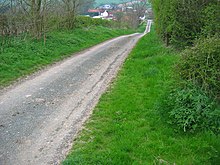
East Lutton is a hamlet in the Ryedale district of North Yorkshire, England. It is situated approximately 9 miles (14 km) east from Malton, and within the Yorkshire Wolds. It is historically part of the East Riding of Yorkshire. The village of West Lutton is 0.5 miles (0.8 km) to the west. The village lies in the Great Wold Valley and the course of the winterbourne stream the Gypsey Race passes through it.
East Lutton forms part of the civil parish of Luttons.
In 1823 East Lutton was in the parish of Weaverthorpe, the Wapentake of Buckrose, and the Liberty of St Peter's in the East Riding of Yorkshire. Population, including West Lutton was 311. East Lutton occupations included four farmers, a grocer & draper, a tailor, a shoemaker, and a corn miller.[1]
References[]
- ^ Baines, Edward (1823). History, Directory and Gazetteer of the County of York. pp. 364, 365.
External links[]
 Media related to East Lutton at Wikimedia Commons
This Ryedale location article is a stub. You can help Wikipedia by . |
- Villages in North Yorkshire
- Ryedale geography stubs