East Point, Northern Territory
| East Point Darwin, Northern Territory | |||||||||||||||
|---|---|---|---|---|---|---|---|---|---|---|---|---|---|---|---|
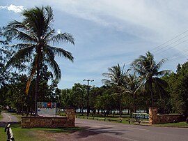 Entrance into East Point | |||||||||||||||
 East Point | |||||||||||||||
| Coordinates | Coordinates: 12°24′39″S 130°49′20″E / 12.41083°S 130.82222°E | ||||||||||||||
| Population | 14 (2016 census)[1] | ||||||||||||||
| Established | 1869 | ||||||||||||||
| Postcode(s) | 0820 | ||||||||||||||
| Location | 6.7 km (4 mi) from Darwin | ||||||||||||||
| LGA(s) | City of Darwin | ||||||||||||||
| Territory electorate(s) | Fannie Bay | ||||||||||||||
| Federal division(s) | Solomon | ||||||||||||||
| |||||||||||||||
| Footnotes | Adjoining suburbs[2][3] | ||||||||||||||

East Point is an inner northern suburb of the city of Darwin, Northern Territory of Australia.[4]
East Point, Lee Point and Point Charles all appear on Goyder's original plan of Port Darwin in 1869. This point, the easterly extremity of the entrance to Darwin Harbour has been used for a variety of purposes. It was the site of naval and anti-aircraft guns during World War II (1942-46), a post war golf course and currently a recreation reserve including a pony club and a war museum.
See also[]
- Darwin Military museum
References[]
- ^ Australian Bureau of Statistics (27 June 2017). "East Point (State Suburb)". 2016 Census QuickStats. Retrieved 28 June 2017.

- ^ "East Point". NT Atlas and Spatial Data Directory. Northern Territory Government. Retrieved 30 April 2019.
- ^ "Darwin City Council Suburbs" (PDF). Place Names Committee. Northern Territory Government. Retrieved 30 April 2019.
- ^ "Place Names Register Extract for "East Point" (Suburb)". NT Place Names Register. Northern Territory Government. Retrieved 26 March 2019.
External links[]
| Wikimedia Commons has media related to East Point, Northern Territory. |
This Northern Territory geography article is a stub. You can help Wikipedia by . |
Categories:
- Suburbs of Darwin, Northern Territory
- Northern Territory geography stubs