Eel Township, Cass County, Indiana
Eel Township | |
|---|---|
 Houses in the Point Historic District of Logansport, located in the township | |
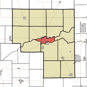 Location of Eel Township in Cass County | |
| Coordinates: 40°45′14″N 86°21′23″W / 40.75389°N 86.35639°WCoordinates: 40°45′14″N 86°21′23″W / 40.75389°N 86.35639°W | |
| Country | United States |
| State | Indiana |
| County | Cass |
| Government | |
| ��� Type | Indiana township |
| Area | |
| • Total | 9.78 sq mi (25.33 km2) |
| • Land | 9.34 sq mi (24.2 km2) |
| • Water | 0.44 sq mi (1.13 km2) |
| Elevation | 633 ft (193 m) |
| Population (2010) | |
| • Total | 18,767 |
| • Density | 1,900/sq mi (740/km2) |
| FIPS code | 18-20494[2] |
| GNIS feature ID | 453272 |

Eel Township is one of fourteen townships in Cass County, Indiana. As of the 2010 census, its population was 18,767.
Geography[]
Eel Township covers an area of 9.78 square miles (25.3 km2) and lies partly between the Eel River and the Wabash River; the former joins the latter within Logansport (the county seat). According to the USGS, it contains one cemetery, Mount Hope.
References[]
- ^ "US Board on Geographic Names". United States Geological Survey. 2007-10-25. Retrieved 2008-01-31.
- ^ "U.S. Census website". United States Census Bureau. Retrieved 2008-01-31.
External links[]
Municipalities and communities of Cass County, Indiana, United States | ||
|---|---|---|
| City | ||
| Towns | ||
| Townships | ||
| CDP | ||
| Unincorporated communities | ||
| Footnotes | ‡This populated place also has portions in an adjacent county or counties | |
| ||
Categories:
- Townships in Cass County, Indiana
- Townships in Indiana