Noble Township, Cass County, Indiana
Noble Township | |
|---|---|
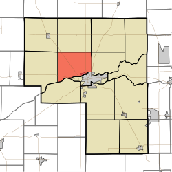 Location of Noble Township in Cass County | |
| Coordinates: 40°47′19″N 86°25′07″W / 40.78861°N 86.41861°WCoordinates: 40°47′19″N 86°25′07″W / 40.78861°N 86.41861°W | |
| Country | United States |
| State | Indiana |
| County | Cass |
| Government | |
| • Type | Indiana township |
| Area | |
| • Total | 26.21 sq mi (67.87 km2) |
| • Land | 26.05 sq mi (67.47 km2) |
| • Water | 0.16 sq mi (0.4 km2) |
| Elevation | 751 ft (229 m) |
| Population (2010) | |
| • Total | 1,960 |
| • Density | 75/sq mi (29/km2) |
| FIPS code | 18-54054[2] |
| GNIS feature ID | 453669 |

Noble Township is one of fourteen townships in Cass County, Indiana. As of the 2010 census, its population was 1,960.[3]
History[]
Noble Township was organized in 1836.[4] It was named for Noah Noble, fifth Governor of Indiana.[5]
Geography[]
Noble Township covers an area of 26.21 square miles (67.9 km2); 0.16 square miles (0.41 km2) (0.61 percent) of this is water.
Cities and towns[]
- Logansport (west edge)
Unincorporated towns[]
(This list is based on USGS data and may include former settlements.)
Adjacent townships[]
- Harrison (north)
- Bethlehem (northeast)
- Clay (east)
- Eel (southeast)
- Clinton (southwest)
- Jefferson (west)
- Boone (northwest)
Major highways[]
Cemeteries[]
The township contains three cemeteries: East Sand Ridge, Harper and Horney.
References[]
- ^ "US Board on Geographic Names". United States Geological Survey. 2007-10-25. Retrieved 2008-01-31.
- ^ "U.S. Census website". United States Census Bureau. Retrieved 2008-01-31.
- ^ "Geographic Identifiers: 2010 Demographic Profile Data (G001): Noble township, Cass County, Indiana". U.S. Census Bureau, American Factfinder. Archived from the original on February 12, 2020. Retrieved January 15, 2013.
- ^ Powell, Jehu Z. (1913). History of Cass County Indiana: From Its Earliest Settlement to the Present Time. Lewis Publishing Company. pp. 661.
- ^ Helm, Thomas B. (1878). History of Cass County, Indiana. Kingman Bros. pp. 36.
External links[]
Municipalities and communities of Cass County, Indiana, United States | ||
|---|---|---|
| City | ||
| Towns | ||
| Townships | ||
| CDP | ||
| Unincorporated communities | ||
| Footnotes | ‡This populated place also has portions in an adjacent county or counties | |
| ||
Categories:
- Townships in Cass County, Indiana
- Townships in Indiana