Egerton, Cheshire
| Egerton | |
|---|---|
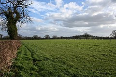 Sheep pasture in the north of the civil parish | |
 Egerton Location within Cheshire | |
| Population | 81 (2001) |
| OS grid reference | SJ522520 |
| Civil parish |
|
| Unitary authority | |
| Ceremonial county | |
| Region |
|
| Country | England |
| Sovereign state | United Kingdom |
| Post town | MALPAS |
| Postcode district | SY14 |
| Dialling code | 01829 |
| Police | Cheshire |
| Fire | Cheshire |
| Ambulance | North West |
| UK Parliament | |

Egerton is a civil parish in the unitary authority of Cheshire East and the ceremonial county of Cheshire, England. A largely rural area, the parish includes the small settlement of Egerton Green (at SJ522520), which lies 3¾ miles to the north east of Malpas and 8 miles to the west of Nantwich, as well as Fairy Glen.[1] The population is less than 100. Nearby villages include Bickerton, Bulkeley and No Man's Heath.
History[]
In the Middle Ages, an ancestor of the Sir Roland Egerton, 1st Baronet, William le Belward, took the surname of Egerton from the lordship of Egerton, Cheshire, which he inherited.[2] His descendants, the Egerton family, include the dukes of Bridgewater and Sutherland.
Governance[]
Egerton is administered jointly with Bickerton by the Bickerton & Egerton Parish Council.[3] From 1974 the civil parish was served by Crewe and Nantwich Borough Council, which was succeeded on 1 April 2009 by the unitary authority of Cheshire East.[4] Egerton falls in the parliamentary constituency of Eddisbury,[5] which has been represented by Edward Timpson since 2019,[6] after being represented by Stephen O'Brien (1999–2015) and Antoinette Sandbach (2015–19).
Geography[]

Egerton is predominantly flat, with an elevation of around 100 metres. Bickerton Road runs through the north, connecting Bickerton School with the A49, and a second lane connects Bickerton Road with the A41. National Cycle Routes 45 and 70 follow the lanes. Bickley Brook runs broadly north–south through the parish. There is a small area of woodland near Egerton Bank Farm in the south of the civil parish.[7]
Demography[]
According to the 2001 Census, the parish had a population of 81.[8] At the 2011 Census the population remained less than 100.[citation needed] This represents a decline from the population of 1851; historical population figures are 103 (1801), 127 (1851), 113 (1901) and 97 (1951).[1]
Landmarks[]
The parish contains one listed building, the remains of a chapel to the west of Egerton Hall, which was demolished in 1760. The chapel dates from the 14th century, and the remains consist of three sandstone walls, which contain two windows.[9][10]
Education[]
There are no schools within the civil parish. Egerton falls within the catchment areas of Bickerton Holy Trinity CE Primary School in Bickerton and Bishop Heber High School in Malpas.[11][12]
References[]
- ^ Jump up to: a b Genuki: Egerton (accessed 14 August 2007)
- ^ George Edward Cokayne Complete Baronetage Volume 1 1900
- ^ Bickerton & Egerton Parish Council, Cheshire East Council, retrieved 1 October 2016
- ^ Cheshire (Structural Changes) Order 2008 Archived May 17, 2009, at the Wayback Machine
- ^ Cheshire East Council & Cheshire West and Chester Council: Interactive Mapping: Eddisbury Archived 2016-10-03 at the Wayback Machine (accessed 30 September 2016)
- ^ Eddisbury Parliamentary constituency, BBC, retrieved 19 December 2019
- ^ Explorer 257: Crewe & Nantwich: Whitchurch & Tattenhall, Ordnance Survey
- ^ Combining Cheshire County Council: Local Statistics: Bickerton - Egerton Archived September 27, 2007, at the Wayback Machine & Neighbourhood Statistics: Bickerton CP (accessed 17 August 2007)
- ^ Historic England, "Remains of Chapel, west of Egerton Hall (1330098)", National Heritage List for England, retrieved 9 January 2014
- ^ Hartwell, Clare; Hyde, Matthew; Hubbard, Edward; Pevsner, Nikolaus (2011) [1971], Cheshire, The Buildings of England, New Haven and London: Yale University Press, p. 355, ISBN 978-0-300-17043-6
- ^ Cheshire County Council: Interactive Mapping: Bickerton Holy Trinity CE Primary School Archived 2008-06-03 at the Wayback Machine (accessed 25 May 2008)
- ^ Cheshire County Council: Interactive Mapping: Bishop Heber High School Archived 2008-06-03 at the Wayback Machine (accessed 25 May 2008)
External links[]
![]() Media related to Egerton, Cheshire at Wikimedia Commons
Media related to Egerton, Cheshire at Wikimedia Commons
- Civil parishes in Cheshire
- Villages in Cheshire