Cheshire East
Cheshire East | |
|---|---|
Borough and Unitary authority | |
 Coat of arms  Council logo | |
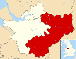 Cheshire East shown within Cheshire | |
| Coordinates: 53°08′46″N 2°22′01″W / 53.146°N 2.367°WCoordinates: 53°08′46″N 2°22′01″W / 53.146°N 2.367°W | |
| Sovereign state | |
| Constituent country | |
| Region | North West England |
| Ceremonial county | |
| Established | 1 April 2009 |
| Administrative HQ | Sandbach (Westfields) |
| Government | |
| • Type | Unitary authority |
| • Body | Cheshire East Council |
| • Leadership | Leader and cabinet |
| • Executive | Labour and Independent coalition |
| • Leader | Sam Cocoran |
| • Mayor | Barry Burkhill |
| • Chief Executive | Lorraine O'Donnell[1] |
| Area | |
| • Total | 450 sq mi (1,166 km2) |
| Area rank | 22nd |
| Population (mid-2019 est.) | |
| • Total | 384,152 |
| • Rank | 16th |
| • Density | 840/sq mi (326/km2) |
| • Ethnicity | 96.7% white |
| Time zone | UTC+0 (Greenwich Mean Time) |
| Postcode areas | |
| Dialling codes | 01260 (Congleton) 01270 (Crewe) 01477 (Holmes Chapel) 01565 (Knutsford) 01606 (Northwich) 01625 (Macclesfield) 01829 (Tarporley) 01948 (Whitchurch) |
| GSS code | E06000049 |
| NUTS 3 code | UKD62 |
| ONS code | 00EQ |
| MPs | Fiona Bruce (C) Kieran Mullan (C) Edward Timpson (C) David Rutley (C) Esther McVey (C) |
| Police area | Cheshire |
| Fire service | Cheshire |
| Ambulance service | North West |
| Website | http://www.cheshireeast.gov.uk |

Cheshire East is a unitary authority area with borough status in the ceremonial county of Cheshire, England. The local authority is Cheshire East Council. The main towns within the area are Crewe, Macclesfield, Congleton, Sandbach and Nantwich. The council is based in Sandbach.
History[]
The borough council was established in April 2009 as part of the 2009 structural changes to local government in England, by virtue of an order under the Local Government and Public Involvement in Health Act 2007.[2] It is an amalgamation of the former boroughs of Macclesfield, Congleton and Crewe and Nantwich, and includes the functions of the former Cheshire County Council. The residual part of the disaggregated former County Council, together with the other three former Cheshire borough councils (Chester City, Ellesmere Port & Neston and Vale Royal) were, similarly, amalgamated to create the new unitary council of Cheshire West and Chester.
Cheshire East has historic links to textile mills of the industrial revolution, such as seen at Quarry Bank Mill. It is also home to Tatton Park, a historic estate that hosts RHS Show Tatton Park.
Geography[]
Cheshire East lies within North West England. It borders Cheshire West and Chester to the west, Greater Manchester to the north, Derbyshire to the east as well as Staffordshire and Shropshire to the south. It is home to the Cheshire Plain and the southern hills of the Pennines. The local geology is mostly glacial clay, as well as glacial sands and gravel.
Demography[]
| Year | Pop. | ±% |
|---|---|---|
| 1981 | 328,500 | — |
| 1986 | 331,700 | +1.0% |
| 1991 | 340,500 | +2.7% |
| 1996 | 349,900 | +2.8% |
| 2001 | 352,100 | +0.6% |
| 2006 | 362,000 | +2.8% |
| 2011 | 370,700 | +2.4% |
| All totals rounded to nearest hundred Source: NOMIS | ||
According to the United Kingdom Census 2011 Cheshire East has a population of 370,127 people.[3]
Ethnicity[]
According to the 2011 Census, ethnic white groups (British, Irish, Other) account for 96.7% of the population (357,940 people), with 3.3% of the population (12,187 people) being in ethnic groups other than white (Asian, Black, Other).[3]
Religion[]
A breakdown of religious groups and denominations:
- Christian: 68.9% (254,940 people)
- Buddhist: 0.2% (882 people)
- Hindu: 0.4% (1,328 people)
- Jewish: 0.2% (581 people)
- Muslim: 0.7% (2,438 people)
- Sikh: 0.1% (279 people)
- Other religions: 0.3% (1,065 people)
- No religion: 22.7% (83,973 people)
- Religion not stated: 6.7% (24,641 people)[3]
Administration[]
Wards[]
The 52 wards of Cheshire East are:[4]
- Agden-parish of
- Alderley Edge
- Alsager
- Audlem
- Bollington
- Brereton Rural
- Broken Cross and Upton
- Bunbury
- Chelford
- Congleton East
- Congleton West
- Crewe Central
- Crewe East
- Crewe North
- Crewe South
- Crewe St Barnabas
- Crewe West
- Dane Valley
- Disley
- Gawsworth
- Handforth
- Haslington
- High Legh
- Knutsford
- Leighton
- Macclesfield Central
- Macclesfield East
- Macclesfield Hurdsfield
- Macclesfield South
- Macclesfield Tytherington
- Macclesfield West and Ivy
- Middlewich
- Mobberley
- Nantwich North and West
- Nantwich South and Stapeley
- Odd Rode
- Poynton East and Pott Shrigley
- Poynton West and Adlington
- Prestbury
- Sandbach Elworth
- Sandbach Ettiley Heath and Wheelock
- Sandbach Heath and East
- Sandbach Town
- Shavington
- Sutton (Sutton Lane Ends)
- Willaston and Rope
- Wilmslow Dean Row
- Wilmslow East
- Wilmslow Lacey Green
- Wilmslow West and Chorley
- Wistaston
- Wrenbury
- Wybunbury
| Ward | Civil parishes[Note 1] and unparished areas |
House of Commons constituency |
|---|---|---|
| Alderley Edge | Alderley Edge | Tatton |
| Alsager | Alsager | Congleton |
| Audlem | Audlem | Eddisbury |
| Austerson | ||
| Baddington | ||
| Broomhall | ||
| Buerton | ||
| Coole Pilate | ||
| Dodcott cum Wilkesley | ||
| Hankelow | ||
| Newhall | ||
| Sound | ||
| Bollington | Bollington | Macclesfield |
| Higher Hurdsfield | ||
| Brereton Rural | Arclid | Congleton |
| Betchton | ||
| Bradwall | ||
| Brereton | ||
| Hassall | ||
| Hulme Walfield | ||
| Moston | ||
| Smallwood | ||
| Somerford | ||
| Somerford Booths | ||
| Swettenham | ||
| Warmingham | Crewe and Nantwich | |
| Broken Cross and Upton | Macclesfield | Macclesfield |
| Bunbury | Acton | Eddisbury |
| Alpraham | ||
| Aston juxta Mondrum | ||
| Bunbury | ||
| Calveley | ||
| Cholmondeston | ||
| Church Minshull | ||
| Henhull | ||
| Hurleston | ||
| Minshull Vernon | ||
| Poole | ||
| Stoke | ||
| Wardle | ||
| Wettenhall | ||
| Worleston | ||
| Chelford | Bexton | Tatton |
| Chelford | ||
| Marthall | ||
| Nether Alderley | ||
| Ollerton | ||
| Peover Inferior | ||
| Peover Superior | ||
| Plumley | ||
| Snelson | ||
| Toft | ||
| Congleton East | Congleton | Congleton |
| Congleton West | Congleton | |
| Crewe Central | Crewe | Crewe and Nantwich |
| Crewe East | Crewe | |
| Crewe North | Crewe | |
| Crewe South | Crewe | |
| Shavington cum Gresty | ||
| Crewe St Barnabas | Crewe | |
| Crewe West | Crewe | |
| Haslington | Barthomley | |
| Basford | ||
| Crewe Green | ||
| Haslington | ||
| Weston | ||
| Knutsford | Knutsford | Tatton |
| Leighton | Crewe | Crewe and Nantwich |
| Leighton | ||
| Leighton | Eddisbury | |
| Macclesfield Central | Macclesfield | Macclesfield |
| Macclesfield East | Macclesfield | |
| Macclesfield Hurdsfield | Macclesfield | |
| Macclesfield South | Macclesfield | |
| Macclesfield Tytherington | Macclesfield | |
| Macclesfield West and Ivy | Macclesfield | |
| Middlewich | Middlewich | Congleton |
| Nantwich North and West | Nantwich | Crewe and Nantwich |
| Nantwich South and Stapeley | Batherton | |
| Nantwich | ||
| Stapeley | ||
| Prestbury | Mottram St Andrew | Macclesfield |
| Over Alderley | ||
| Prestbury | ||
| Sandbach Elworth | Sandbach | Congleton |
| Sandbach Ettiley Heath and Wheelock | Sandbach | |
| Sandbach Heath and East | Sandbach | |
| Sandbach Town | Sandbach | |
| Shavington | Shavington cum Gresty | Crewe and Nantwich |
| Willaston and Rope | Rope | |
| Willaston | ||
| Wilmslow Dean Row | Wilmslow | Tatton |
| Wilmslow East | Wilmslow | |
| Wilmslow Lacey Green | Styal | |
| Wilmslow | ||
| Wilmslow West and Chorley | Chorley | |
| Wilmslow | ||
| Wistaston | Willaston | Crewe and Nantwich |
| Wistaston | ||
| Woolstanwood | ||
| Wrenbury | Baddiley | Eddisbury |
| Bickerton | ||
| Brindley | ||
| Bulkeley | ||
| Burland | ||
| Cholmondley | ||
| Chorley | ||
| Edleston | ||
| Egerton | ||
| Faddiley | ||
| Haughton | ||
| Marbury cum Quoisley | ||
| Norbury | ||
| Peckforton | ||
| Ridley | ||
| Spurstow | ||
| Wirswall | ||
| Wrenbury cum Frith | ||
| Wybunbury | Blakenhall | Crewe and Nantwich |
| Bridgemere | ||
| Checkley cum Wrinehill | ||
| Chorlton | ||
| Doddington | ||
| Hatherton | ||
| Hough | ||
| Hunsterson | ||
| Lea | ||
| Walgherton | ||
| Weston | ||
| Wybunbury |
- Notes
- ^ 1: Civil parishes highlighted in bold have unilaterally declared town status under section 12A of the Local Government Act 1972.
Members of Parliament[]
| Constituency | Member of Parliament | Political party | Year first elected | Notes | Website | Parliamentary profile | ||
|---|---|---|---|---|---|---|---|---|
| Congleton | Fiona Bruce | Conservative Party | 2010 | Website | Profile | 
| ||
| Crewe and Nantwich | Kieran Mullan | 2019 | Website | Profile | 
| |||
| Eddisbury | Antoinette Sandbach | 2019 | Website | Profile | 
| |||
| Macclesfield | David Rutley | 2010 | Lord Commissioner of the Treasury | Website | Profile | 
| ||
| Tatton | The Rt Hon. Esther McVey | 2017 | Website | Profile | 
| |||
| Election | 2008 | 2010 | 2015 | 2017 | 2019 | ||||||
|---|---|---|---|---|---|---|---|---|---|---|---|
| Congleton | Ann Winterton | Fiona Bruce | |||||||||
| Crewe and Nantwich | Edward Timpson | Laura Smith | Kieran Mullan | ||||||||
| Eddisbury | Stephen O'Brien | Antoinette Sandbach | |||||||||
| Macclesfield | Sir Nicholas Winterton | David Rutley | |||||||||
| Tatton | George Osborne | Esther McVey | |||||||||
- Notes
- ^ 2: From the last election before the borough of Cheshire East was established.
Elections[]
At the last Cheshire County Council election in 2005 there were 15 Conservative controlled wards, 6 Labour controlled wards, 5 Liberal Democrat controlled wards and 1 ward controlled by an independent within the unitary authority boundaries.[5]
The first elections for Cheshire East Council took place on 1 May 2008, with the Conservative Party taking overall control. The Conservatives took 59 of the 81 seats with the others being held by the Liberal Democrats (12), Labour (6), 3 members of Middlewich First and one Independent.[6] The first leader of the authority was Wesley Fitzgerald who was elected at Cheshire East's inaugural meeting on 13 May 2008. Wesley Fitzgerald is a Councillor for the Wilmslow South ward. Having decided in February 2012 to step down, a leadership contest was triggered. Michael Jones – a relatively new councillor having been elected in the May 2011 elections – was elected as the Leader of the Conservative Group on 17 March 2012.
The administrative centre for Cheshire East Council is Westfields in Sandbach, the former Headquarters of Congleton Borough Council.[7] The site could be expanded if needed as there is space around the newly built centre.[8] Cheshire East is an observer member of the Association of Greater Manchester Authorities of Greater Manchester, which borders Cheshire to the north.
Transport[]
Roads[]
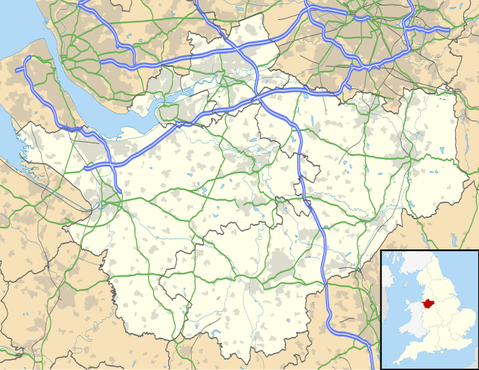
Motorways and primary routes in the borough which are maintained by Highways England (trunk roads de jure) include the M6, M56 and the A556. Other primary routes which are maintained by the council (principal roads de jure) include the A6, A34, A49, A50, A51, A54, A56, A500, A523, A525, A530, A534, A536, A537, A538, A555, A556, A5020 and A5033.
Major road projects[]
A556 Knutsford to Bowdon Improvement: A new five-mile four-lane dual-carriageway bypass of Bucklow Hill and Mere Crossroads on the A556 is currently under construction by Highways England at a cost of between £165-£221 million. The new road will also contain the first 'green bridge' wildlife crossing in the United Kingdom. The existing road will be narrowed to one lane in each direction and re-designated as the B5569 under the maintenance of Cheshire East Council.[9][10]
M6 Junctions 16-19: Smart Motorway: Highways England are preparing to convert the hard shoulder to a permanent running lane and introduce a variable speed limit along this section of the M6, meaning that it will become the first smart motorway in Cheshire. The scheme is expected to cost between £192-£274 million.[11]
Crewe Green Link Road South: A dual-carriageway extension of Crewe Green Link Road is being constructed between the A5020 and Weston Gate Roundabout on the A500 by Cheshire East Council at a cost of £26.5 million.[12]
LED improvements: The Cheshire East Council, for multiple years now, has been investing in LEDs (light emitting diodes) as they are energy-efficient lights that are more likely to avoid sleepiness on the road as of their blue tint.
Rail[]
Local sites of interest[]
The area is home to a large number of sites of public interest:
- Tatton Park is the venue for a variety of events: classical concerts; fireworks displays; classic car shows; open-air theatre and the Country Show (massed pipes and drums, sheepdog trials, competitions, crafts fair, and dancing).[13]
- is privately owned with over 1,000 people living and working on it in town (Knutsford), in villages such as Rostherne and Ashley, and in the rural parishes surrounding. The new Ashley Hall Showground and Event Centre hosts events such as the Cheshire Ploughing and Hedge Laying Competition, the Ashley Hall Traction Engine Rally and charity barn dances.[14]
- Jodrell Bank Observatory is home to a number of significant radio telescopes including the Lovell Telescope; and is involved in a range of international research projects such as MERLIN.
- Gawsworth Hall is a half-timbered hall, and possibly once home to Shakespeare's 'Dark Lady'. Concerts are held in the grounds, and each summer there is an open-air theatre season, featuring Shakespearean classics and light opera, comedy, jazz, and drama.[15]
- Cuckooland Museum is a reputed museum which exhibits the world's largest and finest collection of antique cuckoo clocks.[16]
- Arley Hall is a Victorian-Jacobean Grade II listed country house, sometimes used as locations for filming. There have been two Coronation Street weddings filmed here.[17]
- Quarry Bank Mill is set in the village of Styal and is a working water-mill and living museum.[18]
- Capesthorne Hall is a Jacobean-style stately home which plays host to a variety of events.[19]
- Alderley Edge is a great sandstone escarpment that overlooks the Cheshire plain.[20] The Edge itself has been mined for copper since at least the time of the Roman invasion, and is the centre of the legend of the Wizard of Alderley,[21] made famous by local author Alan Garner's books The Weirdstone of Brisingamen and The Moon of Gomrath. Nowadays it is said that the Wizard was Merlin, but this is an addition that only appeared over the past thirty years. Tours of the mines are available, but should not be attempted without an experienced guide – the Edge is riddled with mineshafts.
- St James' and St Paul's Church, Marton is a 14th-century house of worship which lies on an artificial mound or earthwork.[22]
- Knutsford is best known as the site where King Canute forded the Lily Stream, and as the home of Victorian author Elizabeth Gaskell, and the town holds a May Day parade and festival every year.[23]
- Lyme Park is an estate and park located near Disley. Lyme Hall is the principal feature of the park.[24]
- Little Moreton Hall is one of the country's best-preserved half-timbered and moated manor houses.[25]
- Sandbach Crosses are two Anglo-Saxon stone crosses now erected in the market place in the town of Sandbach, Cheshire, England .[26] They are recognised as a Grade I listed building[27] and a scheduled monument.[28]
- Old Hall Hotel in Sandbach is a Grade I listed building.[29] The Hall is on English Heritage's Buildings at Risk Register as priority A, this is the highest grading.[30]
Twin towns[]
The former borough of Macclesfield was twinned with Eckernförde, Germany.[31]
Twinning remains active in the Crewe and Nantwich area. The town of Crewe began twinning with the town of Mâcon in France in 1957. This continued when the borough of Crewe and Nantwich was formed in 1974. The borough added the town of Bischofsheim in Germany in 1991. In 2003 the administration of twinning was passed to CANTA, the Crewe and Nantwich Twinning Association, a voluntary association supported by the borough. The association immediately added Dzierżoniów in Poland as a Friendship Town. The association has received continuing support from Cheshire East after the borough became part of the new authority.[32]
References[]
- ^ "Executive Leadership Team". Cheshire East Council. Retrieved 22 July 2020.
- ^ Cheshire (Structural Changes) Order 2008 Archived 17 May 2009 at the Wayback Machine
- ^ Jump up to: a b c UK Census (2011). "Local Area Report – Cheshire East (1946157071)". Nomis. Office for National Statistics. Retrieved 14 March 2018.
- ^ "Ward Profiles". Cheshire East Council. Archived from the original on 9 March 2013. Retrieved 6 March 2013.
- ^ Cheshire county council elections 2005. Archived 7 July 2013 at archive.today Retrieved 9 August 2007.
- ^ "Council and Democracy". Cheshire East Council. Archived from the original on 18 August 2010. Retrieved 26 August 2010.
- ^ Wilmslow Express Archived 28 August 2008 at the Wayback Machine Council's seat of power is Sandbach
- ^ "Westfields to be extended". www.thisisstaffordshire.co.uk. Archived from the original on 3 August 2008. Retrieved 24 July 2008.
- ^ "A556 Knutsford to Bowdon Improvement". Highways England. Archived from the original on 6 December 2015. Retrieved 5 December 2015.
- ^ "B5569". The SABRE Wiki. Archived from the original on 8 December 2015. Retrieved 5 December 2015.
- ^ "M6 Junctions 16-19: Smart Motorway". Highways England. Archived from the original on 13 December 2015. Retrieved 12 December 2015.
- ^ "Crewe Green Link Road South". Cheshire East Council Highways Service. Archived from the original on 20 December 2015. Retrieved 12 December 2015.
- ^ Tatton Park website. Archived 29 March 2009 at the Wayback Machine Retrieved 1 September 2007.
- ^ Tatton Estate website. Archived 12 June 2015 at the Wayback Machine Retrieved 1 June 2015.
- ^ Gawsworth Hall website. Archived 11 April 2009 at the Wayback Machine Retrieved 1 September 2007.
- ^ "The Times & The Sunday Times". thetimes.co.uk. Retrieved 1 May 2018.
- ^ Arley Hall and Gardens website. Archived 28 February 2009 at the Wayback Machine Retrieved 1 September 2007.
- ^ Quarry Bank Mill website. Archived 7 April 2009 at the Wayback Machine Retrieved 1 September 2007.
- ^ Capesthorne Hall website. Archived 25 June 2007 at the Wayback Machine Retrieved 1 September 2007.
- ^ Information site about Alderley Edge. Archived 9 March 2009 at the Wayback Machine Retrieved 1 September 2007.
- ^ Wizard of Alderley information. Archived 30 September 2007 at the Wayback Machine Retrieved 1 September 2007.
- ^ St James' and St Paul's Church, Marton information. Archived 9 May 2007 at the Wayback Machine Retrieved 1 September 2007.
- ^ History of Knutsford. Archived 28 September 2007 at the Wayback Machine Virtual Knutsford website. Retrieved 1 September 2007.
- ^ Lyme Park Information. Archived 9 August 2005 at the Wayback Machine National Trust website. Retrieved 1 September 2007.
- ^ "Little Moreton Hall". The National Trust. Archived from the original on 4 December 2008. Retrieved 27 November 2008.
- ^ Revealing Cheshire's Past: Saxon places to visit, Cheshire County Council, archived from the original on 10 July 2007, retrieved 12 October 2007
- ^ Historic England, "Sandbach crosses (1159937)", National Heritage List for England, retrieved 17 July 2007
- ^ Revealing Cheshire's Past:Sandbach Crosses, Cheshire County Council, archived from the original on 5 March 2012, retrieved 4 April 2009
- ^ Historic England, "Old Hall Hotel, Sandbach (1310849)", National Heritage List for England, retrieved 27 March 2008
- ^ Don't let old hall crumble, crewe chronicle, 17 June 2008, archived from the original on 23 July 2011, retrieved 25 August 2008
- ^ Details of twinning arrangements. Archived 13 August 2008 at the Wayback Machine Macclesfield Borough Official Website. Retrieved 25 September 2007.
- ^ "association". www.canta.org.uk. Archived from the original on 9 January 2014.
External links[]
- Cheshire East Council Website
- Cheshire Market towns
- CANTA the Crewe and Nantwich Twinning Association
| show Neighbouring ceremonial counties and principal areas |
|---|
| show |
|---|
| show Districts of North West England |
|---|


| Authority control |
|
|---|
- Borough of Cheshire East
- Unitary authority districts of England
- English unitary authorities created in 2009
- Districts of Cheshire
- Cheshire and Warrington Local Enterprise Partnership