Elazığ Airport
Elazığ Airport Elazığ Havalimanı | |||||||||||
|---|---|---|---|---|---|---|---|---|---|---|---|
 | |||||||||||
| Summary | |||||||||||
| Airport type | Public / Military | ||||||||||
| Operator | DHMI | ||||||||||
| Serves | Elazığ, Turkey | ||||||||||
| Location | Elazığ, Turkey | ||||||||||
| Elevation AMSL | 2,927 ft / 892 m | ||||||||||
| Coordinates | 38°36′24″N 039°17′29″E / 38.60667°N 39.29139°E | ||||||||||
| Website | elazig.dhmi.gov.tr | ||||||||||
| Map | |||||||||||
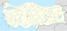
 EZS Location of airport in Turkey | |||||||||||
| Runways | |||||||||||
| |||||||||||
| Statistics (2011) | |||||||||||
| |||||||||||

Aerial view of the airport.
Elazığ Airport (IATA: EZS, ICAO: LTCA) is an airport in Elazığ, Turkey. First opened to air traffic in 1940, Elazig Airport is one of the oldest airports still in use in Turkey. The old runway 09/27 had been closed and has been removed. New 13/31 runway is installed.[5] A new terminal building has also been built in 2012.
Airlines and destinations[]
| Airlines | Destinations |
|---|---|
| AnadoluJet | Ankara, Istanbul–Sabiha Gökçen |
| Pegasus Airlines | Istanbul–Sabiha Gökçen, Izmir |
| SunExpress[6] | Seasonal: Düsseldorf, Frankfurt, Stuttgart |
| Turkish Airlines | Istanbul |
Traffic Statistics[]
Annual passenger traffic at EZS airport.
See source Wikidata query.
| Year (months) | Domestic | % change | International | % change | Total | % change |
|---|---|---|---|---|---|---|
| 2011 * | 513,804 | 35,250 | 549,054 | |||
| 2010 | 444,391 | 25,658 | 470,049 | |||
| 2009 | 343,348 | 1,496 | 344,844 | |||
| 2008 | 135,293 | 135,293 | ||||
| 2007 | 119,877 | 119,877 |
References[]
- ^ http://www.elazig.dhmi.gov.tr/getBinaryFile.aspx?Type=13&dosyaID=3&IstatistikID=59
- ^ http://www.elazig.dhmi.gov.tr/getBinaryFile.aspx?Type=13&dosyaID=3&IstatistikID=59
- ^ "Airport information for LTCA". World Aero Data. Archived from the original on 2019-03-05.
{{cite web}}: CS1 maint: unfit URL (link) Data current as of October 2006. Source: DAFIF. - ^ Airport information for LTCA at Great Circle Mapper. Source: DAFIF (effective October 2006).
- ^ http://maps.google.de/maps?f=q&source=s_q&hl=de&geocode=&q=elazig&sll=51.151786,10.415039&sspn=10.838462,28.256836&ie=UTF8&hq=&hnear=Elaz%C4%B1%C4%9F,+T%C3%BCrkei&ll=38.606307,39.281015&spn=0.01318,0.043945&t=k&z=15
- ^ Liu, Jim (3 September 2020). "SunExpress 01-19SEP20 International operations as of 30AUG20". routesonline.com.
- ^ "Statistics". Archived from the original on 2015-06-28. Retrieved 2010-12-24.
External links[]
Categories:
- Airports in Turkey
- Buildings and structures in Elazığ Province
- Transport in Elazığ Province
- Elazığ
- Turkish airport stubs
- Elazığ Province geography stubs