Elâzığ
Elâzığ | |
|---|---|
Municipality | |
 A view of İzzet Pasha Mosque in the city centre | |
 Seal | |
 Elâzığ Location of Elazığ | |
| Coordinates: 38°40′N 39°13′E / 38.667°N 39.217°E | |
| Country | |
| Region | Eastern Anatolia |
| Province | Elazığ |
| Government | |
| • Mayor | Şahin Şerifoğulları (AKP) |
| Area | |
| • District | 2,211.07 km2 (853.70 sq mi) |
| Elevation | 1,067 m (3,501 ft) |
| Population (2012)[2] | |
| • Urban | 347,857 |
| • District | 406,300 |
| • District density | 180/km2 (480/sq mi) |
| Time zone | UTC+3 (TRT) |
| Postal code | 23 xxx |
| Area code(s) | (+90) 424 |
| Licence plate | 23 |
| Website | www |

Elâzığ (Turkish pronunciation: [eˈlazɯː], Armenian: Քարբերդ/Kharberd,[3] Kurdish: Elezîz/Xarpêt[4]), formerly Mamuretülaziz, is a city in Eastern Anatolia region of Turkey, and the administrative centre of Elâzığ Province. It is located in the uppermost Euphrates valley. The plain on which the city extends has an altitude of 1,067 metres (3,501 ft). Elâzığ resembles an inland peninsula surrounded by the natural Lake Hazar and reservoirs of Keban Dam, Karakaya Dam, Kıralkızı and Özlüce.[5]
Etymology[]
In the 19th century, under the reign of Mahmud II, the governor Reşid Mehmed Pasha started an expansion of Mezre, a suburb located on the plain below Kharput. During the reign of Sultan Abdulaziz (r. 1861–1876), military barracks, a hospital and a governor's mansion were built to accommodate the seat of a new vilayet (province). The town was renamed "Mamuretülaziz" (Ottoman Turkish: معمورة العزيز, lit. 'made prosperous by Aziz') in 1866 on the occasion of the fifth anniversary of the enthronement of Sultan Abdulaziz, although he was not the initial founder. In time the city became known as "Elâzîz" due to its ease of pronunciation. On November 17, 1937, President Mustafa Kemal Atatürk changed the name of the city to "El'azık". However, since this was hard to pronounce in Turkish, on December 10, 1937, the government changed the city's name to its final form, "Elâzığ".[6]
History[]
The city of Elâzığ was founded among the skirts of the hill on which the historical Harput Castle was constructed. According to the present historical sources, the most ancient inhabitants of Harput was the Hurrian nation who settled in these parts in c. 2000 B.C.
Harput and its surrounding region was part of the kingdom of Urartu at the period of its maximum extension.[7]
The ancient town and citadel called Kharput (Kharpert), which means "rocky fortress" in Armenian, was built by the first Armenian kings about five km (3.1 miles) from modern Elâzığ. However, very little written material about this city reached our day.[citation needed] It is possible that Harput stands on or is near the site of Carcathio-certa in Sophene, reached by Corbulo in A.D. 65. The early Muslim geographers knew it as Ḥiṣn Ziyād, but the Armenian name, Khartabirt or Kharbirt, whence Kharput and Harput, was generally adopted in time.
William of Tyre wrote that Joscelin I, Count of Edessa (Jocelyn) of Courtenay, and King Baldwin II of Jerusalem were prisoners of Belek Ghazi in Kharput's castle and that they were rescued by their Armenian allies. William of Tyre calls the place Quart Piert or Pierre.
Ottoman Harput and Mamûretü'l-Azîz[]
Harput and its vicinity fell under Turkish control in the year 1085 as the outcome of the battle of Manzikert on August 26, 1071. The Çubukoğulları, Artuqids, Sultanate of Rum, Ilkhanate, Beylik of Dulkadir, Aq Qoyunlu, Safavids and Ottomans had reigned in the region.[8]
Harput was an important station of the American missionaries for many years. The missionaries built Euphrates College, a theological seminary, and boys' and girls' schools. It operated until 1915 when its buildings were confiscated and used by the Ottoman army as barracks. In November 1895, government-backed Turks and Kurds massacred, looted and burned the Armenian villages on the plain. In the same month, Harput was attacked and the American schools were burned down.[9][10] During the Armenian genocide, many residents were killed.[11][10]
Harput is still partly settled today, but due to its high elevation and lack of water, it is slowly in the process of being abandoned, with most of its residents moving to Elâzığ. Harput still has a few thousand inhabitants.
Turkish Republican era[]

The town was captured by Kurdish rebels during the Sheikh Said rebellion in 1925.[12]
Elâzığ was the seat of the Fourth Inspectorate-General from 1936[13] until 1952.[14] The Inspectorate General included the provinces of Elâzığ, Erzincan, Bingöl and Tunceli and it was governed by a Governor Commander under the military authority. He had wide-ranging power over the civilians and could order the capital punishment without the permission from the Turkish parliament. The office of the Governor Commander was eventually left vacant in 1948[15] but the legal framework for the Inspectorate-Generals was only abolished in 1952.[14]
Demographics[]
The city has a large Kurdish population, many of which consider them as Zazas, and a similarly populous ethnically Turkish population. [16]
Ecclesiastical history[]
Harput has been the seat of a Syrian Orthodox bishop as early as the eleventh century, whose diocese was initially called Ḥiṣn Ziyād and later Harput. Unlike many Christian dioceses in Turkey, this one is still functioning even after the massacres that took place in the city during the Assyrian and Armenian Massacres, in which the bishop and most of his flock were killed.[17] The diocese has two priests, with the main church being based in the ancient Merymana Kilisesi next to the wall of the old fortress.[18][19]
An Armenian Catholic diocese of Kharput was created in 1850 but was not re-established as a residential diocese after the Armenian genocide, only as an Armenian Catholic Titular see.
An Armenian Evangelical Church, built in the 19th century, survives as a ruined shell of its former self in the middle of a car park.
Economy[]


In the late 19th and early 20th century, Elâzığ exported raisins, apricots and almonds to Europe. Opium was also grown in the area.[20] Honey was also produced, but not so much exported, but used by locals.[21] Gold was also found in the area in the early 20th century.[22]
Many of those who were forced to move with the construction of the dam chose to settle in Elâzığ centre and the state indemnities paid were invested in houses in Elâzığ or laid a base for small businesses. However, the Keban Dam affected more than 30,000 people and at least 212 villages. Over 80% of families in zones affected by the Keban dam were landless peasants and thus ineligible to receive compensation or peasants with little land who would receive very little money (Koyunlu 1982: 250)
The dam, industry, and mining accounts for the high level of urbanization (42.7% in 1970) surpassing the average levels for Eastern Anatolia. The main agricultural activity of the area centers around vineyards and Elazığ also serves as a market hub for other agricultural products. The state-run vineyards of Elazığ are notable for its production of Buzbağ, a full-flavored red wine.
Today, Elâzığ is the capital of the Elâzığ province, a busy city with a university and an industrial base, although historic monuments are scarce. The exception is the ancient Harput citadel and town, a dependency of the greater municipality of Elâzığ today situated three miles (4.8 km) to the north of the city centre. Elâzığ is the most developed city (and province) in the region according to a report that was carried out by the Ministry of Development, making it the most developed region of Eastern Anatolia Region.[23]
Geography[]
Elâzığ is situated at the northwestern corner of a 30-mile-long valley, known locally as Uluova (literally the Great Valley). The area's Armenians called this valley "Vosgetashd" (the Golden Plain). Its altitude is 3,300 feet (1,000 m), latitude and longitude of 38 degrees and 41 minutes North, and 39 degrees and 14 minutes East. Elâzığ Province is surrounded by the Euphrates in the north, and since the completion of Keban Dam the rivers came to cover almost ten percent of the surface area (826 square kilometres (319 sq mi)) of the province (8,455 square kilometres (3,264 sq mi)). Elâzığ's adjacent province borders are with: Tunceli (North), Erzincan (North-West), Bingöl (East), Diyarbakır (South), and Malatya (West).
Climate[]
Elâzığ has a continental climate (Köppen climate classification: Dsa or Trewartha climate classification: Dca) with cold, snowy winters and hot, dry summers. However, due to the natural and artificial lakes around the city, some variation from this climate is experienced.[citation needed]
| hideClimate data for Elazığ (1991–2020, extremes 1938–2020) | |||||||||||||
|---|---|---|---|---|---|---|---|---|---|---|---|---|---|
| Month | Jan | Feb | Mar | Apr | May | Jun | Jul | Aug | Sep | Oct | Nov | Dec | Year |
| Record high °C (°F) | 13.0 (55.4) |
18.6 (65.5) |
26.4 (79.5) |
32.2 (90.0) |
34.4 (93.9) |
38.6 (101.5) |
42.2 (108.0) |
42.2 (108.0) |
39.0 (102.2) |
32.1 (89.8) |
24.3 (75.7) |
19.6 (67.3) |
42.2 (108.0) |
| Average high °C (°F) | 4.0 (39.2) |
6.3 (43.3) |
12.4 (54.3) |
18.4 (65.1) |
24.2 (75.6) |
30.7 (87.3) |
35.2 (95.4) |
35.2 (95.4) |
30.1 (86.2) |
22.6 (72.7) |
13.1 (55.6) |
5.9 (42.6) |
19.8 (67.6) |
| Daily mean °C (°F) | 0.1 (32.2) |
1.5 (34.7) |
6.7 (44.1) |
12.1 (53.8) |
17.1 (62.8) |
23.0 (73.4) |
27.4 (81.3) |
27.3 (81.1) |
21.9 (71.4) |
15.3 (59.5) |
7.3 (45.1) |
2.2 (36.0) |
13.5 (56.3) |
| Average low °C (°F) | −3.1 (26.4) |
−2.6 (27.3) |
1.6 (34.9) |
6.2 (43.2) |
10.3 (50.5) |
14.7 (58.5) |
19.0 (66.2) |
18.9 (66.0) |
13.9 (57.0) |
8.8 (47.8) |
2.6 (36.7) |
−0.9 (30.4) |
7.4 (45.3) |
| Record low °C (°F) | −22.6 (−8.7) |
−21.4 (−6.5) |
−17.0 (1.4) |
−7.0 (19.4) |
0.0 (32.0) |
4.0 (39.2) |
6.7 (44.1) |
10.2 (50.4) |
1.0 (33.8) |
−2.2 (28.0) |
−15.2 (4.6) |
−22.6 (−8.7) |
−22.6 (−8.7) |
| Average precipitation mm (inches) | 37.8 (1.49) |
41.8 (1.65) |
50.9 (2.00) |
60.7 (2.39) |
51.4 (2.02) |
13.6 (0.54) |
3.3 (0.13) |
1.3 (0.05) |
9.9 (0.39) |
42.1 (1.66) |
45.6 (1.80) |
45.6 (1.80) |
404.0 (15.91) |
| Average precipitation days | 8.03 | 8.63 | 9.60 | 10.53 | 10.03 | 3.70 | 1.47 | 1.00 | 2.87 | 6.73 | 6.70 | 8.90 | 78.2 |
| Mean monthly sunshine hours | 89.9 | 101.7 | 151.9 | 180.0 | 251.1 | 303.0 | 334.8 | 303.8 | 261.0 | 198.4 | 132.0 | 65.1 | 2,372.7 |
| Mean daily sunshine hours | 2.9 | 3.6 | 4.9 | 6.0 | 8.1 | 10.1 | 10.8 | 9.8 | 8.7 | 6.4 | 4.4 | 2.1 | 6.5 |
| Source: Turkish State Meteorological Service[24] | |||||||||||||
Cuisine[]
Elâzığ cuisine is the second richest among all cities in Turkey with 154 different types of food and drinks according to a study conducted by Ankara Chamber of Commerce.[25] Particularly those originated in the historic city of Harput have an important fame in the region and the country. Apart from famous meat platters most of which include meatballs, naturally dried fruits and vegetables and using them in main dishes are unique to Elâzığ cuisine. Several examples could include:[5]
- Kofik dolma - stuffed dried peppers or aubergines
- Kelecoş - fried meat and onion served over a bed of flatbread pieces softened in yogurt
- İşkene - a breakfast soup containing broth and vegetables
- Harput köfte - meatballs made with a mixture of minced meat, cracked wheat, herbs and spices boiled in tomato sauce
- Taş Ekmeği - unleavened flatbread baked over hot stone or hotplate served with butter and jam
- Işkın yemeği - a wild rhubarb dish
- Sırın - pan-broiled handmade filo pastry roundels with a layer of yogurt and tomato sauce on top
- Kömme - baked handmade filo pastry roundels built with a layer of meat filling and a layer of walnut paste
- Gaygana - a mixture of eggs, yogurt, bicarbonate, and flour drops fried in oil
- Orcik - walnut halves sewn in a thread, dipped into deep grape syrup
- Orcik şekeri - caramelised sugar coated walnut pieces
Elâzığ is also known for its vineyards, and two types of grape varieties Öküzgözü and Boğazkere.
Transport[]
Elâzığ is served by Elazığ Airport which lies about 12 km (7 mi) from the city center. The airport is the 19th busiest airport in Turkey in terms of passenger traffic.[26][27] There are daily domestic flights from/to Ankara, Istanbul and İzmir. During summer months there are some international flights from/to cities such as Düsseldorf and Frankfurt as well as from/to Antalya and Adana.
There are local companies provide coach service to almost all cities in Turkey. Ferryboat services are also present over the reservoir lakes to supplement highway connections to towns such as Ağın, and Pertek and Çemişgezek of Tunceli.
The Blue Train (passenger express) provides connection from Elâzığ to Ankara.[5]
Education[]
Elâzığ is home to Fırat University, established in 1975 and since has become one of the leading academic institutions in the eastern Turkey.[28]
Attractions[]

- Fırat University
- Harput Castle
- Elazığ Culture Park
- Elazığ Botanical Park
- Elazığ Gazi Caddesi
- Buzluk Mağarası (Ice Cave)
- Museum of Archaeology and Ethnography
- Hazar Gölü (Lake Hazar)


- Hazarbaba Ski Centre
- Historic mosques (Cami in Turkish), churches and shrines (Türbe in Turkish). Do note they are in Harput, on a hill out of town, but near enough to pay them a visit.
- Ulu Camii: Built by Artuqid Sultan Fahrettin Karaaslan in 1156. It is one of the oldest and important structures in Anatolia
- Sarahatun Camii (also known as Sarayhatun Cami): Built by Sara Hatun, mother of Aq Qoyunlu (White Sheep Turkomans) Sultan Bahadır Han (also known as Uzun Hassan), in 1465 as a small mosque. It was renovated in 1585 and 1843.
- Kurşunlu Camii: Built between 1738 and 1739 in Harput during the Ottoman era.
- Alacalı Camii
- Ağall Camii: built in 1559.
- Arap Baba Mescidi ve Türbesi: Built during the reign of Seljuk Sultan Gıyaseddin Keyhüsrev III (son of Kılıçarslan IV) in 1279. The shrine contains a mummified body which is known as Arap Baba among commons.
- Fetih Ahmet Baba Türbesi (Shrine of Fetih Ahmed)
- Mansur Baba Türbesi
- Mary Church
- Sefik Gul Community Centre of Culture
Twin towns – sister cities[]
Elâzığ is twinned with:[29]
 Akmola Region, Kazakhstan
 Mamusha, Kosovo
Gallery[]
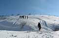
Hazarbaba
Elâzığ on a snowy day
Elâzığ train station

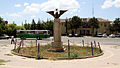
Elâzığ
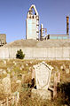
Old cemetery (with a cement plant behind it)

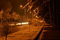
City view at night


Notable people[]
- - (died 1956) politician and businessman
- Kenan Çoban — actor, known as abdulhey in Valley of the Wolves
- Vedat Dalokay — architect and a former mayor of Ankara
- Cahit Kıraç — Governor of multiple provinces
- Reha Denemeç — Co-founder of the Justice and Development Party (AKP)
- Belek Ghazi — commander
- J. Michael Hagopian - (died 2010) Armenian-American documentary filmmaker
- Hamastegh - (died 1966) Armenian writer, student of Tlgadintzi
- Bekir İrtegün — footballer
- Ahmet Kabaklı — (died 2001) writer
- Esat Kabaklı — musician
- Dursun Karataş — founder and leader of the Revolutionary People's Liberation Party–Front (DHKP-C)
- George Kiraz — Armenian poet and writer
- Fatih Kısaparmak — musician
- Stephen P. Mugar — (died 1982) Armenian-American businessman and entrepreneur
- Shahan Natalie — (died 1983), Armenian writer and principal organizer of Operation Nemesis
- Catholicos Nerses IV — (died 1173), Armenian church leader, theologian and writer
- Erkan Oğur — musician
- Ahmet Tevfik Ozan — poet and writer
- Necati Şaşmaz — actor
- Raci Şaşmaz — film producer, writer and actor
- Mümtaz Sevinç — actor
- Yakup Şevki Subaşı - military officer in the Ottoman and Turkish armies
- Tlgadintsi — (died 1915) Armenian writer
- Vahan Totovents — (died 1938) Armenian writer, student of Tlgadintzi
- Mahir Ünlü — writer, from Harput
- Namık Kemal Yolga — diplomat and statesman
- Ashur Yousif — (died 1915) Assyrian journalist and teacher at the Euphrates College
- İhsan Yüce — (died 1991) actor
- Rupen Zartarian — (died 1915) Armenian writer, student of Tlgad
References[]
- ^ "Area of regions (including lakes), km²". Regional Statistics Database. Turkish Statistical Institute. 2002. Retrieved 2013-03-05.
- ^ "Population of province/district centers and towns/villages by districts - 2012". Address Based Population Registration System (ABPRS) Database. Turkish Statistical Institute. Retrieved 2013-02-27.
- ^ M. Th. Houtsma. E. J. Brill's First Encyclopaedia of Islam, 1913-1936, Volume 4. p. 915.
- ^ Adem Avcıkıran (2009). Kürtçe Anamnez Anamneza bi Kurmancî (PDF) (in Turkish and Kurdish). p. 56. Retrieved 17 December 2019.
- ^ Jump up to: a b c "Elâzığ" (PDF). kultur.gov.tr.
- ^ "ELAZIĞ ismi nerden gelmiştir, adını nasıl almıştır, efsanesi hikayesi nedir - BilgilerSitesi.Com". www.bilgilersitesi.com.
- ^ Çilingiroğlu, Altan; French, David H. (1991). Anatolian Iron Ages: the proceedings of the second Anatolian Iron Ages Colloquium held at İzmir, 4–8 May 1987. ISBN 9780946897384.
- ^ "Republic Of Turkey Ministry Of Culture And Tourism". Kultur.gov.tr. Retrieved 2014-08-09.
- ^ "History of Elazig". www.turkeyforyou.com.
- ^ Jump up to: a b Dadrian, Vahakn N. (2003). The History of the Armenian Genocide. Berghahn Books. p. 160. ISBN 1571816666.
- ^ Henry H. Riggs, "Days of Tragedy in Armenia: Personal Experiences in Harpoot, 1915-1917", 1997, Michigan.
- ^ Robert, Olson (2013). The Emergence of Kurdish Nationalism and the Sheikh Said Rebellion, 1880–1925. University of Texas Press. p. 110.
- ^ Soner Çaǧaptay, Islam, Secularism, and Nationalism in Modern Turkey: Who is a Turk?, Taylor & Francis, 2006, ISBN 978-0-415-38458-2, p. 48
- ^ Jump up to: a b Fleet, Kate; Kunt, I. Metin; Kasaba, Reşat; Faroqhi, Suraiya (2008-04-17). The Cambridge History of Turkey. Cambridge University Press. p. 343. ISBN 978-0-521-62096-3.
- ^ Bayir, Derya (2016-04-22). Minorities and Nationalism in Turkish Law. Routledge. pp. 139–141. ISBN 978-1-317-09579-8.
- ^ White, Paul J. (2000). Primitive Rebels Or Revolutionary Modernizers?. Zed Books. pp. 87, 158. ISBN 1856498212.
- ^ Fiey, Pour un Oriens Christianus Novus, 216–17
- ^ "Mor Malki Ürek". soc-wus.org.
- ^ "Google Maps". Google Maps.
- ^ Prothero, W. G. (1920). Armenia and Kurdistan. London: H.M. Stationery Office. p. 62.
- ^ Prothero, W. G. (1920). Armenia and Kurdistan. London: H.M. Stationery Office. p. 64.
- ^ Prothero, W. G. (1920). Armenia and Kurdistan. London: H.M. Stationery Office. p. 74.
- ^ "The most developed and most undeveloped province, 25 May 2012". Haberturk.com. 2012-05-25. Retrieved 2014-08-09.
- ^ "Resmi İstatistikler: İllerimize Ait Mevism Normalleri (1991–2020)" (in Turkish). Turkish State Meteorological Service. Retrieved 28 June 2021.
- ^ "Lezzetli Ülkenin Lezzet Haritası (2008-01-05) - ANKARA TICARET ODASI ". Atonet.org.tr. 2008-01-05. Archived from the original on 2014-09-24. Retrieved 2014-08-09.
- ^ "Statistics". General Directorate of State Airports Authority. Archived from the original on June 28, 2015. Retrieved January 29, 2013.
- ^ "Elazığ - Turkey". World Airport Codes. Retrieved 2019-05-23.
- ^ "History". firatuniversitesi.medyasoftdigital.com. Retrieved 2019-05-23.
- ^ "Elazığ'ın Kardeş Şehirleri". elazig.bel.tr (in Turkish). Elazığ. Retrieved 2021-04-10.
Sources[]
- David Ayalon, Moshe Sharon (1986). Studies in Islamic History and Civilization; Article: Ma'mûrat al-Aziz. Brill Publishers. p. 342. ISBN 978-0-510-03200-5.
- Alpaslan Koyunlu (1982). Keban Project 1974-1975 Excavations; Article: The Village Settlement of Mumzuroğlu – Observations on Housing. M.E.T.U.
- Fiey, Jean Maurice (1993). Pour un Oriens Christianus Novus: Répertoire des diocèses syriaques orientaux et occidentaux. Beirut: Orient-Institut. ISBN 9783515057189.
External links[]
| Wikimedia Commons has media related to Elâzığ. |
| show Elâzığ in Elâzığ Province of Turkey |
|---|

| show |
|---|
| show Authority control |
|---|
- Elazığ
- Assyrian communities in Turkey
- Districts of Elazığ Province
- Populated places established in 1834
- Cities in Turkey
- Kurdish settlements in Elazığ Province