Iğdır Province
Iğdır Province
Iğdır ili | |
|---|---|
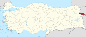 Location of Iğdır Province in Turkey | |
| Country | Turkey |
| Region | Northeast Anatolia |
| Subregion | Ağrı |
| Government | |
| • Electoral district | Iğdır |
| • Governor | Hüseyin Engin Sarıibrahim |
| Area | |
| • Total | 3,588 km2 (1,385 sq mi) |
| Population (2018)[1] | |
| • Total | 197,456 |
| • Density | 55/km2 (140/sq mi) |
| Area code(s) | 0476 |
| Vehicle registration | 76 |
Iğdır Province (Turkish: Iğdır ili, Kurdish: Parêzgeha Îdirê,[2] Azerbaijani: Iğdir rayonu, Armenian: Իգդիրի մարզ, romanized: Igdiri marz) is a province in eastern Turkey, located along the borders with Armenia, Azerbaijan (the area of Nakhchivan Autonomous Republic), and Iran. Its adjacent provinces are Kars to the northwest and Ağrı to the west and south. It occupies an area of 3,587 km2 and population of 184,418[3] (2010 est.), it was 168,634 in 2000 (up from 142,601 in 1990). It was created from southeastern part of the former Kars Province in 1993. The current Governor of the province is Hüseyin Engin Sarıibrahim.[4]
Anatolias highest mountain, Mount Ararat (Ağrı Dağı) is at present in Turkey's Iğdır province, but much of the land is a wide plain far below the mountain. The climate is the warmest in this part of Turkey; cotton can be grown in Iğdır. The closed border with Armenia follows the Aras River.
The provincial capital is the city of Iğdır.
Districts[]
Iğdır province is divided into four districts (capital district in bold):
History[]

Archaeological research has uncovered Hurrian settlements in the Iğdır region going back to 4000 BC. The area was part of the Urartu kingdom circa 800 BC. There is a Urartu statuary in the area. It remained under Urartian control until its transition to the Median Empire, Persian Empire, Alexander The Great, Orontid Dynasty of the Kingdom of Armenia. Seleucid, Parthian, Roman, Sassanid and Byzantine forces were prominent from the 4th century BC, followed by the Arab armies of Islam in 646. Turks, Georgians and Mongols fought through here for 400 years from 1064 onwards until the area was settled by Kara Koyunlu and then Ak Koyunlu Turkic tribes in the early 15th century.
For centuries, constant warfare ensued between the two arch rivals, the Ottoman Empire and the Persian Empire from 1534 until 1746. The region, most of the time remaining in Persian hands, was officially ceded once again in 1746, when subsequently most of its land within the province of Iğdır today became part of the Erivan khanate, a Muslim principality in Persia. The northern part of the province remained in Persian hands until after the Russo-Persian War, 1826–1828 when it became part of the Russian Empire under the Treaty of Turkmenchay. Under Russian administration, the area became the Surmali uyezd (with its capital at the city of Iğdır) of the Armenian Oblast and later the Erivan Governorate. The southern half of the province remained in Ottoman hands through most of the 19th century but was incorporated into the Russian Empire as a result of the Russo-Turkish War of 1877–78.
Towards the end of World War I, the whole area came under the administration of the First Republic of Armenia as part of Ararat province. After an attack into the territory by the Turkish army, Iğdır was ceded to Turkey by the Soviet government under the Treaty of Kars. A substantial Armenian population remained in the area throughout this history of struggle between great powers. Armenians formed the ethnic majority in the city of Iğdır itself until 1919–1920 when most either died or fled due to starvation during the Turkish–Armenian War. It was part of the former Province of Beyazıt between 1922 and 1927, part of Ağrı Province between 1927 and 1934, and finally part of Kars Province between 1934 and 1993, before becoming a separate province.[5]
Demographics[]
Statistics (1886-1927)[]
Present-day Iğdır Province was administered by the Russian Empire as Surmalin Uyezd from 1849 to 1918. According to the Russian family lists accounts from 1886, of the total 71,066 inhabitants of the districts 34,351 were Azerbaijanis (48.3%, mentioned as 'Tatars' in the source), 22,096 Armenians (31.1%) and 14,619 Kurds (20.6%).[6] According to the Russian Empire Census in 1897, the town of Iğdır had a population of 4,680, of which 3,934 (84%) were Armenians, and 559 (12%) were Russians.[7] The district had a population of 89,055 in 1897 of which Azerbaijanis constituted 46.5% of the population, followed by 30.4% Armenians, 21.4% Kurds and 1.6% Slavs.[8] Iğdır city had a population of 4,680 in the same census of which 84.1% were Armenians, 12% Slavic, 1.8% Azerbaijani and 1.5% Kurdish.[8]
In the 1927 Turkish census, the district was part of Kars Province and had a population of 25,209, of which 52.9% spoke Turkish as first language followed by Kurdish at 47%. The whole population adhered to Islam.[9]
According to Nicole F Watts book in 2010 (Activists in Office: Kurdish Politics and Protest in Turkey) at least 50 percent of the population of Iğdir is Kurdish.[10]
Places of interest[]

- The caravanserai of Zor, believed to have been built by an Armenian architect in the 13th or 14th century, is located 35 km south-west of the city of Iğdır, and is named after the nearby village of Zor. It was one of halting places along the trade route between northern Persia and Georgia. Caravans used to stay over-here before passing over the Çilli pass. Restoration works have begun on the structure, which has been put under protection since 1988.[11] The ruins of an Armenian church was once located in the same area, but today nothing remains of it.[12]
- Surmari castle, 25 km west of the city of Iğdır, on the road to Tuzluca, in the village of Sürmeli, is the site of the medieval Armenian town of Surmari. However, it is currently inaccessible due to border restrictions.
- Statues with Ram Heads, Cementer stones with ram heads existing almost in all old cementers in Iğdır Plain are remnants from Kara Koyunlu period. These cementers of brave, heroic persons and young persons who had died in youth age.[13]
- Aras Bird Research and Education Center, One of only four active bird research and banding (ringing) stations in Turkey. 204 bird species have been recorded so far in the wetlands along Aras River, Yukari Ciyrikli, Tuzluca. Bird enthusiasts can volunteer or visit to experience the diverse birdlife and traditional village life. From Kars to Igdir, turn immediately right 10 meter before the Aras bridge and drive 4 km to Yukari Ciyrikli village.[14]
See also[]
References[]
- ^ "Population of provinces by years - 2000-2018". Turkish Statistical Institute. Retrieved 9 March 2019.
- ^ "Li Îdirê bi roketê êrîşî binkeya leşkerî ya Tirkiyê kirin" (in Kurdish). Rûdaw. 4 January 2019. Retrieved 27 April 2020.
- ^ "Statistical Institute page". tuik.gov.tr.[permanent dead link]
- ^ http://www.igdir.gov.tr/yoneticilerimiz#
- ^ "Doğubayazıt Tarihi Bilgileri". Diyadinnet. 3 March 2006.
- ^ (in Russian) Свод статистических данных о населении Закавказского края, ИГДЫРСКИЙ УЧАСТОК (1886 г.). Tiflis, 1893.
- ^ (in Russian) Первая всеобщая перепись населения Российской Империи, 1897 г. (Erivanskaya Guberniya), N. A. Troynitskii, Saint Petersburg, 1904, p. 144.
- ^ Jump up to: a b "Первая всеобщая перепись населения Российской Империи 1897 г. Распределение населения по родному языку и уездам. Российской Империи кроме губерний Европейской России". Demoscope (in Russian). Retrieved 9 January 2021.
- ^ Kara, Hidayet; Yuca, Sami. "Cumhuriyetin İlk Nüfus Sayımına Göre Iğdır'ın Demografik Yapısı" (PDF). International Journal of History. 2: 194–195. doi:10.9737/hist_218.
- ^ Watts, Nicole F. (2010). Activists in Office: Kurdish Politics and Protest in Turkey (Studies in Modernity and National Identity). Seattle: University of Washington Press. p. 167. ISBN 978-0-295-99050-7.
- ^ "Her Yönüyle Iğdır", Ziya Zakir Acar, 2004
- ^ "Armenian Architecture - VirtualANI - The Caravanserai of Zor, near Igdir". virtualani.org.
- ^ "Introduction of Iğdır", Iğdır Municipality Publishing, 2003
- ^ "Archived copy". Archived from the original on 6 October 2019. Retrieved 28 January 2020.CS1 maint: archived copy as title (link)
Coordinates: 39°53′37″N 43°59′52″E / 39.89361°N 43.99778°E


| show Authority control |
|---|
- Iğdır Province
- States and territories established in 1992
- Turkish Kurdistan