Osmaniye Province
This article needs additional citations for verification. (March 2018) |
Osmaniye Province
Osmaniye ili | |
|---|---|
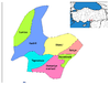
 Location of Osmaniye Province in Turkey | |
| Country | Turkey |
| Region | Mediterranean |
| Subregion | Hatay |
| Government | |
| • Electoral district | Osmaniye |
| • Governor | Erdinç Yılmaz |
| Area | |
| • Total | 3,767 km2 (1,454 sq mi) |
| Population (2018)[1] | |
| • Total | 534,415 |
| • Density | 140/km2 (370/sq mi) |
| Area code(s) | 0328 |
| Vehicle registration | 80 |
| Website | http://osmaniye-bld.gov.tr |
Osmaniye Province (Turkish: Osmaniye ili) is a Turkish province located in southern Turkey. It existed as a province by the name Cebel-i Bereket (meaning "Fertile Mountain") in the early republic until 1933, when it was incorporated into Adana Province. It was made a province again in 1996. It covers an area of 3,767 km2 and has a population of 479,221 (2010 est). The province is situated in Çukurova, a geographical, economical and cultural region.
The capital of the province is Osmaniye (Population: 194,000). The next largest towns are Kadirli (Population: 83,618) and Düziçi (Population: 42,000).
Districts[]

Osmaniye province is divided into 7 districts (capital district in bold):
Historical sites and ruins[]
- Karatepe - Aslantaş (Domuztepe-Pınarözü) - Kadirli/Düziçi
- In 2018, ancient mosaics were discovered. One of the mosaics show a radish on it. It also has a human figure holding grapes and a partridge in his hand. In addition, it has Greek text. It is believed to date back to 1st century.[2]
Notable people[]
- Yaşar Kemal, Kurdish Writer, and human rights activist, and one of the best known writers in Turkey
- Devlet Bahçeli, Turkish Politician
- Samet Aybaba, Football Manager
- Ahmet Yildirim, Football Manager
Festivals[]
- - Kadirli (25–26 May)
Gallery[]

Ancient city of Hierapolis Castabala in Osmaniye

A view from the city of Osmaniye

Corn field and irrigation canal


See also[]
References[]
- ^ "Population of provinces by years - 2000-2018". Turkish Statistical Institute. Retrieved 9 March 2019.
- ^ Ancient mosaics discovered in southern Turkey
External links[]
| Wikimedia Commons has media related to Osmaniye Province. |
- (in Turkish) Osmaniye governor's official website
- (in Turkish) Osmaniye municipality's official website
- (in Turkish) Osmaniye Haber
- (in English) Osmaniye weather forecast information
| show Authority control |
|---|
Coordinates: 37°13′41″N 36°12′45″E / 37.22806°N 36.21250°E

This article about a Mediterranean Region of Turkey location is a stub. You can help Wikipedia by . |
- Osmaniye Province
- Çukurova
- Mediterranean Region, Turkey geography stubs