Gümüşhane Province
Gümüşhane Province
Gümüşhane ili | |
|---|---|
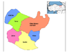
 Location of Gümüşhane Province in Turkey | |
| Country | Turkey |
| Region | East Black Sea |
| Subregion | Trabzon |
| Government | |
| • Electoral district | Gümüşhane |
| • Governor | Kamuran Taşbilek |
| Area | |
| • Total | 6,575 km2 (2,539 sq mi) |
| Population (2018)[1] | |
| • Total | 162,748 |
| • Density | 25/km2 (64/sq mi) |
| Area code(s) | 0406 |
| Vehicle registration | 29 |
| Website | http://www.gumushane.gov.tr |
Gümüşhane Province (Turkish: Gümüşhane ili) is a province in northern Turkey, bordering Bayburt to the east, Trabzon to the north, Giresun and Erzincan to the west. It covers an area of 6,575 km² and has a population of 129,618 in 2010. The population was 186,953 in 2000. The name Gümüşhane means silver house. The city has a rich mining (silver and bronze) history and was the source of exports for Trabzon. The current Governor is Kamuran Taşbilek, he was appointed on the 27 October 2019.[2]
Gümüşhane is the capital city of the province.
Geography[]
Gümüşhane is surrounded by high mountains, Zigana-Trabzon Mountains to the north, Çimen Mountains to the south, Giresun Mountains to the west and Pulur, Soğanlı Mountains to the east. Trekking is popular sport is at these mountains. The Zigana Mountain has a ski center on it and it is a well known touristic place for winter sports. Abdal Musa Peak (3331 m.) is the highest peak within it. The main trees in the forests are Scotch pine and fir, and there are many animals and birds in the area. There are many lakes such as Karanlık Göl, Beş Göller, Artebel Gölü, Kara Göller which are at the peak of Gavurdağı Mountain, and are preserved as natural parks. Mountainous territory comprises 56% of the total area of Gümüşhane province.
History[]
In September 1935 the third Inspectorate General (Umumi Müfettişlik, UM) was created.[3] Its creation was based on the Law 1164 from June 1927,[4] which was passed in order to Turkefy the population.[5] The third UM span over the provinces of Erzurum, Artvin, Rize, Trabzon, Kars Gümüşhane, Erzincan and Ağrı. It was governed by a Inspector General seated in the city of Erzurum.[3][6] The Inspectorate General was dissolved in 1952 during the Government of the Democrat Party.[7]
Archaeology[]
In November 2017, archaeologists announced the discovery of a 1400 year-old Byzantine sarcophagus in the antique village of Sadak in Satala in Kelkit. According to researchers, there were Greek inscriptions on the cover saying "Blessed Kandes sleeps here". According to Gümüşhane Museum Director Gamze Demir, the broken part of the sarcophagus, which is considered to be 2.5 meters long is believed to be under the ground.[8][9][10]
Districts[]
Gümüşhane province is divided into 6 districts (capital district in bold):
Economy[]
Historically, the province had silver mines. However, production ceased due to deforestation by 1920.[11]
See also[]
References[]
- ^ "Population of provinces by years - 2000-2018". Turkish Statistical Institute. Retrieved 9 March 2019.
- ^ "Vali Özgeçmiş". www.gumushane.gov.tr. Retrieved 2020-04-08.
- ^ Jump up to: a b "Üçüncü Umumi Müfettişliği'nin Kurulması ve III. Umumî Müfettiş Tahsin Uzer'in Bazı Önemli Faaliyetleri". Dergipark. p. 2. Retrieved 8 April 2020.
- ^ Aydogan, Erdal. "Üçüncü Umumi Müfettişliği'nin Kurulması ve III. Umumî Müfettiş Tahsin Uzer'in Bazı Önemli Faaliyetleri". Retrieved 8 April 2020.
- ^ Üngör, Umut. "Young Turk social engineering : mass violence and the nation state in eastern Turkey, 1913- 1950" (PDF). University of Amsterdam. pp. 244–247. Retrieved 8 April 2020.
- ^ Bayir, Derya (2016-04-22). Minorities and Nationalism in Turkish Law. Routledge. pp. 139–141. ISBN 978-1-317-09579-8.
- ^ Fleet, Kate; Kunt, I. Metin; Kasaba, Reşat; Faroqhi, Suraiya (2008-04-17). The Cambridge History of Turkey. Cambridge University Press. p. 343. ISBN 978-0-521-62096-3.
- ^ sabah, daily (2017-11-03). "Construction workers find ancient sarcophagus cover in Turkey's Gümüşhane". Daily Sabah. Retrieved 2021-03-05.
- ^ "Byzantine Sarcophagus Cover Unearthed in Turkey - Archaeology Magazine". www.archaeology.org. Retrieved 2021-03-05.
- ^ "Trafoyu Yenilerken Bin 600 Yıllık Lahit Buldular". Haberler.com (in Turkish). 2017-11-02. Retrieved 2021-03-05.
- ^ Prothero, W.G. (1920). Armenia and Kurdistan. London: H.M. Stationery Office. p. 73.
External links[]
| Wikimedia Commons has media related to Gümüşhane Province. |
| show Authority control |
|---|
Coordinates: 40°23′17″N 39°25′07″E / 40.38806°N 39.41861°E

- Gümüşhane Province