Şiran
Şiran | |
|---|---|
District | |
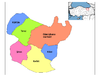
 Location of Şiran within Turkey. | |
 Şiran Location of Şiran | |
| Coordinates: 40°11′N 39°08′E / 40.183°N 39.133°E | |
| Country | |
| Region | Black Sea |
| Province | Gümüşhane |
| Government | |
| • Mayor | Yavuz Altıparmak (AKP) |
| Area | |
| • District | 927.91 km2 (358.27 sq mi) |
| Elevation | 1,457 m (4,780 ft) |
| Population (2012)[2] | |
| • Urban | 9,483 |
| • District | 17,775 |
| • District density | 19/km2 (50/sq mi) |
| Time zone | UTC+2 (EET) |
| • Summer (DST) | UTC+3 (EEST) |
| Postal code | 29xxx |
| Area code(s) | 406 |
| Licence plate | 29 |
| Climate | Dsb |
| Website | www.siran.bel.tr |

Şiran is a town and district of Gümüşhane Province in the Black Sea region of Turkey. It is one of the points of passage between Eastern Anatolia and Black Sea regions of Turkey, in the sense that the western road departing from Erzincan towards the Zigana Pass (the key pass between the two geographies) has its last urban stop in Şiran. According to the 2010 census, population of the district is 17,600 of which 8,207 live in the town of Şiran.[3] The district covers an area of 928 km2 (358 sq mi),[4] and the town lies at an elevation of 1,457 m (4,780 ft)
See also[]
References[]
- ^ "Area of regions (including lakes), km²". Regional Statistics Database. Turkish Statistical Institute. 2002. Retrieved 2013-03-05.
- ^ "Population of province/district centers and towns/villages by districts - 2012". Address Based Population Registration System (ABPRS) Database. Turkish Statistical Institute. Retrieved 2013-02-27.
- ^ Statistical Institute[permanent dead link]
- ^ Statoids. "Statistical information on districts of Turkey". Archived from the original on 2010-05-26. Retrieved 2008-12-04.
External links[]
- District governor's official website (in Turkish)
- Road map of Şiran and environs
- Local city forum website (in Turkish)
Coordinates: 40°11′22″N 39°07′36″E / 40.18944°N 39.12667°E
This Turkey location article is a stub. You can help Wikipedia by . |
Categories:
- Populated places in Gümüşhane Province
- Districts of Gümüşhane Province
- Turkey geography stubs