Adıyaman Province
Adıyaman Province
Adıyaman ili | |
|---|---|
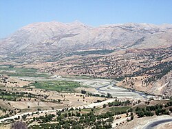 Rural Adıyaman | |
 Location of Adıyaman Province in Turkey | |
| Country | Turkey |
| Region | Southeast Anatolia |
| Subregion | Gaziantep |
| Government | |
| • Electoral district | Adıyaman |
| • Governor | Mahmut Çuhadar |
| Area | |
| • Total | 7,606.16 km2 (2,936.75 sq mi) |
| Population (2020)[1] | |
| • Total | 632,459 |
| • Density | 83/km2 (220/sq mi) |
| Area code(s) | 0416 |
| Vehicle registration | 02 |

Adıyaman Province (Turkish: Adıyaman ili, Kurdish: Parêzgeha Semsûrê[2]) is a province in the Southeastern Anatolia Region of Turkey. The capital is Adıyaman. The province is considered part of Turkish Kurdistan and has a Kurdish majority.[3]
Adıyaman Province was part of the province of Malatya until 1954, when it was made into a province as a reward for voting for the winning Democratic Party in the 1954 general election.[4] The province consists of the districts Adıyaman (center district), Besni, Çelikhan, Gerger, Gölbaşı, Kâhta, Samsat, Sincik and Tut.
History[]
Early Armenian rule[]
Armenian existence in Adıyaman dates back to the 4th century, where they were known as 'fire worshippers'. Armenians lived in the area when Arab Muslims captured the area in 639. The Arabs considered the city as part of Armenia and experienced immigration from Byzantine Armenia due to Byzantine oppression in 713. The city came under Seljuk rule after the Battle of Manzikert in 1071 and the local Armenians established principalities in the area. One of these principalities was founded by Philaretos Brachamios who tried to protect the land between the Seljuk and the Byzantine. The Armenians had good relations with the European Crusader states, but the Crusader County of Edessa would advance against the Armenians in Adıyaman. Political leaders in Adıyaman were also victims of assassinations by Edessa. Wife of Kogh Vasil founded an army to protect the area from Edessa as well, but Edessa ultimately captured the area. Close relations between the Armenians and the Crusader states, however, continued until Nur ad-Din captured the area in 1150. The area came under the rule of Timurtash of the Artuqids for his support for Nur ad-Din and later the Seljuks from the beginning of the 13th century. The locals failed at removing the rulership of Kilij Arslan II during the late 12th century. In the subsequent period, the area was fought over between the Mamluk Sultanate and the Armenian Kingdom of Cilicia, changing hands between the two.[5]
Ottoman rule[]
Ottoman Sultan Selim I captured the area during the Ottoman–Mamluk War in 1516-1517. In the first defter of the area in 1519, it was mentioned that the Kurdish Reşwan tribe populated the area. Documents from 1524 and 1536 also contain records of the Reshwan tribe being present. The tribe was engaged in agriculture after having had a nomadic lifestyle.[6]
Evliya Çelebi visited the city in the 17th century and described the agricultural life.[7]
At the beginning of the 19th century, most Armenians lived near the castle of Adıyaman city and mostly made their living through shop keeping and trading. In the villages, they were involved in agriculture and animal husbandry. The local Armenians welcomed American missionaries approaching them during the 19th century at first, but prevented them from converted them later on. Some of the Gregorian Armenians did however convert to Protestantism and the missionaries ultimately divided the local Armenian community. Ainsworth visited the town of Adıyaman in the 1842 and mentioned that the town contained 800 Muslim households and 300 Armenian households and that it had several mosques but no churches. After his visit to the town, he visited the Kurdish village of Kerkunah in the outskirts and afterwards Kâhta, where he mentioned that a Kurdish rebellion was taking place.[8] Most of the rural areas spoke Kurdish in 1882, while Turkish was prevalent in Adıyaman town.[9]
Armenian nationalism increased among the Armenians by the end of the century and most of the Armenian population fell victim to the Armenian genocide in 1915. There are, however, still some Armenians around Kâhta.[5]
The area was part of Mamuret-ul-Aziz Vilayet as Behisni, Hasanmansur and Kahta districts. These three districts had a total population of 99,439 in 1914 of which 93.4% was Muslim and 6.6% Christian.[10]
Republican era[]
The names of 224 villages in Adiyaman Province was Turkified as part of the campaign to remove any mention of Kurdishness in the country.[11] In 1932, the whole region was chiefly populated by Kurds.[12] The province had a population of 208,755 in 1955 of which 99.8% adhered to Islam and 0.2% to Christianity.[13] In 1960, the province had a population of 233,717 of which 99.7% was Muslim and 0.3% Christian.[14] In 1965, the population increased to 267,277 of which 99.8% was Muslim and 0.2% Christian.[15] The Turkish authorities put the province under State of emergency (OHAL) in the early 1990s as part of the Kurdish–Turkish conflict.[16]
Demographics[]
|
Out of the 339 villages in the province, 296 are populated by Kurds while the remaining 43 are populated by Turks. In terms of religious affiliation, 293 of the villages have an Hanafi population, 80 villages with an Alevi population and two villages are reported to having a Shafi'i population.[24]
The majority of the population is Hanafi Kurdish,[3][25] with a significant Kurdish Alevi population.[26] One estimate from 2014 places the Alevi population at 11%.[27] The province is generally more pious than other Kurdish areas in Turkey[28] and has been a hotspot for radicalization and Islamism in recent years (see Dokumacılar).[29] Historian Şahidin Şimşek argued that Hanafi adherents in the province had been manipulated by the state to believe that Kurdish nationalism equated to Alevism. Another theory points at the poverty in the province.[30]
The Kurdish tribes in the province include the Balyan,[31] Bezikan, Canbegan, Cikkan, Culur, Çerkezan, Dersim, Direjan, Ferşatan, Gavuz, Hacimehmedan, Haciyan, Hidiri, Hidisor, Izol, Karalos, Kavi, Kirvar, Kurdan, Melikzade, Mikri, Mirdesan, Pirvan, Poliklos, Reşwan, Rumyan, Sinemilli,[32] and the Ziran.[33]
The Alevis of the western districts of Besni, Gölbaşı and Tut are Turkmen and Kurdish.[34]
References[]
- ^ Jump up to: a b "Nüfus Bilgileri" (in Turkish). Retrieved 22 April 2021.
- ^ "Parêzgeha Semsûrê çûn û hatina bajêr qedexe kir". Peyama Kurd (in Kurdish). 2 April 2020. Retrieved 27 April 2020.
- ^ Jump up to: a b "Kurds, Kurdistān". Encyclopaedia of Islam (2 ed.). BRILL. 2002. ISBN 9789004161214.
- ^ "Adıyaman Tarihi" (in Turkish). Retrieved 8 December 2020.
- ^ Jump up to: a b Dalyan, Murat Gökhan. "A Glance at the History of Armenians in Adıyaman". Marmara University. Retrieved 19 April 2021.
- ^ Dede, Suat (December 2011). "From nomadism to sedentary life in Central Anatolia: The case of the Risvan tribe (1830 - 1932)" (PDF). Bilkent University School of Economics and Social Sciences: 20–21 & 68. Retrieved 29 March 2015.
- ^ Arslan, Ramazan (2010). "XIX. Yüzyılda Adıyaman'da Sosyo-Ekonomik Yapı" (PDF). Dumlupınar Üniversitesi Sosyal Bilimler Dergisi (in Turkish). Kütahya Dumlupınar University (26): 5.
- ^ Ainsworth, W. F. (1842). Travels and Researches in Asia Minor, Mesopotamia, Chaldea, and Armenia. I. pp. 267–271.
- ^ Arslan, Ramazan (2010). "XIX. Yüzyılda Adıyaman'da Sosyo-Ekonomik Yapı" (PDF). Dumlupınar Üniversitesi Sosyal Bilimler Dergisi (in Turkish). Kütahya Dumlupınar University (26): 4.
- ^ Jump up to: a b Karpat, Kemal (1982). Ottoman population 1830-1914. The University of Wisconsin Press. p. 146. ISBN 9780299091606.
- ^ Tuncel, Harun (2000). "Türkiye'de İsmi Değiştirilen Köyler English: Renamed Villages in Turkey" (PDF). Fırat University Journal of Social Science (in Turkish). 10 (2): 28. Archived from the original (PDF) on 14 November 2013. Retrieved 13 January 2013.
- ^ Oriental Institute Communications: Tell Asmar and Khafaje: The First Season's Work in Eshnunna 1930/31. 13–19. Oriental Institute of the University of Chicago. 1932. p. 129.
- ^ Dündar, Fuat (2000), Türkiye nüfus sayımlarında azınlıklar (in Turkish), p. 202, ISBN 9789758086771
- ^ Dündar, Fuat (2000), Türkiye nüfus sayımlarında azınlıklar (in Turkish), p. 211, ISBN 9789758086771
- ^ Dündar, Fuat (2000), Türkiye nüfus sayımlarında azınlıklar (in Turkish), p. 222, ISBN 9789758086771
- ^ Yavuz, Hakan (2001). "Five stages of the construction of Kurdish nationalism in Turkey". Nationalism and Ethnic Politics. 7 (3): 1–24. doi:10.1080/13537110108428635. S2CID 144320678.
- ^ Kopar, Metin (2017), "Adıyaman in The State Annuals Of Turkish Republic (1925-1930)", Sosyal Bilimler Dergisi (in Turkish): 185, retrieved 22 April 2021
- ^ "GENEL NÜFUS SAYIMI 1935" (PDF) (in Turkish). p. VIII. Retrieved 22 April 2021.
- ^ "Malatya vilâyetine bağlı Adıyaman kazasında (Adıyaman) adiyle yeniden bir vilâyet kurulması hakkında Kanun [Resmî Gazete ile ilâm : 22 . VI. 1954 - Sayı • 8735]" (PDF) (in Turkish). p. 16. Retrieved 22 April 2021.
- ^ Jump up to: a b c "POPULATİON OF REGIONS AND PROVİNCES BY CENSUS YEAR" (PDF) (in Turkish). p. 5. Retrieved 22 April 2021.
- ^ "1990 genel nüfus sayımı verileri". Türkiye İstatistik Kurumu. Archived from the original on 3 November 2012. Retrieved 22 April 2021.
- ^ "2000 census: City and village population and annual growth rate of population by provinces" (PDF) (in Turkish and English). p. 110. Retrieved 22 April 2021.
- ^ "2010 genel nüfus sayımı verileri". Türkiye İstatistik Kurumu. Archived from the original on 3 November 2012. Retrieved 22 April 2021.
- ^ Peter Alfred, Andrews; Benninghaus, Rüdiger, eds. (1989). Ethnic Groups in the Republic of Turkey. p. 179.
- ^ Turkish state (2014), pp. 13-35.
- ^ Yalçın, Kemal (2004). Sari gyalin. Birzamanlar Yayincilik. p. 157. ISBN 9789756158050.
- ^ Rençber, Fevzi (2014). "Adıyaman Alevilerinin Coğrafi Dağılımları ve Demografik Yapısı". Mezhep Araştırmaları (in Turkish): 15.
- ^ Pamuk, Humeyra (15 October 2015). "Small Turkish town haunted by lost sons, hand of Islamic State".
- ^ Yavuz, M. Hakan; Ali Özcan, Nihat (2015). "Turkish Democracy and the Kurdish Question". Middle East Policy. 22 (4): 73–87. doi:10.1111/mepo.12159.
- ^ Bozarslan, Murat (23 July 2015). "The Islamic State's secret recruiting ground in Turkey". Al-Monitor. Retrieved 8 January 2020.
- ^ Aksüt, Hamza (2012), Aleviler: Türkiye, İran, İrak, Suriye, Bulgaristan (5 ed.), Ankara: Yurt, p. 261, ISBN 978-975-9025-61-8
- ^ Ismail Firdevsoğlu (2013). "Adıyaman Yöresi Aşiretleri" (in Turkish): 23. Cite journal requires
|journal=(help) - ^ Turkish state (2014). Aşiretler Raporu (in Turkish) (3 ed.). Kaynak Yayınları. pp. 13–35. ISBN 978-975-343-220-7.
- ^ "Adıyaman Alevilerine kısa bir bakış". Alevi Net (in Turkish). 16 March 2017.
Further reading[]
- Akdağ, Zekî (2016), Çîrokên gelêrî yên Kurdan : (Herêma Semsûr û Rihayê) (in Kurdish), Istanbul: Weşanên Enstîtuya Kurdî ya Stenbolê, ISBN 9789756282694
- Çiftçi, Tekin (2019). "Kürt Halk Hekimliği, Tedavi Yöntemleri ve Ocaklık Kültürü: Adıyaman Örneği". Bingöl Üniversitesi Yaşayan Diller Enstitüsü Dergisi (in Turkish). 5 (10).
- Çiftçi, Tekin (2020). "An Analysis of Adiyaman's Compilation of Kurdish Orally Transmitted Folktales Utilizing the Methodology of Russian Formalist Literary Criticism: The Folktale Gurrî û Hûtê Kor". International Journal of Kurdish Studies (in Turkish). 6 (1): 187–201. doi:10.21600/ijoks.749827.
- Güzel, Şerif; Alti, Zafer (2018). "Fonetîka devoka Semûrê". Humanities Journal of University of Zakho (in Kurdish). 6 (10.26436/2018.6.1.559). doi:10.21600/ijoks.749827.
External links[]
 Media related to Adıyaman Province at Wikimedia Commons

| Authority control |
|---|
Coordinates: 37°48′02″N 38°18′19″E / 37.80056°N 38.30528°E

- Adıyaman Province
- Provinces of Turkey
- Turkish Kurdistan