Embarrass Township, Edgar County, Illinois
Embarrass Township | |
|---|---|
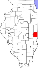
 Location in Edgar County | |
 Edgar County's location in Illinois | |
| Coordinates: 39°40′23″N 87°55′05″W / 39.67306°N 87.91806°WCoordinates: 39°40′23″N 87°55′05″W / 39.67306°N 87.91806°W | |
| Country | United States |
| State | Illinois |
| County | Edgar |
| Established | November 4, 1856 |
| Area | |
| • Total | 44.14 sq mi (114.3 km2) |
| • Land | 44.14 sq mi (114.3 km2) |
| • Water | 0 sq mi (0 km2) 0% |
| Elevation | 669 ft (204 m) |
| Population (2010) | |
| • Estimate (2016)[1] | 580 |
| • Density | 14/sq mi (5/km2) |
| Time zone | UTC-6 (CST) |
| • Summer (DST) | UTC-5 (CDT) |
| ZIP codes | 61917, 61933, 61943, 61944, 61949 |
| FIPS code | 17-045-23958 |
Embarrass Township is one of fifteen townships in Edgar County, Illinois, USA. As of the 2010 census, its population was 620 and it contained 288 housing units.[2]
Geography[]
According to the 2010 census, the township has a total area of 44.14 square miles (114.3 km2), all land.[2]
Cities, towns, villages[]
Unincorporated towns[]
Extinct towns[]
- Catfish
- New Athens
Cemeteries[]
The township contains these five cemeteries: Catfish, Catfish Point, Embarrass, Scott and Zimmerman. Shield cemetery lies on Coles county line, half in Embarrass township. Housel cemetery has records also.
Major highways[]
Airports and landing strips[]
- Ewing Landing Strip
- Lamkey Landing Strip
Demographics[]
| Historical population | |||
|---|---|---|---|
| Census | Pop. | %± | |
| 2016 (est.) | 580 | [1] | |
| U.S. Decennial Census[3] | |||
School districts[]
- Kansas Community Unit School District 3
- Oakland Community Unit School District 5
- Shiloh Community Unit School District 1
Political districts[]
- Illinois' 15th congressional district
- State House District 110
- State Senate District 55
References[]
- "Embarrass Township, Edgar County, Illinois". Geographic Names Information System. United States Geological Survey. Retrieved 2010-01-10.
- United States Census Bureau 2007 TIGER/Line Shapefiles
- United States National Atlas
- ^ a b "Population and Housing Unit Estimates". Retrieved June 9, 2017.
- ^ a b "Population, Housing Units, Area, and Density: 2010 - County -- County Subdivision and Place -- 2010 Census Summary File 1". United States Census. Archived from the original on 2020-02-12. Retrieved 2013-05-28.
- ^ "Census of Population and Housing". Census.gov. Retrieved June 4, 2016.
External links[]
Places adjacent to Embarrass Township, Edgar County, Illinois | |
|---|---|
Municipalities and communities of Edgar County, Illinois, United States | ||
|---|---|---|
| Cities | ||
| Villages | ||
| Townships | ||
| Unincorporated communities | ||
| Footnotes | ‡This populated place also has portions in an adjacent county or counties | |
| ||
Categories:
- Townships in Edgar County, Illinois
- Populated places established in 1856
- Townships in Illinois