Paris Township, Edgar County, Illinois
Paris Township | |
|---|---|
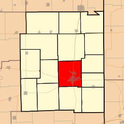 Location in Edgar County | |
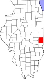 Edgar County's location in Illinois | |
| Coordinates: 39°37′50″N 87°42′34″W / 39.63056°N 87.70944°WCoordinates: 39°37′50″N 87°42′34″W / 39.63056°N 87.70944°W | |
| Country | United States |
| State | Illinois |
| County | Edgar |
| Established | November 4, 1856 |
| Area | |
| • Total | 45.39 sq mi (117.6 km2) |
| • Land | 44.98 sq mi (116.5 km2) |
| • Water | 0.4 sq mi (1 km2) 0.88% |
| Elevation | 689 ft (210 m) |
| Population (2010) | |
| • Estimate (2016)[1] | 9,366 |
| • Density | 219.3/sq mi (84.7/km2) |
| Time zone | UTC-6 (CST) |
| • Summer (DST) | UTC-5 (CDT) |
| ZIP code | 61944 |
| FIPS code | 17-045-57641 |
Paris Township is one of fifteen townships in Edgar County, Illinois, USA. As of the 2010 census, its population was 9,865 and it contained 4,763 housing units.[2]
Geography[]
According to the 2010 census, the township has a total area of 45.39 square miles (117.6 km2), of which 44.98 square miles (116.5 km2) (or 99.10%) is land and 0.4 square miles (1.0 km2) (or 0.88%) is water.[2]
Cities, towns, villages[]
- Paris (vast majority)
Extinct towns[]
- Harris
Cemeteries[]
The township contains these five cemeteries: Conkey, Edgar, Paris Memorial Gardens, Redmon and Saint Marys.
Major highways[]
 US Route 150
 Illinois Route 1
 Illinois Route 16
 Illinois Route 133
Airports and landing strips[]
- Paris Community Hospital Heliport
- Stewart Airport
Demographics[]
| Historical population | |||
|---|---|---|---|
| Census | Pop. | %± | |
| 2016 (est.) | 9,366 | [1] | |
| U.S. Decennial Census[3] | |||
Education[]
Paris Township contains six schools: Carolyn Wenz Elementary School Crestwood School Mayo Middle School Memorial Elementary School, Paris Cooperative High School
Public School districts[]
- Paris Community Unit School District 4 Paris Crestwood Unit 4
- Paris-Union School District 95 Paris District 95
Political districts[]
- Illinois' 15th congressional district
- State House District 109
- State Senate District 55
References[]
- "Paris Township, Edgar County, Illinois". Geographic Names Information System. United States Geological Survey. Retrieved 2010-01-10.
- United States Census Bureau 2007 TIGER/Line Shapefiles
- United States National Atlas
- ^ a b "Population and Housing Unit Estimates". Retrieved June 9, 2017.
- ^ a b "Population, Housing Units, Area, and Density: 2010 - County -- County Subdivision and Place -- 2010 Census Summary File 1". United States Census. Archived from the original on 2020-02-12. Retrieved 2013-05-28.
- ^ "Census of Population and Housing". Census.gov. Retrieved June 4, 2016.
External links[]
Places adjacent to Paris Township, Edgar County, Illinois | |
|---|---|
Municipalities and communities of Edgar County, Illinois, United States | ||
|---|---|---|
| Cities | ||
| Villages | ||
| Townships | ||
| Unincorporated communities | ||
| Footnotes | ‡This populated place also has portions in an adjacent county or counties | |
| ||
Categories:
- Townships in Edgar County, Illinois
- Townships in Illinois