Evansville, Minnesota
Evansville | |
|---|---|
| Motto(s): "Progress Through Perseverance" | |
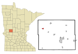 Location of Evansville, Minnesota | |
| Coordinates: 46°0′24″N 95°41′15″W / 46.00667°N 95.68750°W | |
| Country | United States |
| State | Minnesota |
| County | Douglas |
| Area | |
| • Total | 0.79 sq mi (2.04 km2) |
| • Land | 0.78 sq mi (2.03 km2) |
| • Water | 0.00 sq mi (0.01 km2) |
| Elevation | 1,348 ft (411 m) |
| Population | |
| • Total | 612 |
| • Estimate (2019)[5] | 598 |
| • Density | 762.76/sq mi (294.52/km2) |
| Time zone | UTC-6 (Central (CST)) |
| • Summer (DST) | UTC-5 (CDT) |
| ZIP code | 56326 |
| Area code(s) | 218 |
| FIPS code | 27-19898[3] |
| GNIS feature ID | 0643446[4] |
| Website | www |

Evansville is a city in Douglas County, Minnesota, United States. The population was 612 at the 2010 census.[6]
History[]

Evansville was platted in 1879 when the railroad was extended to that point.[7]
Geography[]
According to the United States Census Bureau, the city has a total area of 0.78 square miles (2.02 km2), all land.[8]
Demographics[]
| Historical population | |||
|---|---|---|---|
| Census | Pop. | %± | |
| 1890 | 452 | — | |
| 1900 | 483 | 6.9% | |
| 1910 | 389 | −19.5% | |
| 1920 | 427 | 9.8% | |
| 1930 | 397 | −7.0% | |
| 1940 | 439 | 10.6% | |
| 1950 | 478 | 8.9% | |
| 1960 | 411 | −14.0% | |
| 1970 | 553 | 34.5% | |
| 1980 | 571 | 3.3% | |
| 1990 | 566 | −0.9% | |
| 2000 | 566 | 0.0% | |
| 2010 | 612 | 8.1% | |
| 2019 (est.) | 598 | [5] | −2.3% |
| U.S. Decennial Census[9] | |||
2010 census[]
As of the census[2] of 2010, there were 612 people, 272 households, and 154 families living in the city. The population density was 784.6 inhabitants per square mile (302.9/km2). There were 292 housing units at an average density of 374.4 per square mile (144.6/km2). The racial makeup of the city was 97.9% White, 0.2% African American, 0.8% Native American, 0.5% Asian, and 0.7% from two or more races. Hispanic or Latino of any race were 0.8% of the population.
There were 272 households, of which 28.3% had children under the age of 18 living with them, 47.1% were married couples living together, 6.6% had a female householder with no husband present, 2.9% had a male householder with no wife present, and 43.4% were non-families. 39.0% of all households were made up of individuals, and 22.1% had someone living alone who was 65 years of age or older. The average household size was 2.15 and the average family size was 2.88.
The median age in the city was 41.7 years. 23.2% of residents were under the age of 18; 4.5% were between the ages of 18 and 24; 26.6% were from 25 to 44; 20.6% were from 45 to 64; and 25.2% were 65 years of age or older. The gender makeup of the city was 46.1% male and 53.9% female.
2000 census[]
As of the census[3] of 2000, there were 566 people, 249 households, and 127 families living in the city. The population density was 811.8 people per square mile (312.2/km2). There were 268 housing units at an average density of 384.4 per square mile (147.8/km2). The racial makeup of the city was 99.65% White, 0.18% Pacific Islander, and 0.18% from two or more races.
There were 249 households, out of which 23.7% had children under the age of 18 living with them, 43.4% were married couples living together, 5.6% had a female householder with no husband present, and 48.6% were non-families. 46.2% of all households were made up of individuals, and 27.3% had someone living alone who was 65 years of age or older. The average household size was 2.01 and the average family size was 2.87.
In the city, the population was spread out, with 18.9% under the age of 18, 6.0% from 18 to 24, 22.3% from 25 to 44, 18.9% from 45 to 64, and 33.9% who were 65 years of age or older. The median age was 47 years. For every 100 females, there were 84.4 males. For every 100 females age 18 and over, there were 81.4 males.
The median income for a household in the city was $24,219, and the median income for a family was $36,364. Males had a median income of $32,321 versus $16,563 for females. The per capita income for the city was $17,021. About 7.1% of families and 10.0% of the population were below the poverty line, including 8.9% of those under age 18 and 15.0% of those age 65 or over.
References[]
- ^ "2019 U.S. Gazetteer Files". United States Census Bureau. Retrieved July 26, 2020.
- ^ Jump up to: a b "American FactFinder". United States Census Bureau. Archived from the original on 2020-02-12. Retrieved 2012-11-13.
- ^ Jump up to: a b "American FactFinder". United States Census Bureau. Archived from the original on 2020-02-12. Retrieved 2008-01-31.
- ^ "US Board on Geographic Names". United States Geological Survey. 2007-10-25. Retrieved 2008-01-31.
- ^ Jump up to: a b "Population and Housing Unit Estimates". United States Census Bureau. May 24, 2020. Retrieved May 27, 2020.
- ^ "2010 Census Redistricting Data (Public Law 94-171) Summary File". American FactFinder. U.S. Census Bureau, 2010 Census. Retrieved 23 April 2011.[dead link]
- ^ Upham, Warren (1920). Minnesota Geographic Names: Their Origin and Historic Significance. Minnesota Historical Society. p. 176.
- ^ "US Gazetteer files 2010". United States Census Bureau. Archived from the original on January 12, 2012. Retrieved 2012-11-13.
- ^ "Census of Population and Housing". Census.gov. Archived from the original on April 26, 2015. Retrieved June 4, 2015.
External links[]
| show Municipalities and communities of Douglas County, Minnesota, United States |
|---|

Coordinates: 46°00′15″N 95°40′58″W / 46.00417°N 95.68278°W
| show Authority control |
|---|
- Cities in Minnesota
- Cities in Douglas County, Minnesota