Fairview, Kansas
Fairview, Kansas | |
|---|---|
 Sunset in Fairview, looking across US 36 (2006) | |
 Location within Brown County and Kansas | |
 | |
| Coordinates: 39°50′24″N 95°43′39″W / 39.84000°N 95.72750°WCoordinates: 39°50′24″N 95°43′39″W / 39.84000°N 95.72750°W | |
| Country | United States |
| State | Kansas |
| County | Brown |
| Founded | 1872 |
| Incorporated | 1886 |
| Area | |
| • Total | 0.36 sq mi (0.93 km2) |
| • Land | 0.36 sq mi (0.93 km2) |
| • Water | 0.00 sq mi (0.00 km2) |
| Elevation | 1,224 ft (373 m) |
| Population | |
| • Total | 260 |
| • Estimate (2019)[3] | 248 |
| • Density | 686.98/sq mi (265.55/km2) |
| Time zone | UTC-6 (CST) |
| • Summer (DST) | UTC-5 (CDT) |
| ZIP code | 66425 |
| Area code | 785 |
| FIPS code | 20-22425 [4] |
| GNIS ID | 472974 [5] |
| Website | fairviewks.com |

Fairview is a city in Brown County, Kansas, United States. As of the 2010 census, the city population was 260.[6]
History[]
Fairview was founded on October 27, 1886, on land purchased in 1872 by W. F. Lambertson. It was named for its scenic setting.[7]
Geography[]
Fairview is located at 39°50′24″N 95°43′39″W / 39.84000°N 95.72750°W (39.839885, -95.727369).[8] According to the United States Census Bureau, the city has a total area of 0.37 square miles (0.96 km2), all land.[9]
Demographics[]
| Historical population | |||
|---|---|---|---|
| Census | Pop. | %± | |
| 1900 | 395 | — | |
| 1910 | 386 | −2.3% | |
| 1920 | 386 | 0.0% | |
| 1930 | 367 | −4.9% | |
| 1940 | 333 | −9.3% | |
| 1950 | 336 | 0.9% | |
| 1960 | 272 | −19.0% | |
| 1970 | 283 | 4.0% | |
| 1980 | 258 | −8.8% | |
| 1990 | 306 | 18.6% | |
| 2000 | 271 | −11.4% | |
| 2010 | 260 | −4.1% | |
| 2019 (est.) | 248 | [3] | −4.6% |
| U.S. Decennial Census | |||
2010 census[]
As of the census[2] of 2010, there were 260 people, 130 households, and 71 families living in the city. The population density was 702.7 inhabitants per square mile (271.3/km2). There were 146 housing units at an average density of 394.6 per square mile (152.4/km2). The racial makeup of the city was 93.8% White, 1.9% African American, 0.4% Native American, and 3.8% from two or more races. Hispanic or Latino of any race were 0.8% of the population.
There were 130 households, of which 16.9% had children under the age of 18 living with them, 45.4% were married couples living together, 9.2% had a female householder with no husband present, and 45.4% were non-families. 39.2% of all households were made up of individuals, and 15.4% had someone living alone who was 65 years of age or older. The average household size was 2.00 and the average family size was 2.69.
The median age in the city was 51.3 years. 17.3% of residents were under the age of 18; 5.3% were between the ages of 18 and 24; 16.1% were from 25 to 44; 36.1% were from 45 to 64; and 25% were 65 years of age or older. The gender makeup of the city was 49.6% male and 50.4% female.
2000 census[]
As of the census[4] of 2000, there were 271 people, 132 households, and 71 families living in the city. The population density was 912.0 people per square mile (348.8/km2). There were 149 housing units at an average density of 501.4 per square mile (191.8/km2). The racial makeup of the city was 95.20% White, 3.32% African American, and 1.48% from two or more races. Hispanic or Latino of any race were 1.11% of the population.
There were 132 households, out of which 22.7% had children under the age of 18 living with them, 47.0% were married couples living together, 6.8% had a female householder with no husband present, and 46.2% were non-families. 45.5% of all households were made up of individuals, and 27.3% had someone living alone who was 65 years of age or older. The average household size was 2.05 and the average family size was 2.93.
In the city, the population was spread out, with 20.7% under the age of 18, 4.8% from 18 to 24, 24.4% from 25 to 44, 24.7% from 45 to 64, and 25.5% who were 65 years of age or older. The median age was 45 years. For every 100 females, there were 86.9 males. For every 100 females age 18 and over, there were 90.3 males.
The median income for a household in the city was $31,250, and the median income for a family was $51,607. Males had a median income of $33,333 versus $17,917 for females. The per capita income for the city was $22,789. About 11.0% of families and 9.7% of the population were below the poverty line, including 6.8% of those under the age of eighteen and 15.3% of those 65 or over.
Economy[]
Although Fairview is mostly a bedroom community to the employees and students of nearby Sabetha and Hiawatha, a few businesses thrive. Services available from local business owners include welding, electrical, trash collection, and plumbing. The Fairview Enterprise is the weekly paper, published in the same building since 1931. The city has also successfully maintained a post office.
Fairview is also currently home to Curb Roller Manufacturing which does business worldwide.

Notable people[]
- David Floyd Lambertson, former United States Ambassador and Deputy Assistant Secretary of State in Southeast Asia[10]
- William P. Lambertson, U.S. Representative from Kansas
- Bernard W. Rogers, former Supreme Allied Commander Europe (NATO)
See also[]
References[]
- ^ "2019 U.S. Gazetteer Files". United States Census Bureau. Retrieved July 24, 2020.
- ^ a b "U.S. Census website". United States Census Bureau. Retrieved 2012-07-06.
- ^ a b "Population and Housing Unit Estimates". United States Census Bureau. May 24, 2020. Retrieved May 27, 2020.
- ^ a b "U.S. Census website". United States Census Bureau. Retrieved 2008-01-31.
- ^ "US Board on Geographic Names". United States Geological Survey. 2007-10-25. Retrieved 2008-01-31.
- ^ "2010 City Population and Housing Occupancy Status". U.S. Census Bureau. Archived from the original on April 11, 2015. Retrieved April 9, 2012.
- ^ Kansas State Historical Society (1916). Biennial Report of the Board of Directors of the Kansas State Historical Society. Kansas State Printing Plant. pp. 149.
- ^ "US Gazetteer files: 2010, 2000, and 1990". United States Census Bureau. 2011-02-12. Retrieved 2011-04-23.
- ^ "US Gazetteer files 2010". United States Census Bureau. Archived from the original on 2012-01-25. Retrieved 2012-07-06.
- ^ "Archived copy". Archived from the original on 2008-11-26. Retrieved 2009-06-17.
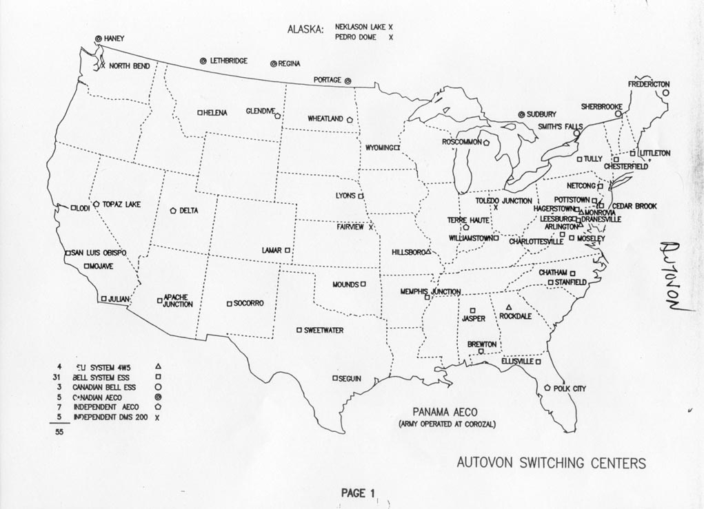
{{cite web}}: CS1 maint: archived copy as title (link) - ^ Former Autovon Switching Centers.
External links[]
- City of Fairview
- Fairview - Directory of Public Officials
- USD 415, local school district
- Fairview City Map, KDOT
Municipalities and communities of Brown County, Kansas, United States | ||
|---|---|---|
| Cities |  | |
| Unincorporated communities | ||
| Indian reservations | ||
| Townships | ||
| Footnotes | †This populated place is designated a Census-Designated Place (CDP) by the United States Census Bureau. ‡This populated place also has portions in an adjacent county or counties. | |
| ||
- Cities in Kansas
- Cities in Brown County, Kansas
- 1872 establishments in Kansas
- Populated places established in 1872