Farinole
show This article may be expanded with text translated from the corresponding article in French. (January 2011) Click [show] for important translation instructions. |
Farinole
Ferringule | |
|---|---|
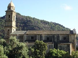 The church in Farinole | |
show Location of Farinole | |
 Farinole | |
| Coordinates: 42°43′58″N 9°21′58″E / 42.7328°N 9.3661°ECoordinates: 42°43′58″N 9°21′58″E / 42.7328°N 9.3661°E | |
| Country | France |
| Region | Corsica |
| Department | Haute-Corse |
| Arrondissement | Calvi |
| Canton | Cap Corse |
| Government | |
| • Mayor (2020–2026) | Ange Cherubini[1] |
| Area 1 | 14.76 km2 (5.70 sq mi) |
| Population (Jan. 2018)[2] | 233 |
| • Density | 16/km2 (41/sq mi) |
| Time zone | UTC+01:00 (CET) |
| • Summer (DST) | UTC+02:00 (CEST) |
| INSEE/Postal code | 2B109 /20253 |
| Elevation | 0–1,120 m (0–3,675 ft) (avg. 200 m or 660 ft) |
| 1 French Land Register data, which excludes lakes, ponds, glaciers > 1 km2 (0.386 sq mi or 247 acres) and river estuaries. | |


Farinole (Corsican: Ferringule) is a commune in the Haute-Corse department of France on the island of Corsica.
The village is located between the mountains and the sea between Saint-Florent and Negro with the two hamlets of Sparagaggio and Bracolaccia. It has good views of the gulf and the Désert des Agriates. The village has two sandy beaches and a pebble beach.
Population[]
| Year | Pop. | ±% |
|---|---|---|
| 1962 | 115 | — |
| 1968 | 121 | +5.2% |
| 1975 | 131 | +8.3% |
| 1982 | 148 | +13.0% |
| 1990 | 176 | +18.9% |
| 1999 | 179 | +1.7% |
| 2008 | 216 | +20.7% |
See also[]
- Torra di Ferringule
- Communes of the Haute-Corse department
References[]
- ^ "Répertoire national des élus: les maires". data.gouv.fr, Plateforme ouverte des données publiques françaises (in French). 2 December 2020.
- ^ "Populations légales 2018". INSEE. 28 December 2020.
| Wikimedia Commons has media related to Farinole. |
| show Communes of the Haute-Corse department |
|---|
This Haute-Corse geographical article is a stub. You can help Wikipedia by . |
Categories:
- Communes of Haute-Corse
- Haute-Corse geography stubs