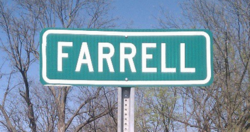
Farrell, Mississippi
Farrell, Mississippi | |
|---|---|
 | |
 Farrell | |
| Coordinates: 34°15′51″N 90°40′20″W / 34.26417°N 90.67222°WCoordinates: 34°15′51″N 90°40′20″W / 34.26417°N 90.67222°W | |
| Country | United States |
| State | Mississippi |
| County | Coahoma |
| Area | |
| • Total | 1.3 sq mi (3.4 km2) |
| • Land | 1.3 sq mi (3.4 km2) |
| • Water | 0.0 sq mi (0.0 km2) |
| Elevation | 164 ft (50 m) |
| Population (2010) | |
| • Total | 218 |
| • Density | 168/sq mi (64.9/km2) |
| Time zone | UTC-6 (Central (CST)) |
| • Summer (DST) | UTC-5 (CDT) |
| ZIP code | 38630 |
| Area code(s) | 662 |
| GNIS feature ID | [1] |

Farrell is an unincorporated community and census-designated place in Coahoma County, Mississippi, United States. As of the 2010 census it had a population of 218.[2] Farrell is located approximately 4 miles (6 km) south of Stovall and 4 miles (6 km) north of Sherard on Mississippi Highway 1. It is about 9 miles (14 km) northwest of Clarksdale, the county seat.
Farrell has a post office. Its zip code is 38630.
Climate[]
The climate in this area is characterized by hot, humid summers and generally mild to cool winters. According to the Köppen Climate Classification system, Farrell has a humid subtropical climate, abbreviated "Cfa" on climate maps.[3]
References[]
- ^ U.S. Geological Survey Geographic Names Information System: Farrell, Mississippi
- ^ "Geographic Identifiers: 2010 Demographic Profile Data (G001): Farrell CDP, Mississippi". U.S. Census Bureau, American Factfinder. Archived from the original on February 12, 2020. Retrieved October 7, 2014.
- ^ Climate Summary for Farrell, Mississippi
Municipalities and communities of Coahoma County, Mississippi, United States | ||
|---|---|---|
| City |  | |
| Towns | ||
| CDPs | ||
| Other communities | ||
| Ghost towns | ||
| Footnotes | ‡This populated place also has portions in an adjacent county or counties | |
| ||
This Coahoma County, Mississippi state location article is a stub. You can help Wikipedia by . |
Categories:
- Census-designated places in Coahoma County, Mississippi
- Census-designated places in Mississippi
- Mississippi Delta region geography stubs