Fayette, Alabama
Fayette | |
|---|---|
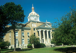 Fayette County courthouse in Fayette | |
 Location of Fayette in Fayette County, Alabama. | |
| Coordinates: 33°41′31″N 87°49′56″W / 33.69194°N 87.83222°W | |
| Country | United States |
| State | Alabama |
| County | Fayette |
| Area | |
| • Total | 8.63 sq mi (22.36 km2) |
| • Land | 8.55 sq mi (22.14 km2) |
| • Water | 0.08 sq mi (0.21 km2) |
| Elevation | 371 ft (113 m) |
| Population (2010) | |
| • Total | 4,619 |
| • Estimate (2019)[1] | 4,275 |
| • Density | 500.00/sq mi (193.06/km2) |
| Time zone | UTC-6 (Central (CST)) |
| • Summer (DST) | UTC-5 (CDT) |
| ZIP code | 35555 |
| Area code(s) | 205, 659 |
| FIPS code | 01-25840 |
| GNIS feature ID | 0157950 |
| Website | fayetteal |

Fayette is a city in Fayette County, Alabama, United States. The population was 4,619 at the 2010 census,[3] down from 4,922 at the 2000 census. The city is the county seat of Fayette County.
History[]
Originally known as "La Fayette", it incorporated on January 15, 1821.[4] When Fayette County was created in 1824, the town's name was officially changed to "Fayette Court House", though it was also known as "Fayetteville", which was the name shown on maps and on the U.S. Census in 1880 and 1890. It was officially shortened to "Fayette" in 1898.
Geography[]
Fayette is located in west-central Fayette County at 33°41′31″N 87°49′56″W / 33.69194°N 87.83222°W (33.692068, -87.832358).[5]
According to the U.S. Census Bureau, the city has a total area of 8.6 square miles (22.4 km2), of which 8.5 square miles (22.1 km2) is land and 0.1 square miles (0.2 km2), or 0.95%, is water.[3]
Demographics[]
| Historical population | |||
|---|---|---|---|
| Census | Pop. | %± | |
| 1880 | 180 | — | |
| 1900 | 452 | — | |
| 1910 | 636 | 40.7% | |
| 1920 | 1,741 | 173.7% | |
| 1930 | 2,109 | 21.1% | |
| 1940 | 2,668 | 26.5% | |
| 1950 | 3,707 | 38.9% | |
| 1960 | 4,227 | 14.0% | |
| 1970 | 4,568 | 8.1% | |
| 1980 | 5,287 | 15.7% | |
| 1990 | 4,909 | −7.1% | |
| 2000 | 4,922 | 0.3% | |
| 2010 | 4,619 | −6.2% | |
| 2019 (est.) | 4,275 | [1] | −7.4% |
| U.S. Decennial Census[6] 2013 Estimate[7] | |||
At the 2000 census there were 4,922 people, 2,092 households, and 1,303 families living in the city. The population density was 575.1 people per square mile (222.0/km2). There were 2,336 housing units at an average density of 273.0 per square mile (105.4/km2). The racial makeup of the city was 75.34% White, 23.38% Black or African American, 0.12% Native American, 0.28% Asian, 0.30% from other races, and 0.57% from two or more races. One percent of the population was Hispanic or Latino of any race.[8] Of the 2,092 households 26.9% had children under the age of 18 living with them, 45.2% were married couples living together, 14.2% had a female householder with no husband present, and 37.7% were non-families. 35.5% of households were one person and 19.0% were one person aged 65 or older. The average household size was 2.20 and the average family size was 2.85.
The age distribution was 21.4% under the age of 18, 9.0% from 18 to 24, 24.2% from 25 to 44, 23.9% from 45 to 64, and 21.6% 65 or older. The median age was 42 years. For every 100 females, there were 81.4 males. For every 100 females age 18 and over, there were 75.7 males.
The median household income was $25,714 and the median family income was $36,589. Males had a median income of $29,857 versus $21,899 for females. The per capita income for the city was $15,553. About 12.5% of families and 18.0% of the population were below the poverty line, including 21.2% of those under age 18 and 22.9% of those age 65 or over.
2010 census[]
At the 2010 census there were 4,619 people, 1,924 households, and 1,206 families living in the city. The population density was 530.2 people per square mile (206.2/km2). There were 2,239 housing units at an average density of 257.4 per square mile (100.0/km2). The racial makeup of the city was 73.4% White, 24.3% Black or African American, 0.3% Native American, 0.3% Asian, 0.6% from other races, and 1.2% from two or more races. 1.4% of the population was Hispanic or Latino of any race.[9] Of the 1,924 households 26.5% had children under the age of 18 living with them, 40.8% were married couples living together, 18.2% had a female householder with no husband present, and 37.3% were non-families. 32.8% of households were one person and 14.0% were one person aged 65 or older. The average household size was 2.27 and the average family size was 2.88.
The age distribution was 22.9% under the age of 18, 9.6% from 18 to 24, 23.0% from 25 to 44, 25.6% from 45 to 64, and 18.9% 65 or older. The median age was 40.2 years. For every 100 females, there were 88.6 males. For every 100 females age 18 and over, there were 88.6 males.
The median household income was $31,705 and the median family income was $41,905. Males had a median income of $34,271 versus $27,500 for females. The per capita income for the city was $16,602. About 15.4% of families and 20.4% of the population were below the poverty line, including 23.2% of those under age 18 and 15.9% of those age 65 or over.
Notable people[]
- Mike Davis, Detroit Mercy Titans men's basketball head coach
- Aaron Fultz, former pitcher for the San Francisco Giants.
- Ronnie McCollum, professional basketball player
- Devin Moore, convict who sparked a large controversy over the video game Grand Theft Auto: Vice City, leading to the court case Strickland v. Sony
- Michael Moore, NFL player
- Charly "Carlos" Palmer, American fine artist
- Curt Porter, former offensive guard for the Denver Broncos
- Dexter Roberts, country singer; finished in seventh place on the thirteenth season of American Idol
- Jimmy Lee Sudduth, Outsider artist and blues musician
- Lois Wilson, Outsider artist subject of the documentary Treasures from the Rubble[10][11][12]
Local media[]
The Times-Record is the local newspaper.
The local radio stations are WLDX Big Cat and WTXT.
Activities[]
- Fayette Aquatic Center
- Boy Scouts of America Troop 45
Government[]
Fayette is organized in a mayor-council form of city government, with a mayor elected citywide and five council members elected from districts. [13]
Education[]
Bevill State Community College has a location in Fayette.
Climate[]
The climate in this area is characterized by hot, humid summers and generally mild to cool winters. According to the Köppen Climate Classification system, Fayette has a humid subtropical climate, abbreviated "Cfa" on climate maps.[14]
References[]
- ^ Jump up to: a b "Population and Housing Unit Estimates". United States Census Bureau. May 24, 2020. Retrieved May 27, 2020.
- ^ "2019 U.S. Gazetteer Files". United States Census Bureau. Retrieved June 29, 2020.
- ^ Jump up to: a b "Geographic Identifiers: 2010 Census Summary File 1 (G001): Fayette city, Alabama". American Factfinder. U.S. Census Bureau. Archived from the original on February 13, 2020. Retrieved April 11, 2016.
- ^ http://www.encyclopediaofalabama.org/article/h-2931
- ^ "US Gazetteer files: 2010, 2000, and 1990". United States Census Bureau. 2011-02-12. Retrieved 2011-04-23.
- ^ "U.S. Decennial Census". Census.gov. Retrieved June 6, 2013.
- ^ "Annual Estimates of the Resident Population: April 1, 2010 to July 1, 2013". Archived from the original on May 22, 2014. Retrieved June 3, 2014.
- ^ "U.S. Census website". United States Census Bureau. Retrieved 2008-01-31.
- ^ "U.S. Census website". United States Census Bureau. Retrieved 2015-07-23.
- ^ https://www.imdb.com/title/tt2124976/
- ^ https://www.al.com/entertainment/2014/01/art_by_lois_wilson_known_for_w.html
- ^ https://www.alabamaheritage.com/issue-120-spring-2016.html
- ^ https://fayetteal.org/about/city-council/
- ^ Climate Summary for Fayette, Alabama
External links[]
Coordinates: 33°41′31″N 87°49′56″W / 33.692068°N 87.832358°W
| show Municipalities and communities of Fayette County, Alabama, United States |
|---|

| show Authority control |
|---|
- Cities in Alabama
- Cities in Fayette County, Alabama
- County seats in Alabama
- 1821 establishments in Alabama
- Populated places established in 1821