Ferreira do Alentejo
Ferreira do Alentejo | |
|---|---|
 Flag  Coat of arms | |
 | |
| Coordinates: 38°03′N 8°06′W / 38.050°N 8.100°WCoordinates: 38°03′N 8°06′W / 38.050°N 8.100°W | |
| Country | |
| Region | Alentejo |
| Intermunic. comm. | Baixo Alentejo |
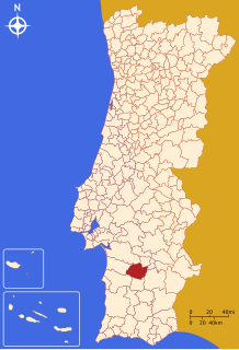
| District | Beja |
| Parishes | 4 |
| Government | |
| • President | (PS) |
| Area | |
| • Total | 648.25 km2 (250.29 sq mi) |
| Population (2011) | |
| • Total | 8,255 |
| • Density | 13/km2 (33/sq mi) |
| Time zone | UTC±00:00 (WET) |
| • Summer (DST) | UTC+01:00 (WEST) |
| Local holiday | March 5 |
| Website | http://www.cm-ferreira-alentejo.pt |

Ferreira do Alentejo (Portuguese pronunciation: [fɨˈʁeɾɐ ðu ɐlẽˈtɛʒu] (![]() listen)), or simply Ferreira, is a town and a municipality in Beja District in Portugal. The population in 2011 was 8,255,[1] in an area of 648.25 km².[2]
listen)), or simply Ferreira, is a town and a municipality in Beja District in Portugal. The population in 2011 was 8,255,[1] in an area of 648.25 km².[2]
The present Mayor is Aníbal Coelho Costa, elected by the Socialist Party. The municipal holiday is March 5.
Parishes[]
Administratively, the municipality is divided into 4 civil parishes (freguesias):[3]
References[]
- ^ Instituto Nacional de Estatística
- ^ "Áreas das freguesias, concelhos, distritos e país". Archived from the original on 2018-11-05. Retrieved 2018-11-05.
- ^ Diário da República. "Law nr. 11-A/2013, page 552 49" (pdf) (in Portuguese). Retrieved 22 July 2014.
External links[]
- Town Hall official website
- Photos from Ferreira do Alentejo
- Some more Photos from Ferreira do Alentejo
- Ferreira do Alentejo Geocoin
| Authority control |
|---|
This Beja location article is a stub. You can help Wikipedia by . |
Categories:
- Ferreira do Alentejo
- Towns in Portugal
- Populated places in Beja District
- Municipalities of Beja District
- Portugal geography stubs