Moura, Portugal
Moura | |
|---|---|
 | |
 Flag  Coat of arms | |
 | |
| Coordinates: 38°08′N 7°27′W / 38.133°N 7.450°WCoordinates: 38°08′N 7°27′W / 38.133°N 7.450°W | |
| Country | |
| Region | Alentejo |
| Intermunic. comm. | Baixo Alentejo |
| District | Beja |
| Parishes | 8 |
| Government | |
| • President | Santiago Macias (CDU) |
| Area | |
| • Total | 958.46 km2 (370.06 sq mi) |
| Population (2011) | |
| • Total | 15,167 |
| • Density | 16/km2 (41/sq mi) |
| Time zone | UTC±00:00 (WET) |
| • Summer (DST) | UTC+01:00 (WEST) |
| Local holiday | Saint John June 24 |
| Website | http://www.cm-moura.pt |

Moura (Portuguese pronunciation: [ˈmowɾɐ] (![]() listen)) is a city and a municipality in the District of Beja in Portugal, subdivided into 5 smaller states. The population in 2011 was 15,167,[1] in an area of 958.46 km².[2] The city itself had a population of 8,459 in 2001.[3] It has now around 11,000 inhabitants.
listen)) is a city and a municipality in the District of Beja in Portugal, subdivided into 5 smaller states. The population in 2011 was 15,167,[1] in an area of 958.46 km².[2] The city itself had a population of 8,459 in 2001.[3] It has now around 11,000 inhabitants.
The current Mayor is José Pós de Mina, elected by the Unitarian Democratic Coalition. The municipal holiday is 24 June.
It is home to Moura Photovoltaic Power Station, one of Europe's largest solar-power facilities.
Parishes[]
Administratively, the municipality is divided into 5 civil parishes (freguesias):[4]
- Amareleja
- Moura (Santo Agostinho e São João Baptista) e Santo Amador
- Póvoa de São Miguel
- Safara e Santo Aleixo da Restauração
- Sobral da Adiça
Climate[]
Moura has a Mediterranean climate with very hot, dry summers and mild winters. It is one of the driest areas in Portugal with just over 400 mm (16 in) of precipitation.
| hideClimate data for Moura, 15 year period (between 1941 and 1991), 158 m (518 ft) | |||||||||||||
|---|---|---|---|---|---|---|---|---|---|---|---|---|---|
| Month | Jan | Feb | Mar | Apr | May | Jun | Jul | Aug | Sep | Oct | Nov | Dec | Year |
| Average high °C (°F) | 14.3 (57.7) |
15.9 (60.6) |
18.7 (65.7) |
21.1 (70.0) |
24.9 (76.8) |
30.2 (86.4) |
34.2 (93.6) |
34.1 (93.4) |
30.2 (86.4) |
24.3 (75.7) |
18.5 (65.3) |
14.5 (58.1) |
23.4 (74.1) |
| Daily mean °C (°F) | 9.9 (49.8) |
11.1 (52.0) |
13.3 (55.9) |
15.3 (59.5) |
18.4 (65.1) |
22.8 (73.0) |
25.8 (78.4) |
25.6 (78.1) |
23.2 (73.8) |
18.6 (65.5) |
13.8 (56.8) |
10.4 (50.7) |
17.3 (63.2) |
| Average low °C (°F) | 5.4 (41.7) |
6.3 (43.3) |
7.8 (46.0) |
9.4 (48.9) |
11.9 (53.4) |
15.3 (59.5) |
17.3 (63.1) |
17.1 (62.8) |
16.1 (61.0) |
12.9 (55.2) |
9.1 (48.4) |
6.2 (43.2) |
11.2 (52.2) |
| Average precipitation mm (inches) | 56.8 (2.24) |
45.4 (1.79) |
49.2 (1.94) |
40.7 (1.60) |
30.8 (1.21) |
15.4 (0.61) |
2.8 (0.11) |
2.1 (0.08) |
17.9 (0.70) |
46.2 (1.82) |
50.9 (2.00) |
60.7 (2.39) |
418.9 (16.49) |
| Source: IPMA[5] | |||||||||||||
Town Twinning[]
Moura has cooperation agreements with the following cities:[6]
 Aroche, Spain, since 1994
 Bissau, Guinea-Bissau, since 1997
- Amareleja-Valencia del Mombuey, Spain, since 2000
 Medjez El Bab, Tunisia, since 1995
 Roccagorga, Italy
Other towns with the same name include:
 Moura, Australia
Notable people[]
- Corino Andrade (1906–2005) a leading neurologist and researcher who first described the familial amyloidotic polyneuropathy (FAP) syndrome
- Eunice Muñoz (born 1928 in Amareleja) a Portuguese actress[7]
- Gonçalo Abecasis (born 1976) a Portuguese American biomedical researcher at the University of Michigan
- Miguel Garcia (born 1983) a former footballer with 228 club caps
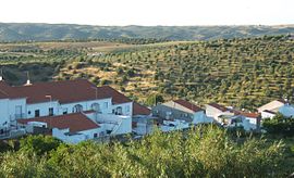
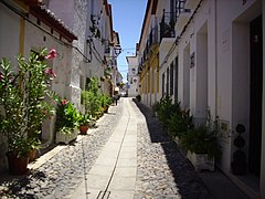
Gallery[]

Moura, Portugal

Moura, Portugal
Moura, Portugal

Moura, Portugal

Moura, Portugal


See also[]
- Moura IPR
References[]
- ^ Instituto Nacional de Estatística
- ^ "Áreas das freguesias, concelhos, distritos e país". Archived from the original on 2018-11-05. Retrieved 2018-11-05.
- ^ UMA POPULAÇÃO QUE SE URBANIZA, Uma avaliação recente - Cidades, 2004 Nuno Pires Soares, Instituto Geográfico Português (Geographic Institute of Portugal)
- ^ Diário da República. "Law nr. 11-A/2013, page 552 79" (pdf) (in Portuguese). Retrieved 28 July 2014.
- ^ "Plano de Gestão das Bacias hidrográficas integradas na Região Hidrográfica 7" (PDF). APA. p. 114. Retrieved 25 June 2021.
- ^ "Twinning Cities and Towns: Moura" (in Portuguese). Lisbon, Portugal: [National Association of Portuguese Municipalities]. Retrieved 12 July 2020.
- ^ Eunice Muñoz, IMDb Database retrieved 10 June 2021.
External links[]
| show Authority control |
|---|
This Beja location article is a stub. You can help Wikipedia by . |
- Moura, Portugal
- Cities in Portugal
- Populated places in Beja District
- Municipalities of Beja District
- Portugal geography stubs