Vidigueira
Vidigueira | |
|---|---|
 Flag  Coat of arms | |
 | |
| Coordinates: 38°12′N 7°48′W / 38.200°N 7.800°WCoordinates: 38°12′N 7°48′W / 38.200°N 7.800°W | |
| Country | |
| Region | Alentejo |
| Intermunic. comm. | Baixo Alentejo |
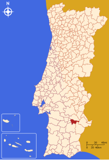
| District | Beja |
| Parishes | 4 |
| Government | |
| • President | (CDU) |
| Area | |
| • Total | 316.0 km2 (122.0 sq mi) |
| Population (2011) | |
| • Total | 5,932 |
| • Density | 19/km2 (49/sq mi) |
| Time zone | UTC±00:00 (WET) |
| • Summer (DST) | UTC+01:00 (WEST) |
| Local holiday | Ascension Day (date varies) |
| Website | http://www.cm-vidigueira.pt |

Vidigueira (Portuguese pronunciation: [viðiˈɣɐjɾɐ] (![]() listen) or [viðiˈɣeɾɐ]) is a town and a municipality in the District of Beja in Portugal. The population in 2011 was 5,932,[1] in an area of 316.61 km².[2]
listen) or [viðiˈɣeɾɐ]) is a town and a municipality in the District of Beja in Portugal. The population in 2011 was 5,932,[1] in an area of 316.61 km².[2]
The present Mayor is Manuel Rosa Narra, elected by the Unitarian Democratic Coalition. The municipal holiday is Ascension Day. The archaeological site of the Roman Ruins of Villa Áulica and Convent of São Cucufate are situated near Vidigueira.
Parishes[]
Administratively, the municipality is divided into 4 civil parishes (freguesias):[3]
- Pedrógão
- Selmes
- Vidigueira
- Vila de Frades
Notable people[]
- Vasco da Gama (c.1460s – 1524) the Portuguese navigator, was made Count of Vidigueira by King Manuel I on the return from his discovery of the maritime route from Europe to India
- Achilles Statius (1524 in Vidigueira – 1581) humanist poet and commentator
- The father of Baruch Spinoza (1662-1677) the Dutch philosopher, lived in Vidigueira in the 17th century, before escaping from the Portuguese Inquisition to the Dutch Republic.
See also[]
- Vidigueira DOC
References[]
- ^ Instituto Nacional de Estatística
- ^ Áreas das freguesias, concelhos, distritos e país
- ^ Diário da República. "Law nr. 11-A/2013, page 552 128" (pdf) (in Portuguese). Retrieved 4 August 2014.
External links[]
| show Authority control |
|---|
This Beja location article is a stub. You can help Wikipedia by . |
Categories:
- Towns in Portugal
- Populated places in Beja District
- Municipalities of Beja District
- Portugal geography stubs