Finsterwalder Glacier
| Finsterwalder Glacier | |
|---|---|
 Location of Hemimont Plateau on the Antarctic Peninsula | |
 Location of Finsterwalder Glacier in Antarctica | |
| Location | Graham Land |
| Coordinates |  79°30′S 84°49′W / 79.500°S 84.817°W / -79.500; -84.817 79°30′S 84°49′W / 79.500°S 84.817°W / -79.500; -84.817 |
| Length | 10 nautical miles (19 km; 12 mi) |
| Width | 2 nautical miles (4 km; 2 mi) |
| Thickness | unknown |
| Terminus | Sharp Glacier |
| Status | unknown |
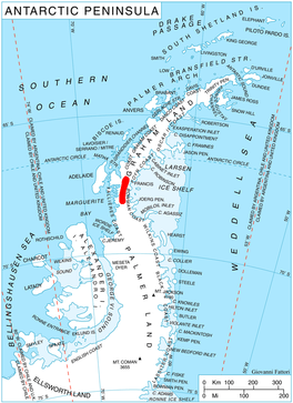
Finsterwalder Glacier ( WikiMiniAtlas67°19′S 66°20′W / 67.317°S 66.333°W / -67.317; -66.333) is a glacier on the northwest side of Hemimont Plateau, 2 nautical miles (4 km; 2 mi) wide and 10 nautical miles (19 km; 12 mi) long, flowing southwest from the central plateau of Graham Land, Antarctica, toward the head of Lallemand Fjord. Its mouth lies between the mouths of Haefeli Glacier and Klebelsberg Glacier, the three glaciers merging with Sharp Glacier where the latter enters the fjord. It was first surveyed from the plateau in 1946–47 by the Falkland Islands Dependencies Survey, and named by them for Sebastian Finsterwalder and his son, , German glaciologists.[1]
See also[]
- List of glaciers in the Antarctic
- Glaciology
References[]
- ^ "Finsterwalder Glacier". Geographic Names Information System. United States Geological Survey. Retrieved 2012-03-23.
![]() This article incorporates public domain material from the United States Geological Survey document: "Finsterwalder Glacier". (content from the Geographic Names Information System)
This article incorporates public domain material from the United States Geological Survey document: "Finsterwalder Glacier". (content from the Geographic Names Information System)
Glaciers in the Antarctic | |
|---|---|
|
Glaciers of Graham Land | |
|---|---|
| Antarctic Peninsula |
|
| Adelaide Island |
|
| James Ross Island |
|
| Palmer Archipelago |
|
| Trinity Peninsula |
|
This article about a glacier in Loubet Coast is a stub. You can help Wikipedia by . |
- v
- t
- Glaciers of Loubet Coast
- Graham Land glacier stubs
- Loubet Coast geography stubs
- Coordinates on Wikidata
- Wikipedia articles incorporating text from the USGS Geographic Names Information System
- All stub articles