First Mesa, Arizona
First Mesa, Arizona | |
|---|---|
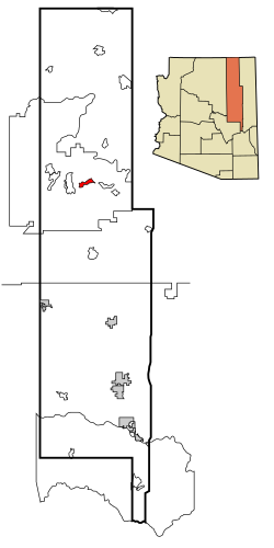 Location in Navajo County and the state of Arizona | |
 First Mesa, Arizona Location in the United States | |
| Coordinates: 35°50′6″N 110°22′42″W / 35.83500°N 110.37833°WCoordinates: 35°50′6″N 110°22′42″W / 35.83500°N 110.37833°W | |
| Country | United States |
| State | Arizona |
| County | Navajo |
| Area | |
| • Total | 15.74 sq mi (40.78 km2) |
| • Land | 15.74 sq mi (40.76 km2) |
| • Water | 0.01 sq mi (0.02 km2) |
| Elevation | 5,810 ft (1,771 m) |
| Population (2010) | |
| • Total | 1,555 |
| • Estimate (2016)[2] | N/A |
| Time zone | UTC-7 (MST) |
| ZIP code | 86042 |
| Area code(s) | 928 |
| FIPS code | 04-23512 |
| GNIS feature ID | 1853158 |

First Mesa (Hopi: Wàlpi) is a census-designated place (CDP) in Navajo County, Arizona, United States, on the Hopi Reservation. As of the 2010 census, the CDP population was 1,555, spread among three Hopi villages atop the 5,700-foot (1,740 m) mesa: Hano (or Tegua, Arizona), Sitsomovi (or ), and Waalpi (or Walpi).
Geography[]
First Mesa is located at 35°50′6″N 110°22′42″W / 35.83500°N 110.37833°W (35.834948, -110.378331).[3]
According to the United States Census Bureau, the CDP has a total area of 9.4 square miles (24 km2).
Demographics[]
| Historical population | |||
|---|---|---|---|
| Census | Pop. | %± | |
| 2000 | 1,124 | — | |
| 2010 | 1,555 | 38.3% | |
| U.S. Decennial Census[4] | |||
| hideLanguages (2000) [5] | Percent |
|---|---|
| Spoke English at home | 60.1% |
| Spoke Hopi at home | 31.1% |
| Spoke Tewa at home | 8.8% |
As of the census[6] of 2000, there were 1,124 people, 294 households, and 251 families residing in the CDP. The population density was 119.3 people per square mile (46.1/km2). There were 367 housing units at an average density of 39.0/sq mi (15.0/km2). The racial makeup of the CDP was 96.1% Native American, 2.9% White, no Black/African American, Asian, or Pacific Islander, 0.2% from other races, and 0.9% from two or more races. 2.5% of the population were Hispanic or Latino of any race.
There were 294 households, out of which 43.5% had children under the age of 18 living with them, 46.6% were married couples living together, 32.3% had a female householder with no husband present, and 14.6% were non-families. 11.6% of all households were made up of individuals, and 2.7% had someone living alone who was 65 years of age or older. The average household size was 3.82 and the average family size was 4.10.
In the CDP, the population was spread out, with 38.3% under the age of 18, 9.1% from 18 to 24, 25.3% from 25 to 44, 19.4% from 45 to 64, and 7.9% who were 65 years of age or older. The median age was 28 years. For every 100 females, there were 90.2 males. For every 100 females age 18 and over, there were 89.9 males.
The median income for a household in the CDP was $19,605, and the median income for a family was $21,346. Males had a median income of $37,000 versus $21,458 for females. The per capita income for the CDP was $7,897. About 36.5% of families and 45.2% of the population were below the poverty line, including 45.5% of those under age 18 and 21.4% of those age 65 or over.
Education[]
First Mesa is served by the Cedar Unified School District.
Hopi High School serves First Mesa.
References[]
- ^ "2016 U.S. Gazetteer Files". United States Census Bureau. Retrieved Jul 18, 2017.
- ^ "Population and Housing Unit Estimates". Retrieved June 9, 2017.
- ^ "US Gazetteer files: 2010, 2000, and 1990". United States Census Bureau. 2011-02-12. Retrieved 2011-04-23.
- ^ "Census of Population and Housing". Census.gov. Retrieved June 4, 2016.
- ^ https://apps.mla.org/cgi-shl/docstudio/docs.pl?map_data_results
- ^ "U.S. Census website". United States Census Bureau. Retrieved 2008-01-31.

| Authority control |
|---|
- Mesas of Arizona
- Census-designated places in Navajo County, Arizona
- Hopi
- Hopi Reservation