Florissant, Colorado
Florissant, Colorado | |
|---|---|
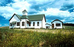
 Panorama of Florissant. | |
 Location of the Florissant CDP in Teller County, Colorado. | |
 Florissant Location of the Florissant CDP in the United States. | |
| Coordinates: 38°56′40″N 105°17′24″W / 38.9445571°N 105.2898699°WCoordinates: 38°56′40″N 105°17′24″W / 38.9445571°N 105.2898699°W[2] | |
| Country | |
| State | |
| County | Teller County |
| Established | 1870 |
| Government | |
| • Type | unincorporated town |
| Area | |
| • Total | 0.516 sq mi (1.336 km2) |
| • Land | 0.516 sq mi (1.336 km2) |
| • Water | 0.000 sq mi (0.000 km2) |
| Elevation | 8,192 ft (2,497 m) |
| Population (2010) | |
| • Total | 104 |
| • Density | 202/sq mi (78/km2) |
| Time zone | UTC-7 (MST) |
| • Summer (DST) | UTC-6 (MDT) |
| ZIP Code[3] | 80816 |
| Area code(s) | 719 |
| GNIS feature[1] | Florissant CDP |

Florissant is an unincorporated town, a post office, and a census-designated place (CDP) located in and governed by Teller County, Colorado, United States. The CDP is a part of the Colorado Springs, CO Metropolitan Statistical Area. The Florissant post office has the ZIP Code 80816.[3] At the United States Census 2010, the population of the Florissant CDP was 104, while the population of the 80816 ZIP Code Tabulation Area was 5,180 including adjacent areas.[4]
Etymology[]
Florissant, Colorado, was named after Florissant, Missouri, the hometown of Judge James Castello, an early settler.[5] The word florissant is the gerund of the French verb fleurir, which roughly means to flourish, to flower, or to blossom.[6]
Geography[]
Florissant is located immediately north of Florissant Fossil Beds National Monument.
The Florissant CDP has an area of 330 acres (1.336 km2), all land.[2]
Demographics[]
The United States Census Bureau initially defined the Florissant CDP for the United States Census 2010.
| Year | Pop. | ±% |
|---|---|---|
| 2010 | 104 | — |
| 2020 | — | |
| Source: United States Census Bureau | ||
Town[]
Florissant is immediately east of the starting point of the Hayman fire, which became most extensive fire in Colorado history in 2002.
Florissant is served by the Florissant Fire Protection District. The District consists of 2 Fire Stations, 3 Engines, 2 Tenders, 3 Rescue Trucks, and a Mule 4WD off-road vehicle.
Florissant has several subdivisions, including Colorado Mountain Estates, Druid Hills, Florissant Heights, Indian Creek, Wilson Lakes, Valley Hi, and Bear Trap Ranch
Florissant continues to grow. Examples of this include the addition of a new library, offering multimedia opportunities, fast broadband, computer access, and wireless access.[citation needed]
See also[]
- Outline of Colorado
- State of Colorado
- Colorado cities and towns
- Colorado census designated places
- Colorado counties
- Colorado metropolitan areas
- Front Range Urban Corridor
- South Central Colorado Urban Area
- Colorado Springs, CO Metropolitan Statistical Area
- Colorado cities and towns
- Florissant Fossil Beds National Monument
References[]
- ^ Jump up to: a b c "U.S. Board on Geographic Names: Domestic Names". United States Geological Survey. Retrieved December 27, 2020.
- ^ Jump up to: a b c "State of Colorado Census Designated Places - BAS20 - Data as of January 1, 2020". United States Census Bureau. Retrieved December 27, 2020.
- ^ Jump up to: a b "Look Up a ZIP Code". United States Postal Service. Retrieved December 27, 2020.
- ^ "2010: DEC Summary File 1". United States Census Bureau. Retrieved December 27, 2020.
- ^ Gannett, Henry (1905). The Origin of Certain Place Names in the United States. Govt. Print. Off. pp. 127.
- ^ http://www.wordreference.com/fren/florissant
External links[]
 Definitions from Wiktionary
 Media from Wikimedia Commons
 News from Wikinews
 Quotations from Wikiquote
 Texts from Wikisource
 Textbooks from Wikibooks
 Resources from Wikiversity
- Florissant @ UncoverColorado.com
- Florissant @ TellerLinks.com
- Florissant Fossil Beds National Monument
- Pikes Peak Historical Society website
- Rampart Library District website
- Teller County website
| show Municipalities and communities of Teller County, Colorado, United States |
|---|

| show Authority control |
|---|
- Census-designated places in Teller County, Colorado
- Census-designated places in Colorado