Fort Smith Airport
Fort Smith Airport | |||||||||||||||
|---|---|---|---|---|---|---|---|---|---|---|---|---|---|---|---|
| Summary | |||||||||||||||
| Airport type | Public | ||||||||||||||
| Operator | Government of the Northwest Territories | ||||||||||||||
| Location | Fort Smith, Northwest Territories | ||||||||||||||
| Time zone | MST (UTC−07:00) | ||||||||||||||
| • Summer (DST) | MDT (UTC−06:00) | ||||||||||||||
| Elevation AMSL | 673 ft / 205 m | ||||||||||||||
| Coordinates | 60°01′13″N 111°57′43″W / 60.02028°N 111.96194°WCoordinates: 60°01′13″N 111°57′43″W / 60.02028°N 111.96194°W | ||||||||||||||
| Map | |||||||||||||||
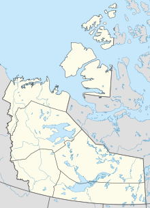 CYSM Location in the Northwest Territories | |||||||||||||||
| Runways | |||||||||||||||
| |||||||||||||||
| Statistics (2010) | |||||||||||||||
| |||||||||||||||

The Fort Smith Airport (IATA: YSM, ICAO: CYSM) is located near Fort Smith, Northwest Territories, Canada. Runway 03/21 has no winter service.
The Fort Smith (District) Heliport is located southeast of the airport.
Airlines and destinations[]
Passenger[]
| Airlines | Destinations |
|---|---|
| Northwestern Air | Edmonton, Fort Chipewyan, Hay River, High Level, Yellowknife |
References[]
- ^ Canada Flight Supplement. Effective 0901Z 16 July 2020 to 0901Z 10 September 2020.
- ^ Synoptic/Metstat Station Information Archived December 1, 2011, at the Wayback Machine
- ^ Total aircraft movements by class of operation
External links[]
- Past three hours METARs, SPECI and current TAFs for Fort Smith Airport from Nav Canada as available.
| By name | |
|---|---|
| By location indicator | |
| By province/territory | |
| By area | |
| National Airports System | |
| Related | |
| |
This article about an airport in the Northwest Territories is a stub. You can help Wikipedia by . |
Categories:
- Certified airports in the South Slave Region
- Northwest Territories airport stubs