Hay River/Merlyn Carter Airport
Hay River/Merlyn Carter Airport | |||||||||||||||
|---|---|---|---|---|---|---|---|---|---|---|---|---|---|---|---|
 Hay River Airport sign | |||||||||||||||
 Airport terminal | |||||||||||||||
| Summary | |||||||||||||||
| Airport type | Public | ||||||||||||||
| Operator | Government of the Northwest Territories | ||||||||||||||
| Location | Hay River, Northwest Territories | ||||||||||||||
| Time zone | MST (UTC−07:00) | ||||||||||||||
| • Summer (DST) | MDT (UTC−06:00) | ||||||||||||||
| Elevation AMSL | 541 ft / 165 m | ||||||||||||||
| Coordinates | 60°50′23″N 115°46′58″W / 60.83972°N 115.78278°WCoordinates: 60°50′23″N 115°46′58″W / 60.83972°N 115.78278°W | ||||||||||||||
| Map | |||||||||||||||
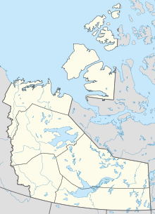 CYHY Location in the Northwest Territories | |||||||||||||||
| Runways | |||||||||||||||
| |||||||||||||||
| Statistics (2010) | |||||||||||||||
| |||||||||||||||


Hay River/Merlyn Carter Airport (IATA: YHY, ICAO: CYHY) is located 1.5 nautical miles (2.8 km; 1.7 mi) north of Hay River, Northwest Territories, Canada.
The airport is named for former bush pilot Merlyn Carter, who was killed by a black bear in 2005.[4]
Sandhill cranes may be found nesting on the airport from May until September.
Airlines and destinations[]
| Airlines | Destinations |
|---|---|
| Air Tindi | Yellowknife[5] |
| Canadian North | Yellowknife[6] |
| Northwestern Air | Edmonton, Fort Smith, High Level |
Cargo[]
| Airlines | Destinations |
|---|---|
| Buffalo Airways | Yellowknife |
See also[]
References[]
- ^ Canada Flight Supplement. Effective 0901Z 16 July 2020 to 0901Z 10 September 2020.
- ^ Synoptic/Metstat Station Information Archived June 28, 2013, at the Wayback Machine
- ^ Total aircraft movements by class of operation
- ^ Bear mauls N.W.T. pilot to death
- ^ [https://airtindi.com
- ^ Full network schedule
External links[]
| Wikimedia Commons has media related to Hay River Airport. |
- Past three hours METARs, SPECI and current TAFs for Hay River Airport from Nav Canada as available.
| By name | |
|---|---|
| By location indicator | |
| By province/territory | |
| By area | |
| National Airports System | |
| Related | |
| |
This article about an airport in the Northwest Territories is a stub. You can help Wikipedia by . |
Categories:
- Certified airports in the South Slave Region
- Northwest Territories airport stubs