Fountain Inn, South Carolina
Fountain Inn, South Carolina | |
|---|---|
 Top, left to right: Downtown Fountain Inn, Fountain Inn City Hall, Cannon Building, Fairview Presbyterian Church, Robert Quillen Office and Library | |
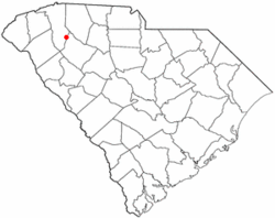
 Location of Fountain Inn, South Carolina | |
| Coordinates: 34°41′36″N 82°11′55″W / 34.69333°N 82.19861°WCoordinates: 34°41′36″N 82°11′55″W / 34.69333°N 82.19861°W | |
| Country | United States |
| State | South Carolina |
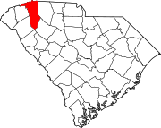
| Counties | Greenville, Laurens |
| Area | |
| • Total | 7.53 sq mi (19.49 km2) |
| • Land | 7.49 sq mi (19.39 km2) |
| • Water | 0.04 sq mi (0.10 km2) |
| Elevation | 866 ft (264 m) |
| Population (2010) | |
| • Total | 7,799 |
| • Estimate (2019)[4] | 10,441 |
| • Density | 1,394.74/sq mi (538.52/km2) |
| Time zone | UTC−5 (Eastern (EST)) |
| • Summer (DST) | UTC−4 (EDT) |
| ZIP code | 29644 |
| Area code(s) | 864 |
| FIPS code | 45-27070[2] |
| GNIS feature ID | 1222514[3] |
| Website | www |
Fountain Inn is a city in Greenville and Laurens counties in the U.S. state of South Carolina. The population was 7,799 at the 2010 census,[5] up from 6,017 in 2000. It is part of the Greenville–Mauldin–Easley Metropolitan Statistical Area.
History[]
The Cannon Building, Fairview Presbyterian Church, Fountain Inn High School, Fountain Inn Principal's House and Teacherage, McDowell House, Robert Quillen Office and Library, Tullyton, and F. W. Welborn House are listed on the National Register of Historic Places.[6][7][8]
Geography[]
The southern part of the city is in Laurens County, while the bulk of the city is in Greenville County. The city's nickname is "The Diamond Tip of the Golden Strip".[9] The city took its name from an inn and fountain that were along the old stagecoach route.[10] The stagecoach drivers called the stop "Fountain Inn", and it stuck. A small garden fountain is installed at City Hall, and there is a marker on the north side of town showing the former location of the old inn.
South Carolina Highway 14 runs through the center of town as Main Street, and Interstate 385 runs along the southern edge of the city, with access from Exits 22, 23, and 26. Greenville is 17 miles (27 km) to the northwest, and Columbia is 84 miles (135 km) to the southeast. Via Highway 14, Laurens is 16 miles (26 km) to the southeast.
According to the U.S. Census Bureau, the city of Fountain Inn has a total area of 7.9 square miles (20.5 km2), of which 0.04 square miles (0.1 km2), or 0.43%, are water.[5]
There are several festivals in Fountain Inn, including Aunt Het Day, based on syndicated cartoon columnist Robert Quillen, that brings in several hundred visitors as Main Street is closed and filled with many unique vendors.
Demographics[]
| Historical population | |||
|---|---|---|---|
| Census | Pop. | %± | |
| 1890 | 212 | — | |
| 1900 | 497 | 134.4% | |
| 1910 | 979 | 97.0% | |
| 1920 | 1,100 | 12.4% | |
| 1930 | 1,264 | 14.9% | |
| 1940 | 1,346 | 6.5% | |
| 1950 | 1,325 | −1.6% | |
| 1960 | 2,385 | 80.0% | |
| 1970 | 3,391 | 42.2% | |
| 1980 | 4,226 | 24.6% | |
| 1990 | 4,388 | 3.8% | |
| 2000 | 6,017 | 37.1% | |
| 2010 | 7,799 | 29.6% | |
| 2019 (est.) | 10,441 | [4] | 33.9% |
| U.S. Decennial Census[11] | |||
As of the census[2] of 2000, there were 6,017 people. The population density was 1,091.6 people per square mile (421.6/km2). There were 2,465 housing units at an average density of 447.2 per square mile (172.7/km2). The racial makeup of the city was 67.49% White, 29.31% African American, 0.13% Native American, 0.28% Asian, 0.02% Pacific Islander, 0.78% from other races, and 0.98% from two or more races. Hispanic or Latino of any race were 2.41% of the population.
There were 3,005 households, out of which 38.8% had children under the age of 18 living with them, 49.8% were married couples living together, 19.9% had a female householder with no husband present, and 26.8% were non-families. 23.9% of all households were made up of individuals, and 8.6% had someone living alone who was 65 years of age or older. The average household size was 2.58 and the average family size was 3.06.
In the town the population was spread out, with 28.3% under the age of 18, 7.7% from 18 to 24, 33.2% from 25 to 44, 19.0% from 45 to 64, and 11.8% who were 65 years of age or older. The median age was 33 years. For every 100 females, there were 83.7 males. For every 100 females age 18 and over, there were 77.7 males.
The median income for a family was $51,705. The per capita income for the city was $26,164. About 11% of the population were below the poverty line.
Government[]
Fountain Inn is governed by a mayor, a city council, a city administrator, and several boards and commissions. The current officeholders are:
City council
- Mayor: GP McLeer
- Council Ward I: John Mahony
- Council Ward II: Jay Thomasson
- Council Ward III: AJ Dearybury
- Council Ward IV: Phil Clemmer
- Council Ward V: Anthony Cunningham
- Council Ward VI: Mack Blackstone
Board of Zoning Appeals/Variance Board
- Patrick Keith
- Jackie Johnson
- Chris Ellisor
- Bill Patterson
- Steve Habina
- Kimberly Banks
- Clifford Jennings
- James Comensoli
Planning Commission
- Kathryn Spence
- Dusty Keller
- Dan Wilson
- Wendell Tumlin
- Brent Fonokalafi
- Aaron Hood
- Matthew Waschkowski
Crime[]
The city of Fountain Inn has one of the lowest crime rates in Greenville County and has the best record in closing case files of towns of similar sizes and geographic area.[citation needed] The Fountain Inn Police Department has annual reports and information regarding current records and statistical surveys of the area.
Education[]
92.6% of the residents have a high school diploma or equivalent, 21.7% with bachelor's degree and 4.1% holding a master's, professional or doctorate.[citation needed]
Notable people[]
Fountain Inn was the adopted home of journalist and humorist Robert Quillen, one of the "leading purveyors of village nostalgia" during the early decades of the 20th century.[12]
Fountain Inn was the home town of one-legged tap dancer Clayton "Peg Leg" Bates.
Fountain Inn is the home town of Travelle Wharton, a retired NFL offensive lineman. He played for the Carolina Panthers of the NFL from 2004 through 2011. He joined the Cincinnati Bengals for the 2012 season. He played college football at the University of South Carolina.
See also[]
References[]
- ^ "2019 U.S. Gazetteer Files". United States Census Bureau. Retrieved July 29, 2020.
- ^ Jump up to: a b "U.S. Census website". United States Census Bureau. Retrieved 2008-01-31.
- ^ "US Board on Geographic Names". United States Geological Survey. 2007-10-25. Retrieved 2008-01-31.
- ^ Jump up to: a b "Population and Housing Unit Estimates". United States Census Bureau. May 24, 2020. Retrieved May 27, 2020.
- ^ Jump up to: a b "Geographic Identifiers: 2010 Demographic Profile Data (G001): Fountain Inn city, South Carolina". American Factfinder. U.S. Census Bureau. Retrieved February 8, 2017.[dead link]
- ^ "National Register Information System". National Register of Historic Places. National Park Service. July 9, 2010.
- ^ "National Register of Historic Places Listings". Weekly List of Actions Taken on Properties: 1/30/12 through 2/03/12. National Park Service. 2012-02-10.
- ^ "National Register of Historic Places Listings". Weekly List of Actions Taken on Properties: 6/27/11 through 7/01/11. National Park Service. 2011-07-08.
- ^ "Welcome to Fountain Inn". Fountain Inn Chamber of Commerce. Retrieved February 8, 2017.
- ^ "Communities". Laurens County Chamber of Commerce. Archived from the original on 13 January 2013. Retrieved 14 June 2014.
- ^ "Census of Population and Housing". Census.gov. Retrieved June 4, 2015.
- ^ John Hammond Moore, ed., The Voice of Small-Town America: The Selected Writings of Robert Quillen, 1920-1948 (Columbia: University of South Carolina Press, 2008), xi.
External links[]
| Look up Fountain Inn in Wiktionary, the free dictionary. |
- Cities in South Carolina
- Cities in Greenville County, South Carolina
- Cities in Laurens County, South Carolina
- Upstate South Carolina


