Gadabay District
Gadabay District | |
|---|---|
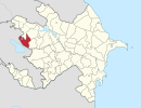
 Map of Azerbaijan showing Gadabay District | |
| Country | |
| Region | Ganja-Qazakh |
| Established | 8 August 1930 |
| Capital | Gadabay |
| Settlements[1] | 109 |
| Area | |
| • Total | 1,230 km2 (470 sq mi) |
| Population | |
| • Total | 109,900 |
| • Density | 89/km2 (230/sq mi) |
| Time zone | UTC+4 (AZT) |
| Postal code | 2100 |
| Website | gedebey-ih |
Gadabay District (Azerbaijani: Gədəbəy rayonu) is one of the 66 districts of Azerbaijan. It is located in the west of the country and belongs to the Ganja-Qazakh Economic Region. The district borders the districts of Dashkasan, Shamkir, Tovuz, and the Gegharkunik and Tavush provinces of Armenia. The Artsvashen exclave of Armenia is surrounded by the Gadabay District and is de facto controlled by Azerbaijan, administrated as part of Goranboy District. Its capital and largest city is Gadabay. As of 2020, the district had a population of 109,900.[2]
Etymology[]
It is a combination of the words "Gada" and "bey". Ancient Turkic tribes lived in Gadabay. Geographical names derived from the words kat and bek are also found in the Turkic states of Central Asia. In those places where the word "ket" is reflected in the ancient Turkish language, there were many guard posts and guards in order to warn the population about the sudden attacks of the enemy. There are dozens of legends about the name Gadabay. Albanian historian Mukhtar Gosh used the name of Gadabay province as "Getabey" in his "Albanian Chronicle" (1206). It is believed that the word "Gettabey" was later deformed and turned into Gadabay. Ancient Turkish used to mean a great, powerful man. Due to its geographical relief, it was an area where ancient warring Turkic tribes lived. Accordingly, the word Gadabay means a brave boy, a person referred to in fiction. The toponym Gadabay consists of the ancient Turkish words gada - guard and bek - hill and means "watchman's hill". This assumption is closer to the truth. The ruins of Gadabay fortress, first mentioned in historical sources in the 12th century, are in the upper part of the region, which is considered to be a hill. According to another possibility, the word Dadabey was deformed and became Gadabay. In the Middle Ages, part of these lands was divided between father and son - Atabey, Shakarbay, Gadabay. Gadabay was the son of Atabay. There are still Atabey and Shakarbey villages in the area. In connection with the word bek-tepe, it is necessary to talk about Gadabay oyko-nimi. Gadabay consists of the ancient Turkic words ket-keshik, gozetchi and bek-tepe in Turkish and means guard (keshikchi) hill.
Geography[]
In west Azerbaijan's border upon Armenia stretches for a distance of 123 kilometres (76 mi).
Gadabay District is located in a zone of midlands and highlands of the Lesser Caucasus. Its territory includes the northern parts of Shahdagh Mount, a part of Bashkend-Dastafur concavity and Shamkir massif.
The highest heights are Goshabulag (3549m), Godzhadagh (2217m) and Garaarkhadzh (3549m).
The drainage of the district is significantly poor. Akhinja, Zayam and Shamkir are the largest rivers. Mountain-forest, mountain-meadow and other grounds spread here. Mountain shrubland and rare forest meadows in midlands, broad-leaved forests, subalpine and alpine meadows at the top of mountains occupy the greatest territory of the district.
Depositions of the Jurassic, Paleogene, Quaternary and other periods cover the surface of district. Gadabay district is rich of its underground resources such as gold, uranium, copper and other mineral resources. Goldfield in Soyudlu was explored by the Siemens brothers until arrival of Red Army soldiers in 1920.[3][4] At present there is opened a factory producing gold, where work about 2000 workers. Gadabay District is also famous for its mineral waters, such as “Narzan”, “Mor-Mor”, “Chaldash”, “Turshsu” and “Soyudlu narzani” (in Soyudlu village).
Gadabay is within the middle and high mountain ranges of the Small Caucasus. The region of Gadabay covers the northern incline of the Shahdagh Ridge, the Bashkand-Dastafur basin and some part of the Shamkir mountain range. Goshabulak (3549 m.), Gocadagh (3317 m.) and others are the highest peaks. Within the area Jurassic, Tabashir, Paleogene and Anthropogenic sediments are spread. There are black and white marble stones. Summer is dry and there is mild heat and in the winter there is a dry mountainous tundra climate. The waterway network is tight. The Akhyncachay and Zayam waterways stream through this region. Within the south-western border of the area, the upper stream of Shamkirchay flows through. Gray mountain forest, meadow soils are spread. The region contains a well-known Red State Nature Reserve and four natural monuments - Govdu, Godakdara, Gamish and Shamlik. There is a beautiful waterfall at Kechidarasi cliff. Goat, sparrows, roe deer and Ayubbulaq as well as Chaldash, Gizilca Narzan, Mor-Mor mineral water springs can also be observed. Within the mountains, in the forests and valleys of the locale, animal and plant life is very rich. Gadabay locale is in the middle and high mountain ranges of the Small Caucasus. The district is located in the northern part of the Shahdagh ridge, the Bashkend-Dizafur depression and the Shamkir mountain range.[5]
History[]
As the administrative unit Gadabay District was originated on August 8, 1930, under the name of Rustam Aliyev. In 1938, it was renamed to Gadabay District.
In July 2020, Gadabay became a site for the clashes with Armenia.[6]
Geological structure[]
Jurassic, Tabashir, Paleogene and Anthropogenic sediments are spread. The granite-rich metamorphic rocks, Gadabayit, was first studied in Gadabay Copper-Cholerite bed (1903).
Rivers and water basins[]
The waterway network is tight. Gadabay is rich in minerals and table water springs such as Mormor, Turshsu, Koroglu, Prince, Narzan, Big Bulak and others. The main waterways are Akimca, Zayam, Inakbogan, Mamasen, Shamkir, Gadabay Cahri and others.
Population[]
| 2000 | 2001 | 2002 | 2003 | 2004 | 2005 | 2006 | 2007 | 2008 | 2009 | 2010 | 2011 | 2012 | 2013 | 2014 | 2015 | 2016 | 2017 | 2018 | |
| Gadabay region | 87,1 | 88,0 | 88,5 | 89,1 | 89,9 | 90,6 | 91,4 | 92,1 | 92,8 | 93,6 | 94,2 | 95,0 | 95,4 | 96,0 | 96,8 | 97,6 | 98,4 | 99,2 | 99,8 |
| urban population | 8,7 | 8,8 | 9,0 | 9,2 | 9,4 | 9,7 | 9,8 | 9,9 | 10,0 | 10,2 | 10,1 | 10,6 | 11,0 | 11,2 | 11,3 | 11,4 | 11,6 | 11,6 | 11,7 |
| rural population | 78,4 | 79,2 | 79,5 | 79,9 | 80,5 | 80,9 | 81,6 | 82,2 | 82,8 | 83,4 | 84,1 | 84,4 | 84,4 | 84,8 | 85,5 | 86,2 | 86,8 | 87,6 | 88,1 |
Demographics[]
Ethnic Groups[]
- Azerbaijanis 99.29%
- Other 0.71% (mostly ethnic Russians, some of whom belong to the Molokan and Doukhobor religious minorities, living in villages such as Slavyanka)
Religion[]
- Muslim 99.9%
- Other 0.1%
Language[]
- Azerbaijani Language 99%
- Russian 0.9%
- Other 0.1%
References[]
- ^ "İnzibati-ərazi vahidləri" (PDF). preslib.az. Retrieved 28 February 2021.
- ^ Jump up to: a b "Population of Azerbaijan". stat.gov.az. State Statistics Committee. Retrieved 22 February 2021.
- ^ "German industrialists' legacy to be revived in Azeri region". azernews.az. 11-02-2011. Archived from the original on 2013-01-15. Check date values in:
|date=(help) - ^ "Second plant in prospect at Azerbaijan gold mine". news.az. Archived from the original on 2014-08-21.
- ^ "Coğrafi mövqeyi - GƏDƏBƏY RAYON Icra Hakimiyyəti". www.gedebey-ih.gov.az. Retrieved 2018-11-23.
- ^ Harutyunyan, Sargis; Danielyan, Emil. "Armenia-Azerbaijan Border 'Calm' After Deadly Clashes". azatutyun.am. RFE/RL. Archived from the original on 5 August 2020. Retrieved 5 August 2020.
...the border between Armenia’s northern Tavush province and the Tovuz district in Azerbaijan, the scene of the clashes.
- ^ Political division, population size and structure: Population by towns and regions of the Republic of Azerbaijan. "Population | The State Statistical Committee of the Republic of Azerbaijan". The State Statistical Committee of the Republic of Azerbaijan. Retrieved 2018-11-23.
| show Authority control |
|---|

- Gadabay District
- Districts of Azerbaijan