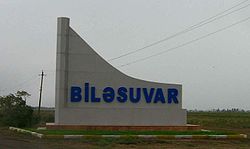
Biləsuvar
Coordinates: 39°27′30″N 48°32′42″E / 39.45833°N 48.54500°E

Bilasuvar
Biləsuvar | |
|---|---|
 | |
 Bilasuvar | |
| Coordinates: 39°27′30″N 48°32′42″E / 39.45833°N 48.54500°E | |
| Country | |
| Region | Aran |
| District | Bilasuvar |
| Elevation | 5 m (16 ft) |
| Population (2010) | |
| • Total | 20,101 |
| Time zone | UTC+4 (AZT) |
| • Summer (DST) | UTC+5 (AZT) |
| Area code(s) | +994 25 |
| Website | bilesuvar-ih |
Bilasuvar (Azerbaijani: Biləsuvar) is a city in and the capital of the Bilasuvar District of Azerbaijan. The area's considerable agricultural potential depends on irrigation.[1] It is situated near one of the country's four border crossings with Iran.
The city is located in the Central Aran region. Biləsuvar was divided into two parts in 1828 with the Turkmanchay Treaty. The similarly-named Iranian city of Bileh Savar is located right across the border.
References[]
- ^ "Archived copy". Archived from the original on 19 November 2007. Retrieved 23 November 2007.CS1 maint: archived copy as title (link)
External links[]
- Biləsuvar at GEOnet Names Server
- World Gazetteer: Azerbaijan[dead link] – World-Gazetteer.com
- Agricultural development news
Capital: Biləsuvar | ||
|  | |
This Bilasuvar Rayon location article is a stub. You can help Wikipedia by . |
Categories:
- Populated places in Bilasuvar District
- Kur Economic Region geography stubs