Martuni, Nagorno-Karabakh
Martuni / Khojavend
Մարտունի / Xocavənd | |
|---|---|
 Street in Martuni | |
 Martuni / Khojavend | |
| Coordinates: 39°47′43″N 47°06′47″E / 39.79528°N 47.11306°ECoordinates: 39°47′43″N 47°06′47″E / 39.79528°N 47.11306°E | |
| Country | |
| District | Khojavend (de jure) |
| Province | Martuni (de facto) |
| Elevation | 390 m (1,280 ft) |
| Population (2015)[1] | |
| • Total | 5,700 |
| Time zone | UTC+4 (AMT) |
| Area code(s) | (+374) 478 |


Martuni (Armenian: Մարտունի) or Khojavend (Azerbaijani: Xocavənd ![]() (listen)) is a town de facto in the self-proclaimed Republic of Artsakh as the centre of its Martuni Province, and the de jure centre of the Khojavend District of Azerbaijan. It is approximately 41 kilometers east of the regional capital, Stepanakert. It has a population of 5,700 as of 2015.[1]
(listen)) is a town de facto in the self-proclaimed Republic of Artsakh as the centre of its Martuni Province, and the de jure centre of the Khojavend District of Azerbaijan. It is approximately 41 kilometers east of the regional capital, Stepanakert. It has a population of 5,700 as of 2015.[1]
The town has an ethnic Armenian-majority population, and also had an Armenian majority in 1989.[2]
Etymology[]
The name Martuni originates from the nom de guerre of Armenian Bolshevik revolutionary and official Alexander Miasnikian. The name Khojavend is of Persian origin.[3]
History[]
Martuni was founded[when?] by local Armenians as a village named Honashen (Armenian: Հոնաշէն), where shen means village and hona, depending on the source, allows different interpretations (namely, “village, dwelling” or “reservoir, well, spring”). In 1925, the settlement was transformed into a city and renamed Martuni.[4]
Excavations in the settlement have uncovered a number of tombs dating to the Neolithic and Bronze Ages. Martuni is also home to several ruined medieval churches and remains of settlements, and khachkars have also been preserved.[5]
During the Soviet period, Martuni was the capital of the Martuni District in the Nagorno-Karabakh Autonomous Oblast. The population of the town, grouped into kolkhozes, largely occupied itself with raising livestock, grape growing, wheat cultivation, and gardening.[5]
Martuni, and the district itself, became a frontline city during the latter stages of the First Nagorno-Karabakh War. In early February 1992, Vazgen Sargsyan, then Defence Minister of Armenia, appointed Monte Melkonian as Chief of Headquarters and assigned him to lead the defense of Martuni and the surrounding regions.[6] On October 2, 1992, Armenian armed forces captured the region around Martuni. According to an Azerbaijani source, considerable damage was done to the infrastructure of 10 villages settled by Azerbaijanis in the region during the war.[7] Melkonian remained as regional commander until he was killed in combat in June 1993.[8]
Historical and cultural heritage[]
The town has a House of Culture commonly called "The Opera", and the Church of St. Nerses the Great, opened in 2004. The Russian 19th-century Gevorgavan Church is located near Martuni.[9]
Economy and culture[]
The population mainly works in different state institutions as well as with agriculture and animal husbandry. As of 2015, Martuni has a municipality building, a House of Culture, two schools, a music school, two kindergartens, a youth centre, 36 commercial enterprises, two factories and a regional hospital.[10]
Gallery[]

Church of St. Nerses the Great in Martuni, opened in 2004
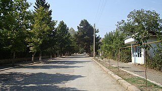
A street in Martuni

A memorial in Martuni

Martuni Museum

Martuni House of Culture ("The Opera")


Climate[]
| hideClimate data for Martuni (Khojavend) | |||||||||||||
|---|---|---|---|---|---|---|---|---|---|---|---|---|---|
| Month | Jan | Feb | Mar | Apr | May | Jun | Jul | Aug | Sep | Oct | Nov | Dec | Year |
| Average high °C (°F) | 5.5 (41.9) |
6.4 (43.5) |
10.1 (50.2) |
17.5 (63.5) |
21.7 (71.1) |
26.6 (79.9) |
29.8 (85.6) |
29.7 (85.5) |
24.8 (76.6) |
19.1 (66.4) |
12.6 (54.7) |
8.0 (46.4) |
17.7 (63.8) |
| Average low °C (°F) | −1.7 (28.9) |
−1.0 (30.2) |
1.8 (35.2) |
7.6 (45.7) |
12.1 (53.8) |
16.4 (61.5) |
19.5 (67.1) |
18.4 (65.1) |
15.2 (59.4) |
10.2 (50.4) |
4.9 (40.8) |
0.6 (33.1) |
8.7 (47.6) |
| Average precipitation mm (inches) | 20 (0.8) |
26 (1.0) |
36 (1.4) |
49 (1.9) |
68 (2.7) |
55 (2.2) |
23 (0.9) |
23 (0.9) |
28 (1.1) |
44 (1.7) |
31 (1.2) |
25 (1.0) |
428 (16.8) |
| Source: http://en.climate-data.org/location/21894/ | |||||||||||||
Demographics[]
| Ethnic group | Number, 1939 sa.[11] | Ratio, 1939 sa.[11] | Number, 1970 sa.[12] | Ratio, 1970 sa.[12] | Number, 1979 sa.[13] | Ratio, 1979 sa.[13] | Number, 2005 sa.[14] | Ratio, 2005 sa.[14] |
|---|---|---|---|---|---|---|---|---|
| Total | 1,906 | 100 % | 4,654 | 100 % | 5,497 | 100 % | 4,878 | 100 % |
| Armenian | 1,701 | 89,2 % | 3,120 | 67 % | 3,588 | 65.3 % | 4,863 | 99,7 % |
| Azerbaijani | 52 | 2,7 % | 1,482 | 31.8 % | 1,862 | 33.9 % | - | - |
| Russian | 136 | 7,1 % | 44 | 0.9 % | 41 | 0.7 % | 8 | 0,2 % |
| Ukrainian | 7 | 0,4 % | 3 | 0.1 % | 1 | 0.0 % | 1 | <0,1 % |
| Other | 10 | 0,5 % | 5 | 0.2 % | 5 | 0.1 % | 6 | 0,1 % |
References[]
- ^ Jump up to: a b "Figures" (PDF). stat-nkr.am. 2015.
- ^ Андрей Зубов. "Андрей Зубов. Карабах: Мир и Война". drugoivzgliad.com.
- ^ Arsène Saparov (2017-09-01). "Contested spaces: the use of place-names and symbolic landscape in the politics of identity and legitimacy in Azerbaijan". Central Asian Survey. 36 (4): 534–554. doi:10.1080/02634937.2017.1350139. S2CID 149221754.
- ^ (1998). Географические названия мира: Топонимический словарь: Свыше 5 000 единиц. М.: «Русские словари». Отв. ред. Р. А. Агеева. p. 262. ISBN 5-89216-029-7.
- ^ Jump up to: a b (in Armenian) Anon. «Մարտունի» (Martuni). Armenian Soviet Encyclopedia. vol. vii. Yerevan: Armenian Academy of Sciences, 1981, p. 352.
- ^ See Markar Melkonian (2005). My Brother's Road: An American's Fateful Journey to Armenia. New York: I.B. Tauris, pp. 207ff. ISBN 1-85043-635-5.
- ^ "25 years pass since occupation of Khojavend region".
- ^ Melkonian 2005, p. 264.
- ^ Kiesling, Brady; Kojian, Raffi (2019). Rediscovering Armenia: An in-depth inventory of villages and monuments in Armenia and Artsakh (3rd ed.). Armeniapedia Publishing.
- ^ Hakob Ghahramanyan. "Directory of socio-economic characteristics of NKR administrative-territorial units (2015)".
- ^ Jump up to: a b Ethno-Caucasus, Этнодемография Кавказа: Мартунинский район (1939 г.)
- ^ Jump up to: a b Ethno-Caucasus, Этнодемография Кавказа: Мартунинский район (1970 г.)
- ^ Jump up to: a b Ethno-Caucasus, Этнодемография Кавказа: Мартунинский район (1979 г.)
- ^ Jump up to: a b "Национальный состав населения самопровозглашённой Нагорно-Карабахской Республики по переписи 2005 года". Population statistics of Eastern Europe & former USSR.
External links[]
| Wikimedia Commons has media related to Martuni (Karabakh). |


- Populated places in Martuni province
- Populated places in Khojavend District
- Cities and towns in the Republic of Artsakh
- Populated places in the Republic of Artsakh
- Nagorno-Karabakh