Jabrayil District
Jabrayil District | |
|---|---|
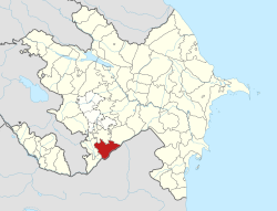 Map of Azerbaijan showing Jabrayil District | |
| Country | |
| Region | Eastern Zangezur |
| Established | 8 August 1930 |
| Capital | Jabrayil (nominal) Jojug Marjanly (de facto) |
| Settlements[1] | 93 |
| Area | |
| • Total | 1,050 km2 (410 sq mi) |
| Population | |
| • Total | 81,700 |
| • Density | 78/km2 (200/sq mi) |
| Time zone | UTC+4 (AZT) |
| Postal code | 1400 |
| Website | cabrail-ih |
Jabrayil District (Azerbaijani: Cəbrayıl rayonu) is one of the 66 districts of Azerbaijan. It is located in the south-west of the country and belongs to the Eastern Zangezur Economic Region.[3] The district borders the districts of Khojavend, Fuzuli, Qubadli, Zangilan, and the Islamic Republic of Iran.
Its capital is Jabrayil, however since the city is completely ruined following its occupation by ethnic Armenian forces, the current de facto capital is Jojug Marjanly until Jabrayil is rebuilt. As of 2020, the district had a nominal population of 81,700.[2]
Etymology[]
The name of Jabrayil was taken from the name of the village Jabrayil that was the centre of the region. Father Jabrayil, who was the founder of the village Jabrayil, was one of the closes of the ruler by name Sultan Ahmed who lived in VIII century and the territories between Zuyaret Mountain and the river Araz belonged to Father Jabrayil and his sons.[4]
History[]
Red Kurdistan[]
The district was part of the Kurdistansky Uyezd and later the Kurdistan Okrug in the Azerbaijani SSR from 7 July 1923 to 23 July 1930. To its Kurdish population, it was known as Cebrayîl.[5]
Armenian occupation[]
The territory was occupied by Armenian forces on August 23, 1993, during the First Nagorno-Karabakh War and was administrated as a part of Hadrut Province of the self-proclaimed Nagorno-Karabakh Republic except the village of Jojug Marjanly, was recaptured on January 6, 1994, during Operation Horadiz. This village was the provisional centre of this district until the recapture of Jabrayil.
The region with 1,050 square km area, including 72 secondary schools, eight hospitals, five mosques, two museums, 120 historic monuments, 149 cultural centres and about 100 villages that remained in the area were totally destroyed.[dubious ]
Return to Azerbaijani control[]
In the context of the 2020 Nagorno-Karabakh conflict, on October 9, 2020, the Azerbaijani Ministry of Defence announced the recapture of the district's central town, Jabrayil, from Armenian forces.[6] On October 20, 2020, Azerbaijani President Ilham Aliyev announced the recapture of Safarsha, Hesengaydi, Fuganli, Imambaghi, Dash Veysalli, Aghtepe, Yarakhmedli villages of Jabrayil district.[7] On October 21–22, 2020, 9 more villages of the district were recaptured according to Azerbaijani sources.[8][9] In November 2020, Azerishiq announced that it had begun supplying electricity to the district.[10]
Administrative structure[]
According to the State Statistics Committee of Azerbaijan Republic as of 2013, there is 1 city, 4 settlements and 92 villages in the district which has a territory of 1050 km2.[11]
Demographics[]
| Year | Population | ±% |
|---|---|---|
| 1897 | 66,360 | — |
| 1926 | 75,371 | +13.6% |
| 1939 | 23,502 | −68.8% |
| 1959 | 26,377 | +12.2% |
| 1970 | 37,227 | +41.1% |
| 1979 | 43,047 | +15.6% |
| 1989 | 49,156 | +14.2% |
| 1999 | 59,318 | +20.7% |
| 2009 | 70,585 | +19.0% |
| Note: Population size may be affected by changes in administrative divisions. Source: www | ||
At the time of the official 1979 Census, the ethnic makeup of the district's population whose ethnicity was known (43,047 people) was:[12]
- Azerbaijanis: 42,415 (98.5%)
- Russians: 434 (1%)
- Armenians: 41 (0.1%)
- Others: 157 (0.4%)
Notable natives[]
- Ashiq Qurbani (1477-1???) — was an Azerbaijani poet and folk singer
- Ashiq Peri (1811–1847) — was an Azerbaijani poet and folk singer
See also[]
References[]
- ^ "İnzibati-ərazi vahidləri" (PDF). preslib.az. Retrieved 28 February 2021.
- ^ Jump up to: a b "Population of Azerbaijan". stat.gov.az. State Statistics Committee. Retrieved 22 February 2021.
- ^ "Azərbaycan Respublikasında iqtisadi rayonların yeni bölgüsü haqqında Azərbaycan Respublikası Prezidentinin Fərmanı".
- ^ "Jabrayil". virtualkarabakh.az. Archived from the original on 2020-12-14. Retrieved 2020-10-18.
- ^ Esger, Şamîlê Selîm. "Kurdên Azerbaycanên, dîroka Laçîn û yên mayîn". Kovara Çira. 3: 57.
- ^ "Cəbrayıl şəhərində Azərbaycan Bayrağı dalğalanır – VİDEO" (in Azerbaijani). Ministry of Defense of Azerbaijan. 9 October 2020. Archived from the original on 10 October 2020. Retrieved 9 October 2020.
- ^ "President Ilham Aliyev: Zangilan city and 6 villages of the district, 18 villages of Fuzuli, Jabrayil, and Khojavand districts were liberated". State News Agency of Azerbaijan. Archived from the original on 2020-10-20. Retrieved 2020-10-21.
- ^ "President Ilham Aliyev: Azerbaijani Army liberated 3 villages of Fuzuli district, 5 villages of Jabrayil district". State News Agency of Azerbaijan. Archived from the original on 2020-10-24. Retrieved 2020-10-23.
- ^ "President Ilham Aliyev: Azerbaijani Army liberated 3 villages of Fuzuli district, 4 villages of Jabrayil district". MINISTRY OF DEFENCE OF THE REPUBLIC OF AZERBAIJAN. Archived from the original on 2020-10-26. Retrieved 2020-10-22.
- ^ "Свет Азербайджана уже горит в Шуше (ВИДЕО)". vestikavkaza.ru (in Russian). Archived from the original on 2020-11-22. Retrieved 2020-11-19.
- ^ Azərbaycan Respublikasının Dövlət Statistika Komitəsi: İnzibati ərazi bölgüsü təsnifatının qüvvədə olan variantı (CƏBRAYIL RAYONU – 60500001 Archived 2017-01-26 at the Wayback Machine)
- ^ "население азербайджана". www.ethno-kavkaz.narod.ru. Archived from the original on 28 March 2012. Retrieved 11 October 2020.
External links[]

| show Nagorno-Karabakh conflict |
|---|
| show Authority control |
|---|
Coordinates: 39°18′N 47°00′E / 39.300°N 47.000°E

This Jabrayil Rayon location article is a stub. You can help Wikipedia by . |
- Jabrayil District
- Districts of Azerbaijan
- Jabrayil District geography stubs